To generate a PDF file, simply Open the print dialog and select "Print to PDF" or equivalent.
back

Mediterranean Plant Specialist Group

The Top 50 Mediterranean Island Plants UPDATE 2017

Pasta S., Perez-Graber A., Fazan L. and Montmollin B. de (Eds)


ISBN : 978-2-8399-2249-4

Citation : Pasta S., Perez-Graber A., Fazan L. and Montmollin B. de (Eds). 2017. The Top 50 Mediterranean Island Plants UPDATE 2017. IUCN/SSC/Mediterranean Plant Specialist Group. Neuchâtel (Switzerland). E-book and on line. 141 pp. top50.iucn-mpsg.org

The designation of geographical entities in this document and the presentation of the material do not imply the expression of any opinion whatsoever on the part of IUCN or other participating organizations concerning the legal status of any country, territory, or area, or its authorities, or concerning the delimitation of its frontiers or boundaries.

Copyright : IUCN/SSC/Mediterranean Plant Specialist Group. Reproduction of the publication for educational or other non-commercial purposes is authorized without prior written permission fro the copyright holder provided the source is full acknowledged. Reproduction of this publication for resale or other commercial purposes is prohibited without prior written permission of the copyright holder. Contact : Bertrand de Montmollin (bertrand(at)montmollin.me)

Available from : top50.iucn-mpsg.org

Open printable version

About

In 2005, the Mediterranean Islands Plant Specialist Group (IUCN / SSC) published The Top 50 Mediterranean Island Plants - Wild plants at the brink of extinction and what is needed to save them; edited by Montmollin, B. de and Strahm, W. (downloadable in English, French, Spanish and Greek under the Download tab). A decade later, the publication has been updated to assess any changes that may have occurred in the conservation status of these 50 taxa and to see what measures have been taken to improve their conservation status 

This revision required the participation of over sixty specialists and was coordinated by Salvatore Pasta with the assistance of Aline Perez-Graber and Laurence Fazan. The new species sheets are presented on a website prepared by Joaquim Perez.

The species sheets of the 2005 publication have been reproduced and the different sections have been updated, adapted and supplemented to reflect the current knowledge on the studied species. To facilitate comparison between the 2005 publication and the current update, the original name of each taxon has been retained, although in some cases, the names have changed. Possible taxonomic changes are explained in the synonymy section and in the text.

The main results of this review are as follows:

Almost half of the taxa (22) have a modified level of threat compared to the 2005 assessment. 21 taxa have a lower threat level and only one has a higher one. This is the case of Lysimachia minoricensis which is now considered as Extinct in the Wild (EW), since all attempts to reintroduce this species into its natural environment have failed and living collections are found only in botanical gardens or seed banks.

The decrease of threat level for 21 taxa can be related to a number of factors:

In conclusion, although the improvement in the threat level for nearly half of the taxa is in itself encouraging, it does not reflect solely a real improvement in the conservation status of these species, but in some cases, is due only to an improvement of the knowledge of the taxa. The 2005 publication certainly contributed to better study and protect these taxa. In many cases, the conservation measures implemented have stabilized or improved the situation. However, all these species are still threatened with extinction and efforts to conserve them must continue. Climate change, a threat that was still somewhat theoretical in 2005, is becoming more evident and the mitigation of its effects on very localized species represents an important challenge.

This update is a team effort which has required the active contribution of many people whom we sincerely thank:

ANDREOU Marios, BACCHETTA Gianluigi, BIBILONI Gabriel, CHRISTODOULOU Charalambos S., COGONI Donatella, CRESPO Manuel B., CURSACH Joana, DELIPETROU Pinelopi, DIMOU Dimitrios, FAZAN Laurence, FERAL Camille, FENU Giuseppe, FOGGI Bruno, FORTEZA Vicens, FOURNARAKI Christina, FRAGA I ARGUIMBAU Pere, GARCIA Oscar, GARFI Giuseppe, GIANGUZZI Lorenzo, GRADAILLE Pep Lluis, GUIDI Fabio, HUGOT Laetitia, IATROU Gregoris, JAGEL Armin, JUAN Ana, KALTSIS Apostolis, KOUTSOVOULOU Katerina, KOZLOWSKI Gregor, KYPRIOTAKIS Zacharias, LA MANTIA Antonino, LAGUNA Emilio, LANFRANCO Edwin, LANFRANCO Sandro, Lo CASCIO Pietro, MANOCCI Mario, MANZANO Xavier, MATTANA Efisio, MIFSUD Stephen, MORAGUES Eva, MOTA POVEDA Juan Francisco, MUS Mauricio, NEVADO Juan Carlos, PANITSA Maria, PARADIS Guilhan, PASTA Salvatore, PEREZ GRABER Aline, PEREZ Joaquim, PIAZZA Carole, RITA Juan, ROMANO Salvatore, SAEZ Llorenç, SCHWARZER Hedwig, SCUDERI Leonardo, STEVENS Darrin T., TRIGAS Panayotis, TROIA Angelo, VENTURELLA Giuseppe, ZERVAKIS Georgios


Bertrand de Montmollin, Chair, Mediterranean Plant Specialist Group (IUCN/SSC)

The mediterranean Islands

Abies nebrodensis

Summary

Latin name Abies nebrodensis (Lojac.) Mattei
Common names Abete delle Madonie (Italian); Sicilian fir (English)
Family Pinaceae
Status CRITICALLY ENDANGERED (CR)
Island
  • Sicily (Italy)
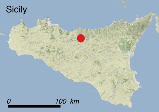
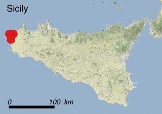
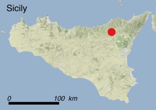
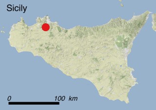
Sicily
Sicily | Abies nebrodensis
Abies Nebrodensis
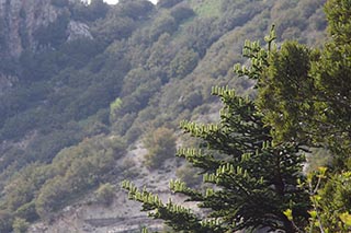
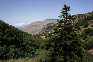
Abies Nebrodensis – habitat
Abies nebrodensis
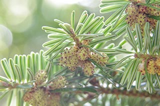
Abies nebrodensis – flowers
Abies nebrodensis
Abies nebrodensis – habitat
Abies nebrodensis
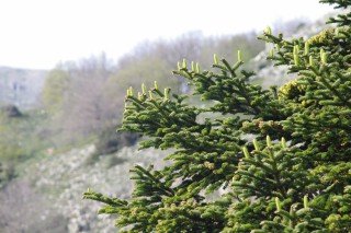
Abies nebrodensis – branches
Abies nebrodensis
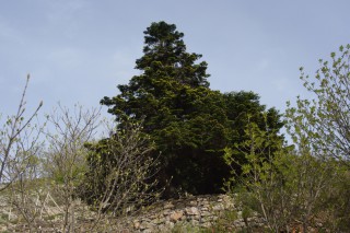
Abies nebrodensis – tree
Abies nebrodensis
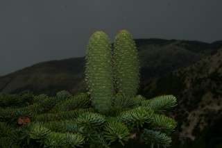
Abies nebrodensis – cones
Abies nebrodensis
Abies nebrodensis – branch with cones

Where is it found ?

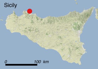
The last individuals of the Sicilian fir occur on the Madonie Mts, either isolated or in very little and scattered nuclei within discontinuous mountain shrubland and forest communities (Habitats 1.4.4: Mixed deciduous and coniferous woodland and 3.4.1: Temperate and Mediterranean-montane scrub). More in detail, they grow on the steep slopes and screes of Vallone Madonna degli Angeli, Mt. Scalone, Mt. Pene and Mt. Cavallo between 1350 and 1700 m a.s.l., on bare soils mostly deriving from quartz sandstones.

How to recognise it ?

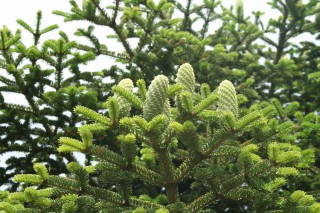
Abies nebrodensis has a single erect stem which, according to observations on cultivated individuals, may grow up to at least 20 m tall and may have a diameter of at least 75 cm. In mature trees the crown is broad and conical. The bark is smooth and light grey in young plants, turning orange and becoming thicker, more rugged, and scaly with age. The needles are short (10-22×2-3 mm), have flattened cross-sections and variably shaped (from obtuse to mucronulate) tips. Their upper surface is dark green and their underside striped blue-green. The needles are arranged in two rows in a horizontal plane and persist during the entire year. The cones are 8-12 (up to 20) cm long when ripe. They are composed of seed scales, slightly hairy towards their ends and spirally arranged around an axis. Each scale is subtended by a bract with a central short tip. Two light brown winged seeds are inserted at the base of each scale. This species is closely related to Abies alba, but has more resinous buds and shorter needles.

Interesting facts

Although recent genetic studies pointed out that the Sicilian fir is a well differentiated species, it shows nonetheless a close relationship with southern Italian Abies alba populations.

The scientific name ‘nebrodensis’ is somewhat misleading: in fact, the Madonie Mts. were once called ‘Nebrodes’, while nowadays the term ‘Nebrodi’ refers to another mountain range located further eastwards in northern Sicily.

Recent paleoecological studies carried out on northern Sicilian mountain ranges suggest that the Sicilian fir may have been more widespread until recent times, probably occurring at lower altitudes together with deciduous and broadleaved species. Hence, many centuries ago Abies nebrodensis was probably common in several forest ecosystems of the island, and for a long time it may have represented one of the most important trade resources for the people living in the mountain ranges of the island. Some sources quote its presence on the Nebrodi Mts. and on Mt. Etna, where it probably disappeared just a few centuries ago. As a matter of fact, during the VIII-V centuries B.C. some Greek colonies of north-eastern Sicily coined money bearing the unmistakeable silhouette of a fir. Later on, fir wood was used for the doors and the roof-beams of several churches of northern and eastern Sicily until the end of the Middle Ages. Human pressure (logging, fires) and climatic oscillations may have favoured the spread of deciduous trees such as Fagus sylvatica, Quercus petraea and Q. cerris, which outcompeted the Sicilian fir, so that it was considered extinct already half a century before being rediscovered on the Madonie Mts. in 1957.

Why is it threatened ?

This species has been categorized CR (Critically Endangered) according to IUCN Red List Criterion D (i.e. plant population numbering fewer than 50 mature individuals). The current population includes only 30 adult trees and AOO and EOO are <1.5 km2. The poor health of the seedlings and saplings grown in the tree nurseries and the low sexual performance of adult individuals should be considered as an issue of a bottle-neck effect due to the limited population size, even if a significant genetic variability has been detected. Habitat degradation (threat 11.1: Habitat shifting & alteration), grazing and trampling of young individuals by introduced herbivores such as boars and fallow deers (threat 8.1.2: Invasive non-native/alien species - Named species), the genetic pollution due to frequent hybridization with non-native firs co-occurring in its natural range (threat 8.3: Introduced genetic material) represent the main threats for Abies nebrodensis. Also global warming (threats 11.2: Droughts and 11.3: Extreme temperatures) may affect the species both directly by lowering its survival chances and indirectly by increasing the frequency of wildfires (threat 7.1.1: Increase in fire frequency/intensity).

What has been done to protect it ?

Legally: the species is included in Appendix I of the Bern Convention and as a priority species in Annexes II and IV of the 92/43 EC Habitats Directive. Also the habitat characterized by its presence (9220 = Apennine beech forests with Abies alba and beech forests with Abies nebrodensis) is listed within Annex I of the same Directive. All the population grows within the Madonie Regional Park.

In situ: once rediscovered, foresters immediately initiated conservation measures. However, soil degradation of the natural habitat has made re-introduction very difficult. Researchers from the University of Palermo are currently investigating the ecological requirements and several reproductive traits of the species. The species has grown well in several European botanical gardens. Several actions of the EU LIFE-funded project LIFE2000NAT/IT/7228 (2001-2005) and of another nationally funded project (CIPE = Comitato interministeriale per la programmazione economica) have been carried out in order to reinforce the extant population, to restore local forest habitats, and to gradually eradicate the non-indigenous fir species. These projects had some good results on the demography of the Sicilian fir: although only 24 out of 30 adult trees are fertile, , seedlings and saplings have increased from 30 to 155.

Ex situ: in 1978, following seed collection, the Sicilian Forestry Service cultivated 110,000 young trees in a nursery. Since their survival rate proved to be extremely low, an adoption program was set up in parallel. Controlled pollination carried out during the EU LIFE-funded project has resulted in the production of an additional 3,000 plants to reinforce the existing population; unfortunately, only a few hundred of them survived. Furthermore, several mature trees grow out of the natural range of distribution of the species in private and public green areas of the Madonie Mts., elsewhere in the Province of Palermo and in the botanic gardens and arboreta of many European countries and in the U.S.A.

What conservation actions are needed ?

Considering the low sexual performance of mature individuals and the low survival rate of seedlings and saplings, grazing and trampling damages may represent a serious threat for the natural regeneration of the species. Hence, strict grazing management measures are urgently needed in order to reduce and control the impact of herbivores. Assisted colonization should be encouraged in selected areas free from non-native fir species in order to prevent genetic contamination due to hybridization. Eradication of the alien Abies species occurring in the surrounding areas has to be completed. Habitat recovery and vegetation dynamics should be regularly monitored in order to understand the response of A. nebrodensis to ongoing changes of land cover patterns.

Scientific coordination

Dr. Salvatore Pasta, Department of Biology, University of Fribourg, Switzerland.

Dr. Angelo Troìa, Dipartimento STEBICEF, sezione di Botanica ed Ecologia Vegetale, Università degli Studi di Palermo, Palermo, Italy.

Photos

Dr. Angelo Troìa, Dipartimento STEBICEF, sezione di Botanica ed Ecologia Vegetale, Università degli Studi di Palermo, Palermo, Italy.

Dr. Leonardo Scuderi, free-lance botanist, Trapani, Italy.

Additional references

Alizoti P.G., Fady B., Prada M.A., Vendramin G.G., 2011. EUFORGEN Technical Guidelines for genetic conservation and use of Mediterranean firs (Abies spp.). Biodiversity International, Rome, Italy.

Boratyński A., 2013. Morphological diversity and structure of West Mediterranean Abies species. Plant Biosystems, 147 (1), 125-134.

Brullo S., Giusso del Galdo G., Guarino R., 2001. The orophilous communities of the Pino-Juniperetea class in the Central and Eastern Mediterranean area. Feddes Repertorium, 112 (3-4): 261-308.

Krajňáková J., Gömöry D., Häggman H., 2014. Biotechnology tools for conservation of the biodiversity of European and Mediterranean Abies species. In: Biotechnology and Biodiversity (pp. 287-310). Springer International Publishing.

Liepelt S., Mayland-Quellhorst E., Lahme M., Ziegenhagen B., 2010. Contrasting geographical patterns of ancient and modern genetic lineages in Mediterranean Abies species. Plant Systematics and Evolution, 284 (3-4): 141-151.

Linares J.C., 2011. Biogeography and evolution of Abies (Pinaceae) in the Mediterranean Basin: the roles of long-term climatic change and glacial refugia. Journal of Biogeography, 38 (4): 619-630.

Raimondo F.M., Schicchi R. (eds.), 2005. Progetto LIFE Natura n° LIFE2000NAT/IT/7228. Rendiconto sul progetto LIFE Natura “Conservazione in situ ed ex situ di Abies nebrodensis (Lojac.) Mattei”, Tipolitografia Luxograph, Palermo, 128 pp.

Schicchi R. (ed.), 2008. Piano di Gestione ‘Monti Madonie’ - POR Sicilia 2000/2006 - Codice Identificativo 1999.IT16.1PO.011/1.11/11.2.9/0296. Palermo, Università degli Studi di Palermo, CI.RI.TA. Centro Interdipartimentale di Ricerche sulla Interazione Tecnologia-Ambiente.

Schicchi R., Raimondo F.M., Mazzola P., Bazan G., 2013. Results of efforts made for in situ and ex situ conservation of Abies nebrodensis (Pinaceae) in Sicily. In: Abstracts XIV OPTIMA MEETING: 144. Orto Botanico and Herbarium Mediterraneum, Università degli Studi di Palermo

Schicchi R., Amato F., La Placa G., Bonomo G., 2014. Population trend in Abies nebrodensis (Lojac.) Mattei. In: International Plant Science Conference “From Nature to Technological Exploitations”, 109° Congresso nazionale della Società Botanica Italiana (Firenze,, 2-5 settembre 2014), Abstracts: 58.

Scialabba A., Schicchi R., Cordì R., 2007. Potenziale germinativo dei semi di Abies nebrodensis (Pinaceae). 102° Congresso nazionale della Società Botanica Italiana (Palermo, 26-29 settembre 2007), riassunti: 237.

Thomas, P. 2013. Abies nebrodensis. The IUCN Red List of Threatened Species 2013: e.T30478A9544830. http://dx.doi.org/10.2305/IUCN.UK.2011-1.RLTS.T30478A9544830.en. Downloaded on 27 January 2016.

Tinner W., Vescovi E., van Leeuwen J., Colombaroli D., Henne P.D., Kaltenrieder P., Morales-Molino C., Beffa G., Gnaegi B., van der Knaap P.W.O., La Mantia T., Pasta S., 2016. Holocene vegetation and fire history of the mountains of Northern Sicily (Italy). Vegetation History & Archeobotany, DOI 10.1007/s00334-016-0569-8.

Aethionema retsina

Summary

Latin name Aethionema retsina Phitos & Snogerup
Common name Stonecress of Skiros Island (English)
Family Brassicaceae
Status CRITICALLY ENDANGERED (CR)
Island
  • Greek Islands (Greece)
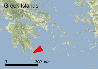
Greek Islands
Greek Islands | Skiropoula and Skiros
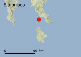
Skiropoula and Skiros
Skiropoula and Skiros | Aethionema retsina
Aethionema retsina
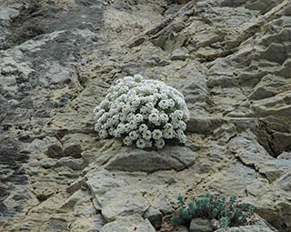
Aethionema retsina – plant
Aethionema retsina
Aethionema retsina – flowers
Aethionema retsina
Aethionema retsina – habitat

Where is it found ?

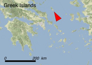
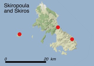
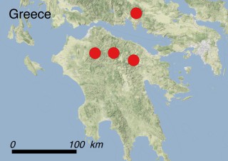
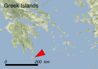
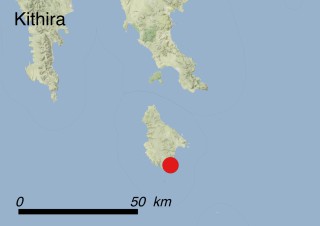
This species is only known to occur on the island of Skiros and on the northern part of Skiropoula, a satellite islet located approximately 4 km southwest of Skiros. As concerns Skiros, three populations (represented by 51 mature individuals in total) are known, and the plants are localised on the steep NE-facing limestone cliffs of Mt. Kochilas and at Cape Korakia. At Skiropoula there is one subpopulation, whose size has not been recently assessed. Aethionema retsina is mostly found within 0.5 km of the seashore and grows in small crevices and shady habitats located between 10 and 200 m a.s.l. (habitat code 6.2: Inland cliffs, rock pavements and outcrops).

How to recognise it ?

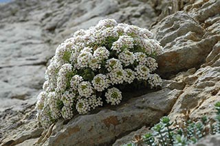
A. retsina is a shrubby perennial that forms cushions up to 20 cm tall and 40 cm wide. Its woody base can be up to 20 cm thick (i.e. as thick as the length of the shoots). The base of the plants produces several shoots per year and the plants bear smooth, broad, somewhat fleshy leaves 10-15 mm long and rounded at the end. Each young shoot usually bears at its upper end an inflorescence of 25-50 slightly asymmetric white flowers. The petals are up to 3.5 mm long and have a purplish tinge when young. The fruits are flat capsules less than twice as long as wide, called silicles. They are framed by a notched wing from which the style sticks out. Each fruit only contains one lens-shaped seed.

Interesting facts

This species was only discovered in 1969 and published in 1973. It is typical to a particular litho-halophilous plant community adapted to grow in the rocky cracks of seashore cliffs. The fleshy habit of the plant is an ecological adaptation to salt spray and a common trait for many coastal plants. Several cross-breeding experiments between A. retsina and other Brassicaceae of high agricultural importance, such as cabbage, canola and mustard, have already been carried out. These experiments aim at the genetic improvement of crop species by transferring some interesting traits found in Aethionema retsina (e.g. salt tolerance and drought resistance). Mature individuals produce numerous seeds, which germinate easily and at high percentage between 10 and 20 °C. The name of the species originates from the name of a traditional Greek wine (retsina): it seems that the botanists who discovered the species were ‘inspired’ by the bottle that was used to carry the original plant sample.   

Why is it threatened ?

This species has been categorized as CR (Critically Endangered) according to IUCN Red List Criteria B1ab(iii,v)+2ab(iii,v). This is because the area of occurrence of the species is extremely small and fragmented, and prone to severe grazing pressure due to the increasing numbers of goats which severely damage plants during their flowering and fruiting stages.

When using a 2×2 km grid, AOO and EOO are 12 and approximately 40 km2; if a 1×1 km grid is used, as for the Greek Red Data Book, then the AOO is no more than 8 km2.

Due to the small size of the islands, shepherds do not need to fence the territory to keep their herds together, hence goats have free access everywhere. Like all plants with no effective grazing protection (poison, spines, etc.) A. retsina is selectively eaten by goats because of its high nutritional value. Another potential threat is represented by limestone quarrying (threat 3.2: Mining and Quarrying), and other works such as the construction of new roads (threat 4.1: Road and railroads) and wind farms (threat 3.3: Renewable energy); in fact, the construction of a massive wind farm consisting of 111 turbines on Mt. Kochilas was stopped by conservationists and the local community in 2013. A. retsina is threatened with grazing, browsing and trampling damages due to local sheep and goat herds (threat 2.3.2: Small-holder grazing, ranching or farming).

What has been done to protect it ?

Legally: This species is not included in any international convention or national legislation. Due to bureaucratic problems, it has not even been included in the list of protected Greek species according to the 92/43 EU Directive. Mt. Kochilas, where 2 of the subpopulations of A. retsina occur, has been declared a NATURA 2000 site GR2420006 “Skyros :Oros Kochylas”, while the islet of Skiropoula falls within the boundaries of NATURA 2000 site GR2420009 “Nisides Skyrou”.

In situ: During the implementation of the LIFE project SKYROSBIODIVERSITY (LIFE09 NAT/GR/000323), some conservation efforts were focused on the species. The location of Korakia, where one of the A. retsina population occurs, was delineated as Plant Micro-Reserve for the endemic flora of Skyros. A simplified monitoring plan for the species was carried out, while a pilot action of reinforcement with human-assisted dispersal of seeds in suitable rock crevices showed encouraging results for a possible larger scale application in the future. Moreover, increased concern was raised in the local community and the visitors about the endemic flora of Skyros, through public information events, leaflets, information boards, etc.

Ex situ: At least 3 seed lots (collected during different years) from the subpopulation of Korakia are stored in the Seed Bank of the Faculty of Biology of the National and Kapodistrian University of Athens. Unfortunately, the collection of seeds from the other populations has been so far impracticable due to limited accessibility of the corresponding sites and/or of the fruiting individuals. Some individuals of this plant are cultivated at the botanical gardens of Copenhagen (Denmark) and of Lund University (Sweden). However, they do not account for the entire gene pool of the species because seeds have only been collected from a few plants.

What conservation actions are needed ?

In situ: The priority should be to protect the species from grazing. The areas where it grows should be fenced and managed to keep grazing animals out. Both the large NE-facing cliffs of Mt. Kochilas and the N-facing cliffs of the islet of Skiropoula should be designated as nature reserves. Moreover, stone quarrying and plant collection should be prohibited.

Ex situ: A. retsina is easy to cultivate and has a high potential as an ornamental plant. It should be propagated and planted in other suitable shaded rocky sites, following IUCN/SSC Guidelines for re-introductions which include guidance on benign introductions. Further efforts should be made in order to collect seeds from all populations in order to be able to conserve the entire genetic pool of the species and to carry out re-enforcement interventions where and when needed.

Scientific coordination

Prof. Gregoris Iatroú, Department of Biology, Division of Plant Biology, Institute of Botany, University of Patras, Greece.

Ass. Prof. Maria Panitsa, Division of Plant Biology, Department of Biology, University of Patras, Greece.

Mr. Apostolis Kaltsis, Plant Conservation Researcher, Faculty of Biology, National and Kapodistrian University of Athens

Photos

Mr. Apostolis Kaltsis, Plant Conservation Researcher, Faculty of Biology, National and Kapodistrian University of Athens

Additional references

Iatroú G., 2006. Aethionema retsina. The IUCN Red List of Threatened Species 2006: e.T61628A12527638. http://dx.doi.org/10.2305/IUCN.UK.2006.RLTS.T61628A12527638.en.

Kaltsis A., Kotsovoulou K., Thanos K., 2009. Aethionema retsina. In: Phitos D., Constantinidis Th., Kamari G. (eds.), 2009. The Red Data Book of Rare and Threatened Plants of Greece. Hellenic Βotanical Society, Patras.

Allium calamarophilon

Summary

Latin name Allium calamarophilon Phitos & Tzanoudakis
Common name wild garlic of Evia (English)
Family Amaryllidaceae
Status DATA DEFICIENT (DD)
Island
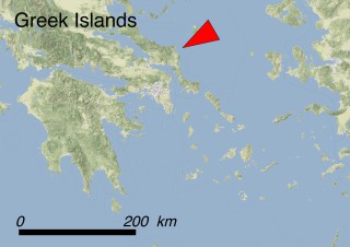
  • Greek Islands (Greece)
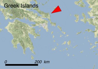
Greek islands
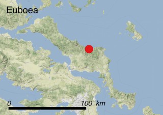
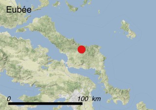
Greek islands | Euboea
Euboea
Euboea | Allium calamarophilon
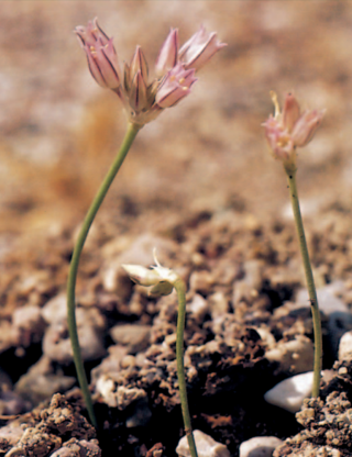
Allium calamarophilon
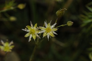
Allium calamarophilon – flower

Where is it found ?

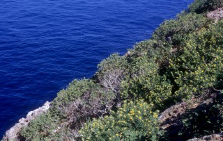
Allium calamarophilon is endemic to the island of Euboea (Evia), one of the largest islands in the Aegean Sea. The only known population, comprising just a few individuals, was discovered in the centre of the island north-east of the small town of Kimi, in 1981. The plants grow between 20 and 30 m a.s.l. on limestone cliffs that rise almost vertically from the sea (habitat 13.1: Sea cliffs and Rocky Offshore Islands).

How to recognize it ?

This plant looks like an onion. A smooth, non-branched 9-13 cm long stem emerges from an underground bulb. One to three leaves are wrapped around the lower third or quarter of the stem, and are more or less equal in length to the stem and 1-1,5 mm wide, slightly canaliculate. The flowers are white to pink and form bundles of usually five to eight flowers at the top of the stem on more or less equal pedicels. Each flower has five or six tepals that are joined at the base. One stamen is attached to the inner part of each tepal base and the ovary is slightly heart-shaped. The species flowers in July and the fruiting period occurs in August.

Interesting facts

The name of the species originates from the site where it grows, which is well known to local people. Every year between July and August numerous squids of the genus Todarodes, locally known with the vernacular name ‘Kalamari’, concentrate for reproduction in the waters near these cliffs.

Why is it threatened ?

This species has been classified as DD (Data Deficient) according to IUCN Red List Criteria, meaning that there is inadequate information to make a direct or indirect risk assessment. In fact, more data are needed to evaluate its status properly, as it has not been observed since its first description in 1981! Due to the inaccessibility of its natural habitat, very little is known about its true population size and distribution and no data are available to assess population stability. The case of A. calamarophilon is paradigmatic of the difficulties of assessing risk level for species which are very poorly known.

A major threat for the species is a recent plan to build a road to access the nearby seashore (threat 4.1: Roads & railroads). This case also allows to emphasize the importance of undertaking environmental impact assessments before building roads or making other major modifications to the environment, because road construction may inadvertently destroy the only known population of a species.

What has been done to protect it ?

Legally: This species is not included in any international convention or national legislation and does not fall within any Natura 2000 site.

In situ: There are no current measures in place. In fact, no field research or monitoring activity has been promoted since the species was discovered.

Ex situ: A. calamarophilon has been cultivated between 1981 and 2000 at the Experimental Botanical Garden of the University of Patras as part of a genetics research project, although due to recent financial constraints the project has stopped and the species is no longer cultivated.

What conservation actions are needed ?

Field investigations are urgently needed to assess if this species still occurs in the wild and if there are any other populations elsewhere. Up-to-date information on both the distribution and the size of the population of the species may allow the set up of an appropriate plan for its conservation. Ex situ propagation initiatives both in Greek and international seed banks and botanic gardens should be encouraged as well. In fact, plants issuing from the propagation of seeds and bulbs could be used in future re-enforcement activities and/or to create new subpopulations in other suitable sites.

Scientific coordination

Prof. Gregoris Iatroú, Department of Biology, Division of Plant Biology, Institute of Botany, University of Patras, Greece.

Ass. Prof. Maria Panitsa, Division of Plant Biology, Department of Biology, University of Patras, Greece.

Photos

Red Data Book of Rare and Threatened Plants of Greece

Additional references

Iatroú G., 2006. Allium calamarophilon. The IUCN Red List of Threatened Species 2006: e.T61598A12507566. http://dx.doi.org/10.2305/IUCN.UK.2006.RLTS.T61598A12507566.en.

Trigas P., Iatroú G., 2006. The local endemic flora of Evvia (W Aegean, Greece). Willdenowia, 36 (Special Issue): 257-270.

Phitos D.,Tzanoudakis D., 1981. A new species of Allium from Euboea (Greece). Botaniká Chroniká, 1: 11-13.

Anchusa crispa

Summary

Latin name Anchusa crispa Viv.
Common names Buglosse crépue (français); Crisped bugloss (English); Buglossa sardo-corsa (Italian)
Family Boraginaceae
Status ENDANGERED (EN)
Islands
  • Corsica (France)
  • Sardinia (Italy)
Corsica and Sardinia
Corsica and Sardinia | Anchusa crispa
Anchusa crispa
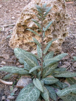
Anchusa crispa – plant
Anchusa crispa
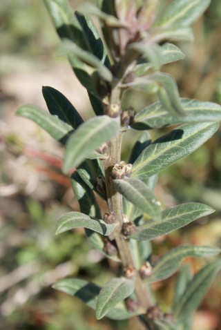
Anchusa crispa – plant

Where is it found ?

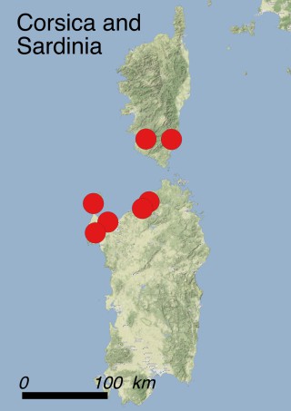
Up to now 14 subpopulations of Anchusa crispa are known to grow along the NW coasts of Sardinia and 6 in Corsica. The global AOO of the species is 76 km2 (56 in Sardinia and 20 in Corsica). A. crispa prefers sunny places on the upper part of sand shores (habitat code 13.3: Coastal Sand Dunes). It generally grows on coarse sands and gravel and it is often found near estuaries within thermo-hygrophilous scrubland communities dominated by Tamarix africana (5.3: Shrub-dominated wetlands). The most common co-occurring species are Elytrigia juncea, Glaucium flavum, Ammophila arenaria subsp. arundinacea and several other psammo-nitrophilous annuals and biennials.

How to recognise it ?

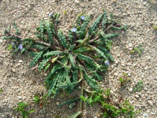
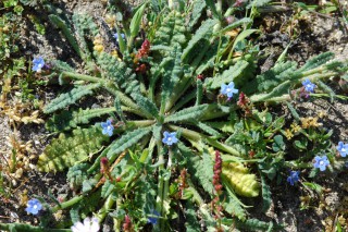
Anchusa crispa is a biannual or short-lived perennial, rarely annual herb, 10 to 35 cm tall. The ramified stem is erect at the base and then decumbent, and is covered with long erect and rigid hairs. The leaves are 5-10 cm long, lanceolate and undulate-crispate. Flowering occurs between March and June; the pale blue or purplish (white for the Sardinian subpopulation of Porticciolo) tubular flowers are grouped into loose alternate inflorescences. The populations of Sardinia are now referred to two different subspecies, A. crispa subsp. crispa and A. crispa subsp. maritima. Slight differences have been detected also among western and eastern Corsican populations: ongoing investigations will probably clarify whether they are worth being assigned to different subspecies as well.

Interesting facts

Substrate features such as depth, nutrient-richness and humidity strongly affect the vigour of the plants and their fertility. The seeds are achenes that perform short-distance dispersal by ants (myrmecochory) and, occasionally long-distance dispersal through cattle passage or by flowing down local streamlets. A. crispa may tolerate occasional trampling, but rapidly disappears under excessive disturbance.

Why is it threatened ?

This plant has been recently assessed as Endangered at regional level both in Corse and in Sardinia. Considering the available data, A. crispa can be categorized as EN (Endangered) at global level according to IUCN Red List criteria B2ab(ii, iv, v), because the AOO is equal to 76 km2, the population is severely fragmented, the number of locations is >5 but the population is severely fragmented and shows a continuous decline in terms of occupied surface, habitat quality and number of mature plants. The surface-area occupied by all Corsican subpopulations is less than 5 ha; additionally, all of them are represented by few individuals, at least three (one in the north of the Gulf of Valinco and two on the eastern coast) are severely decreasing and another one (at Campitellu) disappeared in 1999. All the conservation measures that have been applied up to now appear to be totally inadequate to reverse this trend. Additionally, the fragmentation of populations increases their vulnerability to natural or anthropogenic disturbance. Exceptionally strong windstorms (threat code 11.4: Storms & flooding) occurred between 1999 and 2002, causing the repeated accumulation of very high amounts of sand over the shores where the populations of A. crispa grow, and causing a striking decrease of the individuals of several populations. The species is prone to several disturbances connected with the touristic exploitation of the seaside such as pedestrian, motorbike and vehicle trampling, camping activities, beach ‘cleaning’ activities (threat 6.1: Recreational activities), trail and road construction (threat 4.1: Roads and railroads), manual or chemical plant removal near restaurants (threat 5.2.3: Persecution/Control) and by sand withdrawal (threat 7.3: Other ecosystem modifications). Moreover, the construction of cement ditches along the roadsides (threat 7.2: Dams and water management/use) near the beaches may represent an additional threat for the survival of the species by reducing the overall water input on sand shores.

What has been done to protect it ?

Legally: the Corsican populations of A. crispa are legally protected at national level (decree of 20 January 1982, amended August 31, 1995): in fact, since 1995 the species is included within the Red Book of the Threatened French Flora (= Livre Rouge de la Flore Menacée de France). In Sardinia, the species has been recently assessed as Endangered in the New Italian Red List. At an international level the species is included in the Annex I of the Bern Convention and in Annexes II and IV of the 92/43 EU Directive ‘Habitat’ as a priority species. Several Sardinian populations fall within the National Park “Asinara” and the regional park of “Porto Conte” or within Natura 2000 sites ITB010001 “Isola Asinara”, ITB010042 “Capo Caccia e Punta del Giglio”, ITB010002 “Stagno di Pilo e Casaraccio”, ITB010004 “Foci del Coghinas”, ITB012211 “Isola Rossa – Costa Paradiso” and ITB010006 “Monte Russu”.

In situ: Several conservation actions have been carried out between 1995 and 1997 in the framework of a LIFE Project entitled “Conservation des habitats naturels et des espèces végétales d’intérêt communautaire prioritaire de la Corse”, focused on the protection and restoration of some habitats and the assisted colonization of the sites of Fautea et Roccapina. Unfortunately, both of the small populations were unable to establish and disappeared just two years after the end of the project. Many populations of A. crispa fall within Natura 2000 sites FR9400594 (‘Sites à Anchusa crispa de l’embouchure du Rizzanese et d’Olmeto’) and FR9400604 (‘Station d’Anchusa crispa de Cannella’). A census of all populations has been carried out since 2000, first by G. Paradis (from 2000 to 2005), afterwards by the Conservatoire des Espaces Naturels Corses (CEN) from 2006 to 2015. The CEN also tried to protect some populations of the western (i.e. Cappicciolo and Portigliolo) and of the eastern coast (Cannella). Only the fencing of the beach of Portigliolo resulted to be very successful, allowing the numerical increase and the spreading of the local population. On the contrary, the fencing in the latter two sites was completely unsuccessful, so that in 2015 the population of Cappicciolo was already at the brink of extinction.

Ex situ: seeds of A. crispa are conserved in several seed banks both in France (Conservatoire Botanique National de Corse and Conservatoire Botanique National Méditerranéen of Porquerolles), and in Italy (Banca del Germoplasma della Sardegna, Hortus Botanicus Karalitanus, Cagliari). Additionally, some plants are cultivated in the botanical gardens of Sóller (Majorca), Porquerolles and Geneva (Switzerland).

What conservation actions are needed ?

The French Ministry for Ecology, Sustainable Development and Energy published an ad hoc National Action Plan aiming at the protection of A. crispa. This plan provides an overview on the species’ ecology, distribution and status (last update: 2012), outlines some tools for its protection, summarizing the best practices and the most effective strategies for its long-term conservation. Among them: the nomination of the responsible authorities for the sites harbouring the populations, the writing down of official regulations for the protection of the species, the delimitation of public maritime domain, the acquisition of the sites where A. crispa lives, the implementation of a unique management plan for all the sites, the organisation and planning of ex situ conservation, the identification of suitable sites for assisted colonization, the reinforcement of the most threatened populations, the improvement of the monitoring protocols, the encouragement of further scientific investigation, the increase of public awareness and data sharing at the national, regional and municipality level. Up to now most of these goals have not yet been achieved. As concerns property, the Conservatoire du Littoral (Cdl) is owner of a small part of the site of Portigliolo, and has recently acquired the beach of Capu Laurosu (SE of Propriano). Between 2016 and 2017 the Cdl will fence the site with a stone wall in order to separate it from the adjacent road, will restore the bare areas due to past motorbike activities through bio-engineering techniques and by implanting native plants, will fence the nuclei with A. crispa and will eradicate the invasive alien plant Carpobrotus edulis. All these actions aim at stopping anthropogenic pressure on the site and should favour the survival - and even enhance the spread - of the local A. crispa population.

It is actually difficult to make previsions about the near future of the species on Corsica. As concerns the western populations, that of Cappicciolo is disappearing, while those of Cala Piscona and Portigliolo are stable at the moment. The small population of Capu Laurosu is expected to recover thanks to Cdl planned activities. Eastern Corsica populations are rapidly declining (Favone) and/or the space and habitat suitability is severely compromised (Cannella), so that assisted colonization is urgently needed.

Scientific coordination

Dr. Guilhan Paradis, Ajaccio, France

Carole Piazza, Conservatoire Botanique National de Corse, Office de l’Environnement de la Corse, Corte, France

Giuseppe Fenu, Centro Conservazione Biodiversità, Dipartimento di Scienze della Vita e dell’Ambiente, Università degli Studi di Cagliari, Viale Sant’Ignazio da Laconi 11-13, 09123 Cagliari, Italy.

Donatella Cogoni, Centro Conservazione Biodiversità, Dipartimento di Scienze della Vita e dell’Ambiente, Università degli Studi di Cagliari, Viale Sant’Ignazio da Laconi 11-13, 09123 Cagliari, Italy.

Gianluigi Bacchetta, Centro Conservazione Biodiversità, Dipartimento di Scienze della Vita e dell’Ambiente, and Hortus Botanicus Karalitanus (HBK), Università degli Studi di Cagliari, Viale Sant’Ignazio da Laconi 9 -11, 09123 Cagliari, Italy.

Photos

Dr. Guilhan Paradis, Ajaccio, France

Additional references

Bacchetta G., Coppi A., Pontecorvo C., Selvi F., 2008. Systematics, phylogenetic relationships and conservation of the taxa of Anchusa (Boraginaceae) endemic to Sardinia (Italy). Systematics and Biodiversity, 6: 161-174. doi: 10.1017/S1477200008002673.

Delage A., Hugot L. (coords.), 2015. Liste rouge régionale de la flore vasculaire de Corse. Conservatoire Botanique National de Corse, Office de l'Environnement de la Corse, Corte. 72 p. [http://cbnc.oec.fr].

Ercole S., Giacanelli V., Bacchetta G., Fenu G., Genovesi P. (eds.), 2016. Manuali per il monitoraggio di specie e habitat di interesse comunitario (Direttiva 92/43/CEE) in Italia: Specie vegetali. ISPRA, Serie Manuali e Linee Guida, 140/2016, 314 pp.

Piazza C., 2012. Plan National d’Action en faveur de la buglosse crépue Anchusa crispa Viv., 2012-2016, Conservatoire botanique national de Corse, 120 pp.

Quilichini A., Debussche M., 2000. Seed dispersal and germination pattern in a rare Mediterranean island endemic (Anchus crispa Viv., Boraginaceae). Acta Oecologica-International Journal of Ecology, 21(6): 303-316.

Quilichini A., Debussche M., Thompson J.D., 2001. Evidence for local outbreeding depression in the Mediterranean island species Anchusa crispa Viv. (Boraginaceae). Heredity, 87: 190-197.

Rossi G., Orsenigo S., Montagnani C., Fenu G., Gargano D., Peruzzi L., Wagensommer R.P., Foggi B., Bacchetta G., Domina G., Conti F., Bartolucci F., Gennai M., Ravera S., Cogoni A., Magrini S., Gentili R., Castello M., Blasi C., Abeli T., 2016. Is legal protection sufficient to ensure plant conservation? The Italian Red List of policy species as a case study. Oryx, 50(3): 431-436.

Anthemis glaberrima

Summary

Latin name Anthemis glaberrima (Rech. f.) Greuter
Common name Chamomille of Gramvousa islets (English)
Family Asteraceae
Status CRITICALLY ENDANGERED (CR)
Island
  • Crete (Greece)
Crete
Crete | Anthemis glaberrima
Anthemis glaberrima
Anthemis glaberrima – flower
Anthemis glaberrima
Anthemis glaberrima – plants
Anthemis glaberrima
Anthemis glaberrima – Habitat

Where is it found ?

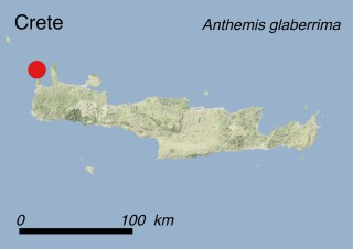
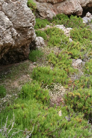
Anthemis glaberrima is endemic to the islets of Agria Gramvousa and Imeri Gramvousa, which are located at the north-western tip of the island of Crete, where it grows on littoral rocks (habitat code 13.1: Sea cliffs and Rocky Offshore Islands). The species was previously reported to occur also in a single locality of the prefecture of Chania in the western part of the main island. Recent accurate field surveys pointed out that this record probably issued from a misidentification with Anthemis rigida. The total AOO is ca. 0.035 km2, with 60'000 to 100'000 individuals. The subpopulation of Imeri Gramvousa covers an area of ca. 0.0015 km2 and consists of about 10'000 to 20'000 individuals.

How to recognize it ?

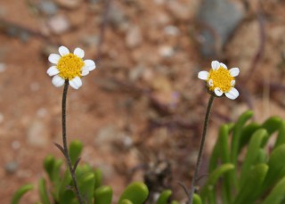
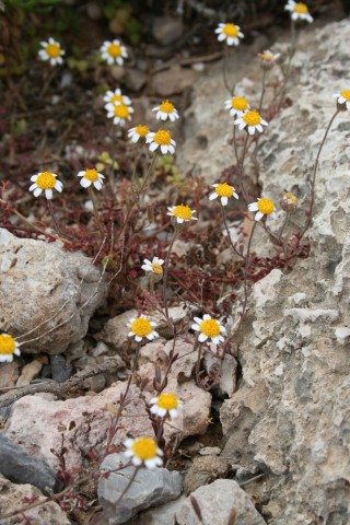
This completely glabrous species is an annual herb: the seeds are dispersed (mainly by wind) at the end of the spring and stored throughout the summer in the soil before germinating and giving rise to a new plant after the first autumn or winter rain. Stem height varies from 2 to 30 cm. The leaves may be entire or deeply incised. The small, daisy-like flower heads are 1 cm in diameter and consist of small tubular yellow flowers in the centre surrounded by white ray flowers (pink underneath). The species flowers from April until May and its dry ribbed fruits (achenes) are mature at the end of May.

Interesting facts

Agria Gramvousa hosts nine Greek endemic plants; hence, the botanic value of this islet is remarkable with respect to its tiny size. A. glaberrima is an islet specialist and belongs to the subgenus Ammanthus, which includes several species (such as Anthemis ammanthus, A. filicaulis and A. tomentella) endemic to the southern islands of the Aegean Sea.

Why is it threatened ?

This species has been categorized CR (Critically Endangered) according to IUCN Red List Criteria B1ac(iv)+2ac(iv), as is mentioned in the European Red List of Vascular Plants. This means that the area where it is found is very limited, and the number of mature individuals is prone to great yearly fluctuations. The main threats to this species include accidental or deliberate introduction of goats or invasive plant species to the islets as well as garbage and solid waste (threats 2.3.2: Small-holder grazing, ranching or farming, 8.1.1: Invasive non-native/alien species - Unspecified species and 9.4: Garbage & solid waste).

What has been done to protect it ?

Legally : Internationally, this species is included in three legal documents: Appendix I of the Bern Convention, Annexes II and IV of the 92/43 EC Directive, where it is listed as a priority species and the Greek Presidential Decree 67/1981 “about the protection of the native flora and fauna…” (Greek Off.J. F.E.K.A’ 23/30.1.1981, corrected by F.E.K.A’ 43/18.2.1981). The islet populations enjoy indirect protection as they fall within the Natura 2000 site GR4340001 ‘Imeri kai Agria Gramvousa - Tigani kai Falasarna - Pontikonisi, Ormos Livadi - Viglia’.

In situ : A plant microreserve of 4.4 ha for a large part of one of the two subpopulations of the species (in the northern part of the islet of Agria Gramvousa) has already been established in the framework of the Cretaplant project (LIFE04NAT_GR_000104, 2004-2007). The area of the Microreserve is designated as a Wildlife Refuge and is protected by Greek Law. Moreover, the setting up of microreserves ensures long-term monitoring activities on the local plant population and the effective protection of its habitat. Furthermore, the project itself improves the awareness of local people, land-owners and users on the importance of nature conservation.

Ex situ: Seeds are stored in the seed bank of the Mediterranean Agronomic Institute of Chania in Crete and in the Seed Bank of the Faculty of Biology at the National and Kapodistrian University of Athens. Few individuals are also cultivated in the botanical garden of the Institute of Chania.

What conservation actions are needed ?

Given the high number of endemic plants which occur on Agria Gramvousa, a management plan should be put in place to prevent the introduction of alien invasive plants. In fact, special attention should be given to the demographic trend of the local goat population, which might threaten the precious botanic heritage of the islet by disrupting the natural balance of local vegetation. Seeds of A. glaberrima should also be stored in other seed banks and plant cultivation should be carried out in several botanical gardens.

Scientific coordination

Prof. Gregoris Iatroú, Department of Biology, Division of Plant Biology, Institute of Botany, University of Patras, Greece.

Ass. Prof. Maria Panitsa, Division of Plant Biology, Department of Biology, University of Patras, Greece.

Dr. Christina Fournaraki, Mediterranean Agronomic Institute of Chania, Crete, Greece.

Dr. Katerina Koutsovoulou, Faculty of Biology, National and Kapodistrian University of Athens.

Photos

Mediterranean Plant Conservation Unit of MAICh

Additional references

Bilz M., Kell S.P., Maxted N., Lansdown R.V., 2011. European Red List of Vascular Plants. Luxembourg: Publications Office of the European Union.

Dimopoulos P., Bergmeier E., Georghiou K., Thanos C.A., 2008. D.1: Final Monitoring Report 2005-2007 (CRETAPLANT: A Pilot Network of Plant Micro-Reserves in Western Crete- LIFE 04 NAT-GR-000104), National and Kapodistrian University of Athens.

Fournaraki C., 2010. Conservation of threatened plants of Crete - Seed ecology, operation and management of a gene bank. PhD thesis, Faculty of Biology, National and Kapodistrian University of Athens.

Fournaraki C., Thanos C., 2009. Anthemis glaberrima (Rech. f.) Greuter. In: Phitos D., Constantinidis Th., Kamari G. (eds.), ‘The Red Data Book of Rare and Threatened Plants of Greece’, vol. 1 (A-D): 92-93. Patras, the Hellenic Botanic Society (in Greek).

Fournaraki C., Thanos C.A., 2011. Anthemis glaberrima. The IUCN Red List of Threatened Species 2011: e.T61617A12524117. http://dx.doi.org/10.2305/IUCN.UK.2011-1.RLTS.T61617A12524117.en.

MAICh, 2005. Action A.1: Inventorying of the localities of the target species/habitats (CRETAPLANT: A Pilot Network of Plant Micro-Reserves in Western Crete- LIFE 04 NAT-GR-000104).

Apium bermejoi

Summary

Latin name Apium bermejoi L. Llorens
Common names Apit den Bermejo (Catalan); Bermejo’s celery (English)
Family Apiaceae
Status CRITICALLY ENDANGERED (CR)
Island
  • Balearic Islands (Spain)
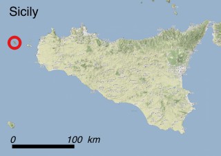
Balearic Islands
Balearic Islands | Minorca
Minorca
Minorca | Apium bermejoi
Apium bermejoi
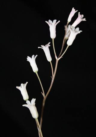
Apium bermejoi – flower
Apium bermejoi
Apium bermejoi – leaf
Apium bermejoi
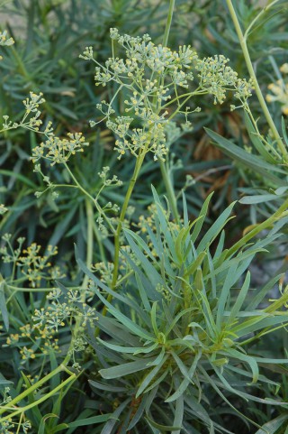
Apium bermejoi – plant
Apium bermejoi
Apium bermejoi – plant
Apium bermejoi
Apium bermejoi – plant
Apium bermejoi
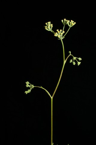
Apium bermejoi – flower

Where it is found ?

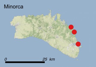
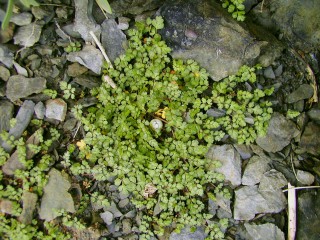
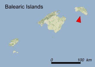
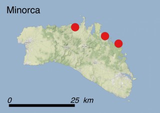
Apium bermejoi is endemic to the Balearic Islands, and occurs in the eastern part of the island of Minorca. There it is only found in two small areas separated by a rocky zone about 200 m wide. The total population numbers less than 100 individuals with strong yearly fluctuations and covers an area of just a few dozen square meters. This species grows in stream beds (Habitat 5.2: Seasonal-Intermittent-Irregular Rivers, Streams, Creeks) which are dry during summer and even during dry winters. In the wild it prefers thin acidic soils within small rock depressions, but under cultivation it is indifferent to the type of substrate, requiring only moderate sun exposure.

How to recognise it ?

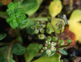
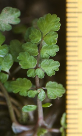
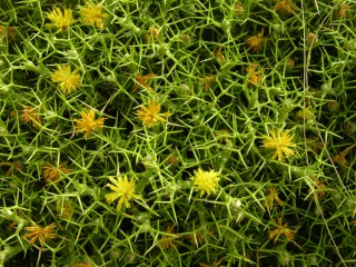
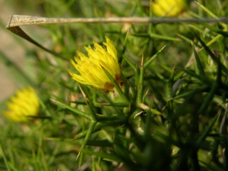
This perennial herbaceous plant creeps over the ground. Its hollow stem is equipped with narrow grooves that secrete aromatic oils, giving to the whole plant a celery smell. Its leaves are compound, with about 5-7 deep lobed leaflets. The flowers are greenish white and arranged in simple umbrella-shaped inflorescences. A. bermejoi usually flowers between April and May, and fructification occurs in June.

Interesting facts

A. bermejoi reproduces from seeds but can also reproduce vegetatively through stolons. Pollination occurs through facultative xenogamy, where ants are the main pollinator agents, but flies may also be efficient agents. This species disperses via geoautochory. The role of the granivourous ants as fruit dispersers is still unclear, but it has been proved that ants look for fruits and carry them to anthills. Seeds germinate easily within a few weeks if the conditions are appropriate.

Why is it threatened ?

This species has been categorized CR (Critically Endangered) according to B1ac(iv)+2ac(iv), C2b criteria; the original population occurs in a single site and the total number of individuals is very low (about 80 clumps in 2015) with strong yearly fluctuations (some years the population was reduced to less than 20 patches). Nevertheless, nowadays the total population, including a subpopulation cultivated ex situ, is about 250 patches.

The species is threatened both directly and indirectly. Its habitat is extremely unstable with available water and nutrients varying greatly from year to year. A. bermejoi does not support very well competition from other species. It is directly threatened by motorbike trampling (threat 6.1: Recreational activities). Ants are fruit predators, but it is possible that they also could facilitate fruit dispersal. The larvae of the moth Orthonama obstipata Fabricius (fam. Geometridae) can severely prey leaves and even kill plants (threat 8.2.1: Problematic native species/diseases – Unspecified species). Climate change may cause changes in its habitat, mainly with a reduction of spring rainfall and an increase of heat weaves during the reproductive stage (threats 11.2: Droughts and 11.3: Extreme temperatures). The hybridization with Apium nodiflorum could be a threat both in the wild and in Botanical Gardens (threat 8.2.2: Problematic native species/diseases - Named species).

What has been done to protect it ?

Legally : A. bermejoi is included in the Annex of the Spanish Royal Decree 139/2011 with the category of “in danger of extinction”; this grants its protection in its natural site. Moreover, the species is included in the Appendix I of the Bern Convention and Annexes II and IV of the 92/43 EC ‘Habitats’ Directive, where it is listed as a priority species. In 2008 a Recovery Plan was approved by the Government of the Balearic Islands. The population of A. bermejoi falls within the Natura 2000 site ES0000235 ‘De s’Albufera de la Mola’.

In situ: From 2003 to 2006, the University of the Balearic Islands (UIB) started a rehabilitation programme for A. bermejoi in its natural habitat with financial support from the MAVA Foundation, Consell Insular de Menorca and Govern Balear. In this framework, a new population was created in a new locality. In 2008 two new populations were established in the wild by UIB in collaboration with Govern Balear. All of these introductions were done with plants generated from seeds of the original population. Unfortunately in 2015 a hybrid with Apium nodiflorum was detected in one of these new localities and it was destroyed to eliminate any further hybridization risk. Nevertheless, nowadays the species is established in two new localities, in one of them the number of individuals is similar or higher to the original population. Other further introductions done by the Govern Balear after 2008 were unsuccessful.

An annual monitoring programme of all subpopulations is being performed.

Ex situ: Seeds of this species are stored in the Botanical Garden of Barcelona, in the seed bank of the Universidad Politécnica of Madrid (BGUPM) and in the seed bank of the Sóller Botanical Garden of Majorca, where the plant is also under cultivation.

What conservation actions are needed ?

It is important to know if the genetic diversity of the natural population is replicated in the new subpopulations created both in the wild and in botanical gardens. It is necessary to control the appearance of hybrids in any of the subpopulations, including the ones cultivated in botanical gardens.

Scientific coordination

Dr. Juan Rita, University of the Balearic Islands.

Dra. Joana Cursach, University of the Balearic Islands.

Sr. Pere Fraga i Arguimbau, Institut Menorquí d’Estudis.

Sr. Gabriel Bibiloni, University of the Balearic Islands.

Dr. Eva Morgues, Government of the Balearic Islands.

Dr. Mauricio Mus, University of the Balearic Islands.

Dr. Llorenç Suez, Autonomous University of Barcelona.

Photos

Dr. Juan Rita, University of the Balearic Islands.

Josep Lluis Gradaille, Jardí Botànic de Sóller.

Additional references

Cursach J., Rita, J., 2012. Reproductive biology and reproductive output assessment in natural and introduced subpopulations of Apium bermejoi, a critically endangered endemic plant from Menorca (western Mediterranean). Nordic Journal of Botany, 30: 754-768.

Rita J., Cursach J., 2013. Creating new populations of Apium bernejoi (Apiaceae), a critically endangered endemic plant on Menorca (Balearic Islands). Anales del Jardín Botánico de Madrid, 70(1): 27-38.

Rita J., Capó M., Cursach, J., 2016. Helosciadium x clandestinum un nuevo híbrido aparecido en Menorca (Islas Baleares). Flora Montiberica, 63: 130-136.

Aquilegia barbaricina

Summary

Latin name Aquilegia barbaricina Arrigoni & E.Nardi
Common name Aquilegia di Barbagia (Italian) Barbaricina colombine (English)
Family Ranunculaceae
Status CRITICALLY ENDANGERED (CR)
Island
  • Sardinia (Italy)
Map Sardinia
Map Sardinia | Aquilegia barbaricina
Aquilegia barbaricina
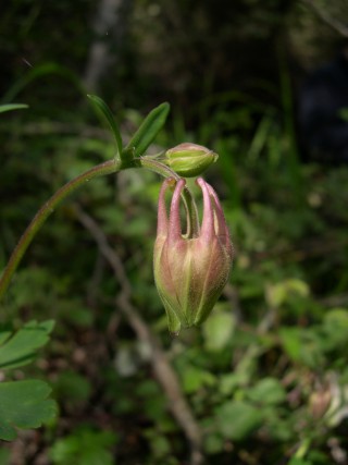
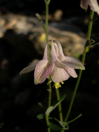
Aquilegia barbaricina – flower
Aquilegia barbaricina
Aquilegia barbaricina – plant
Aquilegia barbaricina
Aquilegia barbaricina – flower
Aquilegia barbaricina
Aquilegia barbaricina – flowers
Aquilegia barbaricina
Aquilegia barbaricina – flower button
Aquilegia barbaricina
Aquilegia barbaricina – flower

Where is it found ?   

Aquilegia barbaricina, an endemic plant to Sardinia, is found in the mountains of the island at altitudes ranging from 900 to 1400 m a.s.l. This plant grows in wet woodlands (habitat code: 1.4.1: Broadleaved deciduous woodland), meadows (habitat 4.4.3: Seasonally wet and wet grasslands) and alongside streams (5.2: Seasonal-Intermittent-Irregular Rivers, Streams, Creeks), mainly occurring on siliceous substrates and more rarely on limestone.

Until 2005 A. barbaricina was only known from a few localities, in the central part of Sardinia. Recent field investigations and a genetic study on the genus Aquilegia in Sardinia strongly improved the knowledge on the present distribution range of this species: to date seven populations have been found. They are located in Monte Spada, Rio Correboi, Nodu ’e Littipori (Fonni), Rio Olai (Orgosolo) and Su Sterzu (Talana) in the Gennargentu Massif, and, in Codula Orbisi (Urzulei) and in Badde Enis (Orgosolo) in the Supramontes region.   

How to recognize it ?   

A. barbaricina is a rhizomatous plant with a subterraneous, stout stem and aerial stems up to 30-60 cm tall, covered with fine hair, branching in the upper part of the stem into 3-5 nearly leafless flower stalks. The leaf petioles are divided once or twice (rarely three times), each division resulting in either a further set of three leaf-bearing stems, or (at a higher level) three leaflets. The cauline leaves have short petioles and are smaller. Leaflets are trilobate with nearly rounded teeth on their outer edge. The pedicel is curved during flowering which occurs in May. The perianth is white to white-pinkish, the sepals lanceolate and 5-8 mm wide. Each petal has a slightly curved spur pointing straight upwards. The fruit is an erect capsule, produced in June.   

Interesting facts

A. barbaricina belongs to the A. vulgaris complex, from which it differs in the usually white to white-pinkish flowers, the different orientation of the flower blade compared to the spur, the funnel-shaped structure and height of the lightly hooked spur, and the anthers which are yellow at maturity.

First described in 1977, this species is considered a “neoendemic” plant issuing from post-Pleistocenic geographic isolation. Recent genetic analyses carried out across the whole distribution range of the Sardinian exclusive taxa of Aquilegia, revealed extremely low levels of genetic diversity in A. barbaricina. This low diversity might be the consequence of local adaptation (divergent selection) to particular environmental conditions, with selection eroding genetic variability. The intra- and inter-specific diversity of habitats may indicate that habitat specialization by divergent selection could have been a very relevant force contributing to population differentiation and species divergence, although this needs further investigation. Additionally, the limited dispersal ability of this species appears to confirm the probably recent geographical isolation of the species.

Why is it threatened ?   

The main threat affecting all populations of A. barbaricina is overgrazing and trampling, largely linked to the high number of domestic livestock such as cows, goats and horses (threat 2.3.2: Small-holder grazing, ranking or farming) and wild ungulates such as mouflons (threat 8.2.2: Problematic native species – named species), leading to considerable damage to the Aquilegia populations, in particular those located in the Gennargentu Massif.

Additionally, its rarity and the beauty of its flowers make A. barbaricina attractive for collectors and researchers, who can easily access most populations; hence the uncontrolled withdrawal of individuals for scientific purposes or for collecting (threat 5.2.1: Gathering terrestrial plants - Intentional use) represents a relevant threat to the species; in fact, several information and images of this species are commonly reported in many guide books and on websites, thus becoming an attraction for collectors.

Some populations, in particular in the Supramontes region, are also threatened by natural factors such as rockfall (threat 10.3: Avalanches/landslides) and floods (threat 11.4: Storms & flooding) that periodically occur.

Based on the Extent Of Occurrence (EOO = 78.46 km2), Area Of Occupancy (AOO = 8 km2), number of locations (one, calculated considering that the main threat affects all populations) and an observed decline due to habitat loss and reduction in mature plants, A. barbaricina must be considered Critically Endangered (CR) according to the IUCN Criterion B : B1ab(i,ii,iii,iv,v)+2ab(i,ii,iii,iv,v).

What has been done to protect it ?   

Legally: Currently there is no legal protection for this species; despite the fact that the Regional Council of Sardinia proposed in 2005 a (not yet approved) law concerning the protection of the islands’ plant species.

The populations located in the Gennargentu massif fall within the Natura 2000 site “Monti del Gennargentu” (ITB021103), while those located in the Supramontes region fall in the Natura 2000 site “Supramonte di Oliena, Orgosolo e Urzulei - Su Sercone” (ITB022212).

In situ and Ex situ: The Autonomous Region of Sardinia funded in 2008 a conservation project aimed at the safeguard of the ten most threatened endemic plant species of the island comprising in situ and ex situ studies. As part of this project, the Biodiversity Conservation Center of the Cagliari University started an in situ periodic monitoring of all known populations of A. barbaricina. Therefore, the surface of each population as well as all mature plants (ca. 700 individuals) are monitored every year. At the same time, a long-term ex situ conservation program at the Sardinian Germplasm Bank was initiated. This program has enabled the conservation of seeds coming from the different populations, and duplicata were also sent to the Millennium Seed Bank (Royal Botanic Gardens of Kew).

Moreover, the project allowed to carry out specific studies on this plant related to its conservation status assessment, the study of its phenological patterns and seed ecophysiological traits, the genetic characterization of its populations and led to the description of a new species of Aquilegia endemic to the Supramontes region, named A. cremnophila.

What conservation actions are needed ?   

The populations should be protected in order to eliminate (or reduce) grazing pressure and to forbid the collection of plants by collectors, researchers or tourists. In particular, the populations of Monte Spada and Rio Correboi, and those of Nodu ’e Littipori (Fonni), Rio Olai (Orgosolo) and Su Sterzu (Talana) in the Gennargentu Massif urgently need to be fenced.

Further research is needed in order to better understand the exact distribution, the reproductive biology and the ecology of A. barbaricina.

Scientific coordination

Giuseppe Fenu, Centro Conservazione Biodiversità, Dipartimento di Scienze della Vita e dell’Ambiente, Università degli Studi di Cagliari, Viale Sant’Ignazio da Laconi 13, 09123 Cagliari, Italy.

Donatella Cogoni, Centro Conservazione Biodiversità, Dipartimento di Scienze della Vita e dell’Ambiente, Università degli Studi di Cagliari, Viale Sant’Ignazio da Laconi 13, 09123 Cagliari, Italy.

Gianluigi Bacchetta, Centro Conservazione Biodiversità, Dipartimento di Scienze della Vita e dell’Ambiente, and Hortus Botanicus Karalitanus (HBK), Università degli Studi di Cagliari, Viale Sant’Ignazio da Laconi 9 -11, 09123 Cagliari, Italy.   

Photos

Gianluigi Bacchetta, Centro Conservazione Biodiversità, Dipartimento di Scienze della Vita e dell’Ambiente, and Hortus Botanicus Karalitanus (HBK), Università degli Studi di Cagliari, Viale Sant’Ignazio da Laconi 9 -11, 09123 Cagliari, Italy.   

Giuseppe Fenu, Centro Conservazione Biodiversità, Dipartimento di Scienze della Vita e dell’Ambiente, Università degli Studi di Cagliari, Viale Sant’Ignazio da Laconi 13, 09123 Cagliari, Italy.

Additional references

Arrigoni P.V., Nardi E., 1977. Le piante endemiche della Sardegna: 1. Bollettino della Società Sarda di Scienze Naturali, 16: 265-268.

Bacchetta G., Brullo S., Congiu A., Fenu G., Garrido J.L., Mattana E., 2012. A new species of Aquilegia (Ranunculaceae) from Sardinia (Italy). Phytotaxa, 56(1): 59-64.

Fenu G., Cogoni D., Pinna M.S., Bacchetta G., 2015. Threatened Sardinian vascular flora: a synthesis of ten years of monitoring activities. Plant Biosystems, 149(3): 473-482.

Fenu G., Mattana E., Congiu A., Garrido J.L., Bacchetta G., 2011. Schede per una lista rossa della flora vascolare e crittogamica italiana: Aquilegia barbaricina Arrigoni et E.Nardi. Informatore Botanico Italiano, 43(2): 381-458.

Garrido J.L., Fenu G., Mattana E., Bacchetta G., 2012. Spatial genetic structure of Aquilegia taxa endemic to the island of Sardinia. Annals of Botany, 109(5): 953-964.

Mattana E., Daws M.I., Fenu G., Bacchetta G., 2012. Adaptation to habitat in Aquilegia species endemic to Sardinia (Italy): seed dispersal, germination, and persistence in the soil. Plant Biosystems, 146(2): 374-383.

Aquilegia nuragica

Summary

Latin name Aquilegia nuragica Arrigoni & E.Nardi
Common names Aquilegia nuragica (Italian); Nuragic columbine (English)
Family Ranunculaceae
Status CRITICALLY ENDANGERED (CR)
Island
  • Sardinia (Italy)
Sardinia
Sardinia | Aquilegia nuragica
Aquilegia nuragica
Aquilegia nuragica – plant

Where is it found ?

Aquilegia nuragica, a narrow endemic to Sardinia, is known from a single population, covering an area of about 1000 m2 at an altitude of 620-680 m a.s.l., located in the Gorropu canyon (Urzulei-Orgosolo).

The population grows on a wet vertical limestone cliff (habitat 6.2: Inland cliffs – rock pavements and outcrops), extremely difficult to access. Occasionally some plants occurred in the dry, sandy pebbly substrate of the riverbed issuing from seeds dispersed from the overhanging cliff; however only a few individuals grow here, because they are regularly washed away during the seasonal flooding of the Flumineddu river.

During the last years no plants were found in the riverbed, probably due to the above-mentioned floods and/or as a consequence of their gathering from tourists and collectors.

Recent field investigations and a genetic study on the genus Aquilegia in Sardinia confirmed that the population growing in the Gorropu canyon is the only to be referred to A. nuragica, while the one located on the Mt. Corrasi belongs to a different species, A. cremnophila.

How to recognize it ?   

A. nuragica is a rhizomatous plant with a partially subterraneous, stout, scarcely branching annual stem up to 20-35 cm tall, glabrous at the bottom and covered with fine hairs or glands higher up. All basal leaves have 15-25 cm long, hairless stalks, and have a complex branching system, each division resulting in sets of three (stalks or leaflets). Smaller leaves growing along the stem have a less complex branching pattern. Leaflets consist of three segments, not always clearly separated, each with pointed teeth on the outer edge. The pedicel is erect during the flowering period (May). The perianth is blue-green to blue-violet and the sepals are ovate to ovate-lanceolate and 9-14 mm wide. Stems and petioles are glabrous to glandular-puberulous, the spur is 11-13 mm long. The single, lilac or purplish flower measures over 40-56 mm in diameter. Petals are 26-30 mm long and their blade is appressed, obovate, with a rounded apex 15-18x10-13 mm long. The fruit is an erect, drop-shaped capsule with little hooks on the tip.   

Interesting facts

The recent genetic analyses, carried out across the whole distribution range of the Sardinian exclusive taxa of Aquilegia, revealed extremely low levels of genetic diversity in A. nuragica. These reduced diversity values might be the consequence of local adaptation (divergent selection) to particular environmental conditions, with selection eroding genetic variability. The A. nuragica population at Gorropu Canyon is probably the most geographically isolated in Sardinia and presents no admixture and does not share any genetic information with other Sardinian Aquilegia taxa. Thus, it is probably subject to high levels of genetic drift.

Aquilegia nuragica may be ascribed to the same ancient Cyrno-Sardinian complex of A. litardierei. Its numerous archaic morphological characters suggest an ancient differentiation of this plant and, at the same time, a long geographical isolation.

Why is it threatened ?   

A. nuragica is facing high extinction risk mainly due to natural factors rather than through human impact. The main threats that resulted in a recent reduction in the population are the seasonal floods of the Flumineddu river (Threat 11.4: Storms & flooding) and, secondarily, the uncontrolled gathering of individuals by researchers and tourists (Threat 5.2.1: Gathering terrestrial plants - Intentional use).

Also tourist and recreational activities, in particular climbing (Threat 6.1: Recreational activities) close to the population could represent a serious threat to A. nuragica. Another potential threat is related to the natural evolution of the rocky cliff, prone to collapses (Threat 10.3: Avalanches/landslides).

Based on the Extent Of Occurrence (EOO = 1000 m2), Area Of Occupancy (AOO = 1 km2), the surface-area occupied by the population (about = 800 m2), the single location and the observed decline due to habitat loss and reduction in reproductive plants, A. nuragica must be considered Critically Endangered (CR) according to the IUCN Criterion B. In addition, monitoring activities carried out in recent years allow us to estimate that the whole population consists of ca. 40 mature individuals; hence, this plant must be considered Critically Endangered (CR) also according to the IUCN Criterion D.

Summarising, A. nuragica must be considered Critically Endangered (CR) according to the formula: B1ab(iii,v)+2ab(iii,v); D.

What has been done to protect it ?   

Legally: currently there is no legal protection for this species; despite the fact that the Regional Council of Sardinia proposed in 2005 a (not yet approved) law concerning the protection of the islands’ plant species.

The population of A. nuragica falls within the Natura 2000 site “Supramonte di Oliena, Orgosolo e Urzulei – Su Sercone” (ITB022212).

In situ: The Autonomous Region of Sardinia funded in 2008 a conservation project aimed at the safeguard of the ten most threatened endemic plants species of the island comprising in situ and ex situ studies. As part of this project, the Biodiversity Conservation Center of the Cagliari University started a periodic in situ monitoring of the population and the mature plants are monitored every year.

Ex situ: Due to the low number of mature individuals and the extreme difficulties in germplasm collecting, ex situ conservation measures have not yet been undertaken.

The project allowed to carry out specific studies related to conservation status assessment of the species and the genetic characterization of its population as well as a taxonomic studies on this genus in Sardinia.

What conservation actions are needed ?   

To ensure the persistence of A. nuragica its only population should be more strictly protected: all recreational activities (i.e. free climbing) should be prohibited near the population and the collection of plants strictly forbidden. The species is mentioned on several tourist websites, which might attract collectors, and any detailed information concerning the exact location of the population should be removed in order to keep people away from the site.

The in situ monitoring should be continued and, as a precautionary measure, the ex situ seed conservation should be started. A translocation project, starting from plants cultivated ex situ, should be implemented in a suitable area.

Further research is needed in order to better understand the exact distribution, the reproductive biology and the ecology of A. nuragica.

Scientific coordination   

Giuseppe Fenu, Centro Conservazione Biodiversità, Dipartimento di Scienze della Vita e dell’Ambiente, Università degli Studi di Cagliari, Viale Sant’Ignazio da Laconi 13, 09123 Cagliari, Italy..

Donatella Cogoni, Centro Conservazione Biodiversità, Dipartimento di Scienze della Vita e dell’Ambiente, Università degli Studi di Cagliari, Viale Sant’Ignazio da Laconi 13, 09123 Cagliari, Italy.

Gianluigi Bacchetta, Centro Conservazione Biodiversità, Dipartimento di Scienze della Vita e dell’Ambiente, and Hortus Botanicus Karalitanus (HBK), Università degli Studi di Cagliari, Viale Sant’Ignazio da Laconi 9 -11, 09123 Cagliari, Italy.   

Photos

Gianluigi Bacchetta, Centro Conservazione Biodiversità, Dipartimento di Scienze della Vita e dell’Ambiente, and Hortus Botanicus Karalitanus (HBK), Università degli Studi di Cagliari, Viale Sant’Ignazio da Laconi 9 -11, 09123 Cagliari, Italy.

Additional references

Arrigoni P.V., Nardi E., 1978. Le piante endemiche della Sardegna: 19-20. Bollettino Società Sarda Scienze Naturali 17: 215-225.

Bacchetta G., Brullo S., Congiu A., Fenu G., Garrido J.L., Mattana E., 2012. A new species of Aquilegia (Ranunculaceae) from Sardinia (Italy). Phytotaxa, 56 (1): 59-64.

Fenu G., Cogoni D., Pinna M.S., Bacchetta G., 2015. Threatened Sardinian vascular flora: a synthesis of ten years of monitoring activities. Plant Biosystems, 149(3): 473-482.

Fenu G., Mattana E., Congiu A., Garrido J.L., Bacchetta G., 2011. Schede per una lista rossa della flora vascolare e crittogamica italiana: Aquilegia nuragica Arrigoni & E. Nardi. Informatore Botanico Italiano, 43(2): 381-458.

Garrido J.L., Fenu G., Mattana E., Bacchetta G., 2012. Spatial genetic structure of Aquilegia taxa endemic to the island of Sardinia. Annals of Botany, 109(5): 953-964.

Arabis kennedyae

Summary

Latin name Arabis kennedyae Meikle
Common name Troodos rockcress (English)
Family Brassicaceae
Status ENDANGERED (EN)
Island
  • Cyprus (Cyprus)
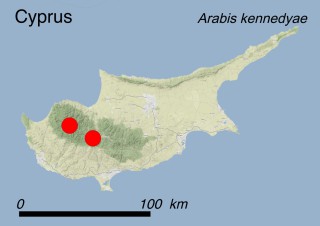
Map Cyprus
Map Cyprus | Arabis kennedyae
Arabis kennedyae
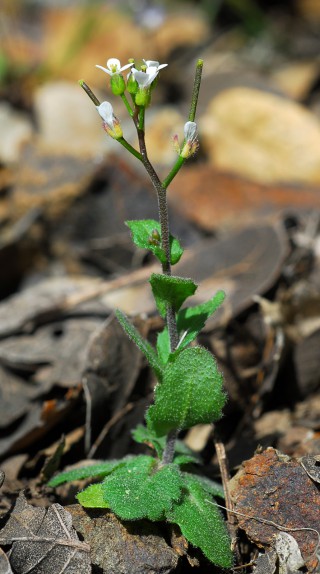
Arabis kennedyae – Plant

Where is it found ?

This plant grows at 1200-1400 m a.s.l. on the ophiolithic rocky slopes of the central Troodos and Tripylos mountains (Troodos range). The species is found in semi-shaded openings at the margins of Cedrus brevifolia and Juniperus foeditissima forests (habitat 1.4.3: Coniferous woodland) or in rocky streamside areas dominated by the golden oak (Quercus alnifolia) (habitat 1.4.2: Broadleaved evergreen woodland) and the Calabrian pine (Pinus brutia) (habitat 1.4.3: Coniferous woodland).

How to recognise it ?

Arabis kennedyae is an annual or biennial herb with erect, often purplish stems usually less than 30 cm tall. The basal leaves are up to 6 cm long, 2 cm wide, and form a rosette. The cauline leaves are shorter than the basal ones. The flowers are small and inconspicuous with four white petals, arranged in loose bunches. The plant flowers from (March-)April to May. The fruits are 25-40 mm long and very narrow, almost looking like extensions of the branched stem. At maturity they dry up and split open into two parts that fall off, leaving an inconspicuous central membrane which supports the tiny seeds.

Interesting facts

The annual or biennial habit of the plant probably depends on the weather conditions. In wetter years the plant can overcome the summer drought period. The seeds are dispersed either by wind or by floating along streams. Since this species is annual or sometimes biennial, population size, expressed as the total number of mature individuals in all subpopulations, as well as the size of each subpopulation, experiences significant annual fluctuation.

Why is it threatened ?

Taking into account monitoring data of the years 2006-2011, the species is no longer considered as CR (Critically Endangered) and should now be classified as EN (Endangered) according to IUCN Red List Criteria B1ac(iv)+2ac(iv). If we use a 1×1 km grid the AOO is ca. 5 km2 and the EOO ca. 14 km2, respectively; moreover, the number of locations is less than 5 and extreme fluctuations in the number of mature individuals have been recorded. The four known subpopulations encompass approximately 10,000 individuals (2011 census).

The direct threats which have been identified during field surveys were the development of recreation areas and activities therein at two locations, which are close to nature trails and a picnic site (threat 6.1: Recreational activities), the construction of new roads and the improvement of existing ones (threat 4.1: Roads and railroads), forest management (threat 4.2: Utility and service lines) at two locations, low to moderate frequency of human-induced fires (7.1.1: Increase in fire frequency/intensity) at all locations despite fire protection measures due to the proximity of inflammable pine forests, and the high frequency of visitors (threat 1.3: Tourism & recreation areas). All the above-mentioned factors may also represent a source of indirect threat by inducing progressive habitat loss.

What has been done to protect it ?

Legally: This species is protected by the Bern Convention where it is listed in Appendix I, and by the 92/43 EC ‘Habitats’ Directive where it is included as a priority species in Annexes II and IV. Moreover, it is included in the Red Data Book of the Flora of Cyprus as an Endangered species. The subpopulation at Tripylos mountain, in the Cedar Valley, was designated as a Plant Micro-Reserve by a Ministerial decree in 2013, according to the Forest Legislation.

In situ: The entire population of this species occurs in Troodos National Forest Park and Paphos State Forest. All subpopulations are located within two sites of the Natura 2000 network (CY2000008 – Koilada Kedron-Kampos; CY5000004 – Ethniko Dasiko Parko Troodous). Monitoring activities took place from 2006 to 2009, within the framework of a PhD Thesis and from 2010 to 2013 within the framework of a LIFE+ project (LIFE08 NAT/CY/000453 - Establishment of a Plant Micro-Reserve Network in Cyprus for the Conservation of Priority Species and Habitats).

Ex situ: Seeds from all subpopulations are stored in the seed-bank of two institutions located in Nicosia: the Nature Conservation Unit of Frederick University and the National Seed Bank of the Agricultural Research Institute.

What conservation actions are needed ?

Based on up-to-date population data, several interventions should be undertaken in order to ensure the survival of the species by reducing or eliminating direct and indirect threats. Road construction and accidental trampling at two locations can be handled by informing the relevant authorities and by signposting for the public, while the modification of the hiking path of Kryos Potamos would allow to preserve the small local subpopulation. On the other hand, population data and habitat availability indicate an increased extinction risk due to small population size combined with large fluctuations and low genetic diversity. In situ conservation should also focus on population size enhancement and on the maintenance of forest openings. Population reinforcement by establishing new plants in the most suitable microsites is needed for the two smallest subpopulations.

Scientific coordination

Dr. Marios Andreou, Nature Conservation Unit – Frederick University, Nicosia, Cyprus.

Dr. Charalambos S. Christodoulou, Department of Forests, Ministry of Agriculture, Rural Development and Environment, Nicosia, Cyprus.

Photos

Dr. Charalambos S. Christodoulou, Department of Forests, Ministry of Agriculture, Rural Development and Environment, Nicosia, Cyprus.

Additional references

Andreou Μ. 2010. Conservation biology of rare plants of Cyprus. PhD Thesis. National and Kapodistrian University of Athens, Athens.

Andreou M., Delipetrou P., Kadis C., Tsiamis G., Bourtzis K., Georghiou K. 2011. An integrated approach for the conservation of threatened plants: the case of Arabis kennedyae (Brassicaceae). Acta Oecologica 37: 239-248.

Tsintides T., Christodoulou C.S., Delipetrou P., Georghiou K., 2007. The Red Data Book of the Flora of Cyprus. Cyprus Forestry Association, Chr. Nicolaou & Sons Ltd., Lefkosia ISBN 978-9963-9288-0-4

Arenaria bolosii

Summary

Latin name Arenaria bolosii (Cañig.) L. Sáez & Rosselló
Common name Sandwort of Majorca (English)
Family Caryophyllaceae
Status CRITICALLY ENDANGERED (CR)
Island
  • Balearic Islands (Spain)
Balearic Islands
Balearic Islands | Majorca
Majorca
Majorca | Arenaria bolosii
Arenaria bolosii
Arenaria bolosii – plant
Arenaria bolosii
Arenaria bolosii – plant
Arenaria bolosii
Arenaria bolosii – flowers
Arenaria bolosii
Arenaria bolosii – flowers

Where is it found ?

This species is only known from a single mountainous area on the island of Majorca in the central part of the Tramuntana mountain range. Less than 200 individuals grow in an area covering approximately one hectare. It is very sensitive to competition from other species and therefore grows in open areas with little soil cover. It is found on north-facing slopes above 900 m of altitude. Its habitat is a very patchy garrigue on stony and rocky substrate, characterized by spiny cushion-like shrubs, subshrubs and herbs (code 3.8.2: Garrigue).

How to recognise it ?

This perennial herb grows in loose clumps, up to 5-10 cm tall. The plant, green-grey tinged with pink, is branched out from the base with stems covered by small hairs. The leaves are arranged in pairs, lanceolate to linear. The small white flowers have five petals and develop at the tips of the stems. Flowering and fruit production occur between June and July.

A. bolosii can be confused with the related A. grandiflora L. subsp. glabrescens, a taxon which can be assigned to low concern category, co-occurring in the same site as well as on other mountain ranges of the island. A. bolosii differs by its grey color and compact habitus, the dense 0.2-0.4 mm glandular hairs on the inflorescence indumenta (A. grandiflora subsp. glabrescens may also bear glandular hairs, but these are less dense and shorter than 0.2 mm) and the smaller seeds (1-1.2 mm vs. 1.3-15 mm in A. grandiflora subsp. glabrescens).

Interesting facts

Apart from its perennial habit, little is known about the biology of this plant. Its small size and the buds close to the ground protect it from the wind and allow it to withstand the dry microclimatic conditions.

Why is it threatened ?

A. bolosii is categorized as CR (Critically Endangered) according to IUCN Red List Criterion B1ab(iii)+2ab(iii). This means that the number of individuals and the surface of suitable habitat are both very small, as it is known from two sites prone to frequent disturbance due to hikers and goats, which undoubtedly affect the stony ground.

The main treats are: Plant collectors seeking botanical rarities (threat 5.2.1: Gathering terrestrial plants - Intentional use). In addition, the species seems to hybridize with the closely related species A. grandiflora subsp. glabrescens (threat 8.2.2: Problematic native species/diseases - Named species). Other threats include grazing by goats (threat 8.2.2: Problematic native species/diseases - Named species), and habitat modification as people use the area for hiking (threat 6.1: Recreational activities). The potential impact of fires affecting Arenaria patches (threat 7.1.3: Fire and fire suppression – Trend unknown/unrecorded) should not be underestimated.

What has been done to protect it ?

Legally: the site hosting the population of A. bolosii falls within the Natura 2000 network (ES5310027 ‘Cimals de la Serra’) set up under the autonomic legislation (Official Bulletin of the Balearic Islands 38, 16/03/2006 and 47 ext., 01/04/2006). The site also falls within a Natural Area of Special Interest (ANEI de Tramuntana) and the Serra de Tramuntana Nature Area. To the last one the status of “Integral Natural Reserve” has been recognized according to the Official Bulletin of the Balearic Islands 54 ext., 11/04/2007). The species is protected at a Regional level (BOIB 66, 15/05/2008) and listed as Vulnerable.

In situ: No measures have been taken yet. There is a lack of regular monitoring and population census.

Ex situ: Seeds of this plant are stored in the seed bank of the Botanical Garden of Sóller in Majorca, but it is possible that these are hybrids with A. grandiflora subsp. glabrescens.

What conservation actions are needed ?

This species needs increased legal protection, such as its inclusion in the Annexes of the EC Habitats Directive.

Public access to the site must be controlled effectively and a clear delimitation of the walking paths is needed. Moreover, more information on forbidden activities such as picnic, camping, gathering or walking outside of the paths should be given to groups especially as concerns the use of the walking path (GR-221) which passes through the population.

Other conservation measures to be taken must include the introduction of the species in other areas of the Majorcan mountains, but carefully avoiding the vicinity of the other Balearic congener species.

If the seeds stored in seed banks are found to be hybrids, any re-introduction campaign using this material will be detrimental to conservation. Genetic studies are therefore needed, and seeds should be collected only when it has been established that they belong to this species.

Scientific coordination

Dr. Mauricio Mus, University of the Balearic Islands.

Sr. Gabriel Bibiloni, University of the Balearic Islands.

Sr. Pere Fraga i Arguimbau, Island Council of Menorca.

Dr. Eva Moragues, Government of the Balearic Islands.

Dr. Juan Rita, University of the Balearic Islands.

Dr. Llorenç Sàez, Autonomous University of Barcelona.

Photos

Dr. Llorenç Sàez, Autonomous University of Barcelona.

Josep Lluis Gradaille, Jardí Botànic de Sóller.

Astragalus macrocarpus subsp. lefkarensis

Summary

Latin name Astragalus macrocarpus subsp. lefkarensis Agerer-Kirchhoff & Meikle
Common name Lefkara milk-vetch (English)
Family Fabaceace
Status VULNERABLE (VU)
Island
  • Cyprus (Cyprus)
Map Cyprus
Map Cyprus | Astragalus macrocarpus subsp. lefkarensis
Astragalus macrocarpus subsp. lefkarensis
Astragalus macrocarpus subsp. lefkarensis – plant

Where is it found ?

This subspecies is endemic to Cyprus and occurs in seven locations. It is found near the villages of Lefkara (after which the subspecies has been named), Asgata, Tochni, Alaminos, Kormakitis, Kelokedara and Ineia between 75 and 700 m a.s.l. Astragalus macrocarpus subsp. lefkarensis grows on mountain slopes within secondary plant communities derived from the degradation of evergreen mixed forest, i.e. open maquis (habitat 3.8.1.: Maquis, arborescent matorral and thermo-Mediterranean brushes) and phrygana (habitat 3.8.2: Garrigue).

How to recognise it ?

A. macrocarpus subsp. lefkarensis is an erect, hairy perennial shrub with a robust stem 30-60 cm high. The leaves are compound with 15-30 leaflets which are longer than wide, and can be opposite or alternate. The flowers are bright yellow, arranged in axillary clusters of three to nine. The flowering period is between March and April. The fruits are egg-shaped and relatively large (2.5-5 cm) pods, containing up to five large seeds.

Interesting facts

The plant is drought-resistant due to its thick grey-white hairs. The seeds are dispersed when the ripe beans fall off the plant and then roll due to their heavy weight and elliptical shape. No mechanisms for uphill seeds dispersal are known, but propagation from rhizomes probably prevents the population from gradually being shifted downwards.

Why is it threatened ?

After recent field surveys, A. macrocarpus subsp. lefkarensis is no longer listed as CR (Critically Endangered). It has been included in the Red Data Book of the Flora of Cyprus as VU (Vulnerable) according to IUCN Red List Criterion D2, due to the restricted distribution range. When using a 1×1 km grid, the AOO is 17 km2 and the EOO is 134 km2. The total population size amounts to ca. 3000 individuals (2007 census).

The lack of pollinators seems to be the cause of the low sexual reproduction of A. macrocarpus subsp. lefkarensis. Since this subspecies produces a very small quantity of seeds, reproduction is mostly vegetative resulting in very low genetic variability in the four small remaining subpopulations. This may limit its capacity to adapt to environmental changes.

During spring a Bruchidae beetle (Βruchidius plagiatus) lays its eggs on the flowers. The larvae hatch in the seeds and feed on their nutritive reserves, consuming 50-75% of the seeds (threat 8.2.2: Problematic native species/diseases - Named species). Seed consumption along with fruit and seed abortion are the main reasons for the low reproductive success of this species.

The expansion of both urban areas (threat 1.1: Housing and Urban areas) and tourism (threats 1.3: Tourism & recreation areas, and 6.1: Recreational activities) threaten the populations of Lefkara and Alaminos.

What is being done to protect it ?

Legally: This subspecies is protected by the Bern Convention, where it is listed in Appendix I, and by the 92/43 EC ‘Habitats’ Directive where it is included as a priority species in Annexes II and IV. It is included in the Red Data Book of the Flora of Cyprus as Vulnerable. In 2013 the subpopulation located in Asgata (the largest subpopulation) was designated as a Plant Micro-Reserve (http://www.plantnet.org.cy/update_on_the_progress.html).   

In situ: Only part of the population is included in the Natura 2000 network; the subpopulation at Lefkara (CY6000005 – Periochi Lefkaron) and the subpopulation at Asgata (CY5000007 – Periochi Asgatas). Monitoring activities took place from 2010 to 2013 within the framework of a LIFE+ project entitled 'Establishment of a Plant Micro-Reserve Network in Cyprus for the Conservation of Priority Species and Habitats' (LIFE08 NAT/CY/000453).

Ex situ: A small number of seeds collected from the Lefkara and Kelokedara subpopulations are stored in the seedbank of two institutions located at Nicosia: the Nature Conservation Unit of Frederick University of Nicosia and the National Seed Bank of the Agricultural Research Institute of Cyprus. The subspecies has been successfully cultivated by the Department of Forests and planted in the Athalassa Botanic Garden in Nicosia.

What conservation actions are needed ?

In situ: The identity of potential pollinators should be investigated in order to enhance the chances of offspring.The insect Βruchidius plagiatus, which predates on the seeds of A. macrocarpus subsp. lefkarensisis is a rare Cyprian endemic as well; therefore, any interventions have to be designed very carefully. Moreover, the competent authorities need to inform landholders about the presence of this rare plant in their property and to encourage its protection.

Ex situ: Since the plants have a very low reproductive capacity, collecting large numbers of seeds from the wild and storing them in a seed bank could affect the recruitment of natural subpopulations. Therefore, any collection for ex situ conservation needs to be carried out carefully and documented in order to conserve the maximum genetic diversity in the collections and create the minimum damage to the wild populations.

Scientific coordination

Dr. Marios Andreou, Nature Conservation Unit - Frederick University, Nicosia, Cyprus.

Dr. Charalambos S. Christodoulou, Department of Forests, Ministry of Agriculture, Rural Development and Environment, Nicosia, Cyprus.

Photos

Dr. Charalambos S. Christodoulou, Department of Forests, Ministry of Agriculture, Rural Development and Environment, Nicosia, Cyprus.

Additional references

Tsintides T., Christodoulou C.S., Delipetrou P., Georghiou K., 2007. The Red Data Book of the Flora of Cyprus. Cyprus Forestry Association, Chr. Nicolaou & Sons Ltd., Lefkosia ISBN 978-9963-9288-0-4


Biscutella rotgesii

Summary

Latin name Biscutella rotgesii Foucaud
Common names Lunetière de Rotgès (français); Buckler-Mustard of Rotgès (English)
Family Brassicacae
Status VULNERABLE (VU)
Island
  • Corsica (France)
Corsica
Corsica | Biscutella rotgesii
Biscutella rotgesii
Biscutella rotgesii – Young leeves
Biscutella rotgesii
Biscutella rotgesii – flowers
Biscutella rotgesii
Biscutella rotgesii – fruits

Where is it found?

Endemic to Corsica, this species colonizes rockeries and screes on serpentines, under a meso-mediterranean-type climate, between 150 and 320 m a.s.l. Up to now three populations have been detected; the first occurs north of Ponte Leccia (Morosaglia municipality, 5 ha), the second along the slopes of the quarry of Salastraco (Pietroso municipality, ca. 3 ha), and the last at the canyon of Trévadine (Ghisoni and Ghisonaccia municipalities, ca. 25 ha), located just below the famous canyon of the Inzecca. The species shows a wide ecological amplitude, colonizing both steady and incoherent substrates on slopes ranging from 5° to 70°, within open plant communities such as grasslands (habitat 4.4.1: Dry grasslands), garrigue (habitat 3.8.2: Garrigue) and low maquis (habitat 3.8.1: Maquis, arborescent matorral and thermo-Mediterranean brushes) or in shaded conditions under the tree canopy of maquis (3.8.1) or woodland communities dominated by maritime pine (habitat 1.4.3: Coniferous woodlands), holm oak (habitat 1.4.2: Broadleaved evergreen woodland) or cade juniper (3.8.1).

How to recognise it?

It is a little perennial plant 10 to 35 cm tall, with a green-ash colored stem that is ramified from the base. The leaves are rough and hairy, with a crenulated margin and form a basal rosette. The small (<1 cm) pale yellow flowers are grouped into loose racemes. The fruits (silicles) are typically lens-shaped; once ripe and dry, they open and release the seeds. Flowering occurs between March and October but mostly between April and May.

Interesting facts

As most of the plants colonizing serpentines, this species is able to tolerate high amounts of heavy metals as well as low water availability, thus avoiding the concurrence of most of the other plants, less adapted to thrive in such hostile soil conditions.

Why is it threatened?

The risk level of Biscutella rotgesii has been downscaled with respect to the first edition of the Top50: it has now been categorized as VU (Vulnerable) according to the IUCN Red List Criteria D2. In fact, although field investigations carried out in 2005 by the Conservatoire Botanique National de Corse (CBNC) allowed to discover three populations covering rather wide areas and counting a high number of individuals, using a 2×2 km grid the AOO is 16 km2, the EOO 45 km2, and the number of populations <5 and the species is prone to several potential threats, such as wildfires (threat 7.1.3: fire & fire suppression: trend unknown/unrecorded) like the one that occurred in 1993 which destroyed most of the population of Ponte Leccia; road construction and maintenance (threat 4.1: Roads and railroads), very risky for the population of the canyon of Trevadine; the alteration of local plant assemblages due to the overwhelming competition and the fast spread of the alien invasive Ailanthus altissima (threats 8.1.2: Invasive non-native/alien species - Named species, and 11.1: Habitat shifting & alteration), and extensive cattle grazing (threat 2.3.2: Small-holder grazing, ranching or farming). Only the population of Salastraco appears to be safe from threats.

What has been done to protect it?

Legally: the species is listed among the protected plants of Corsica, which is complementary to the national list (governmental decree of June 24, 1986 published in the Official Journal of the French Republic on August 15, 1986). B. rotgesii also figures within the Red Book of the Threatened Flora of France (1995). No protection measure is effective at an international level.

An ad hoc National Action Plan has been written down. This document provides an overview on the species’ ecology, distribution and status (last update: 2012), outlines some tools for its protection, summarizing the best practices and the most effective strategies for its long-term conservation. Unfortunately, it has not yet been published by the French Ministry of Environment.

In situ: only a small part of the population of the canyon of Trévadine grows within the Natura 2000 site R9400597 ‘Défilé de l’Inzecca’. Two prefectoral decrees for biotope protection (arrêté préfectoral de protection de biotope) were created for the Ponte Leccia and Inzecca subpopulations. After being informed about the presence of the species, the regional road service carries out any cleaning/maintenance interventions of the roadsides with a great caution, so that their impact on local subpopulations is negligible.

Ex situ: The Conservatoire Botanique National de Corse (CBNC) has collected and stored seeds from the 3 locations. B. rotgesii is also cultivated at the Botanical Garden of Porquerolles (France), where a seed collection is stored as well.

What conservation actions are needed?

Conservation is an important issue for this strictly Corsican endemic, with only 3 stations. Nevertheless, B. rotgesii does not seem to be a particularly endangered species. The study carried out by the CBNC (2012) shows that it is able to colonize many habitats on serpentine and seems to tolerate quite well several disturbance factors, being able to grow on shallow and poor soils and sheltered by cushion-like chamaephytes which are not consumed by livestock (Anthyllis hermanniae, Euphorbia spinosa, Genista corsica, etc.).

Further field investigations on the ecology and biology of the species should be encouraged to improve the current knowledge on real threats. In particular, it is important to clarify the impact of grazing and wildfire occurrence on the populations, as well as the effect of encroachment by Pinus pinaster and spreading of Ailanthus altissima. Public awareness on this little plant should also be promoted. In this direction, an information panel has already been prepared by the CBNC.

Scientific coordination

Carole Piazza, Conservatoire botanique national de Corse, Office de l’Environnement de la Corse, Corte, France

Dr. Guilhan Paradis, Ajaccio, France

Laetitia Hugot, Conservatoire botanique national de Corse, Office de l’Environnement de la Corse, Corte, France

Photos

Camille Féral, DDTM, Ajaccio, France 

Additional references

Ardiet L., 2010. Document d’objectifs. Site Natura 2000 ‛Défilé de l’Inzecca’. Biotope, Agence de Corse. 165 p. Commande de la DREAL de Corse.

Delage A., Hugot L. (coords.), 2015. Liste rouge régionale de la flore vasculaire de Corse. Conservatoire Botanique National de Corse, Office de l'Environnement de la Corse, Corte. 72 p. [http://cbnc.oec.fr].

Leblay E., 2006. Etude de Biscutella rotgesii Foucaud en vue de sa conservation. Rapport de stage. Université de Bretagne occidentale, Institut de géoarchitecture, Master2 ADE option environnement et aménagement, 51 p.

Office de l’Environnement de la Corse (OEC), 2007. Brochure illustrée de description de Biscutella rotgesii à l’usage du grand public.

Revaka M.-A., Piazza C., Hugot L., 2012. Plan national d'actions: Biscutella rotgesii Foucaud - Lunetière de Rotgès - Cinquième projet de plan pour la consultation du Conseil Scientifique Régional du Patrimoine Naturel (CSRPN) 1 février 2012. Rapport de 57 pages. Conservatoire Botanique National de Corse, Direction régionale de l’Environnement, de l’Aménagement et du Logement (Corse), Office de l'Environnement de la Corse.

Brimeura duvigneaudii

Summary

Latin name Brimeura duvigneaudii (L. Llorens) Rosselló, Mus & Mayol
Family Hyacinthaceae
Status VULNERABLE (VU)
Island
  • Balearic Islands (Spain)
Balearic Islands
Balearic Islands | Majorca
Majorca
Majorca | Brimeura divigeaudii
Brimeura duvigneaudii
Brimeura duvigneaudii – plant
Brimeura duvigneaudii
Brimeura duvigneaudii – flower
Brimeura duvigneaudii
Brimeura duvigneaudii – flower
Brimeura duvigneaudii
Brimeura duvigneaudii – flower

Where is it found ?   

Endemic to northern Majorca, this species only occurs in two areas which are 14.5 km distant from one another: most populations are found in the northernmost part of Serra de Tramuntana and Formentor Peninsula (subsp. duvigneaudii) and a single population is found in a karstic gorge in the southern slope of Serra de Tramuntana (subsp. occultata L. Sáez, Rita, Bibiloni, Roquet & López-Alvarado). Brimeura duvigneaudii subsp. duvigneaudii grows in limestone rock crevices (habitat 6.2: Inland cliffs. Rock pavements and outcrops) and open slopes (habitat 6.4: Miscellaneous inland habitats with very sparse or no vegetation) near the sea at an altitude of ca. 560 m a.s.l., whereas subsp. occultata is restricted to a single karstic canyon at ca. 270 m a.s.l. (habitat 6.2: Inland cliffs. Rock pavements and outcrops)   

How to recognize it ?  

This plant is small and inconspicuous, not exceeding 15 cm in height (although subsp. occultata has flowering stems that reach 28 cm in height). Its grass-like, ribbed, linear leaves are about 3 mm wide and triangular in cross-section. The one-sided inflorescences are composed of two to seven (rarely eleven, and up to 14 in subsp. occultata) flowers with white or pink corollas (never blue like those of its close relative B. amethystina). The best criterium to distinguish this species from the closely related B. fastigiata is the length of the flower lobes, which in B. duvigneaudii are shorter than the flower tube.  

Interesting facts   

Its biology is poorly known. The above-ground parts of the plant die back in summer so that the plant overcomes the hottest and driest season as a bulb. Only one population has so far been observed producing seeds; all others seem to reproduce only asexually through bulb propagation.   

Why is it threatened ?   

Brimeura duvigneaudii subsp. duvigneaudii has been categorized VU (Vulnerable) according to IUCN Red List Criteria D2. Using a grid of 1×1 km, this taxon has an EOO of 19.5 km² and an AOO of 9 km². No data are available on the amount of mature individuals, hence the current demographic trends of the population are unknown, although recruitment seems to be low. There is also evidence that this plant may have disappeared in one locality. The main threat is represented by grazing pressure due to wild goats (threat 2.3.2: Small-holder grazing, ranching or farming). This subspecies is vulnerable also to extreme natural events, such as fires started by shepherds to feed their flocks (threat 7.1.1: Fire and fire suppression - Increase in fire frequency/intensity) and drought (threat 11.2: Droughts). Further research is needed and if a decline is noted, this species could be upgraded to ‘Endangered’ or ‘Critically Endangered’ under Criteria B1 and B2.

The subsp. occultata has been categorized as CR (Critically Endangered) according to IUCN Red List Criteria B1ab(iii)+2ab(iii); D. This means that it only occurs in a single locality and that its population is small, declining, with an estimation of no more than 50 mature individuals. Sport activities such as canyoning (threat 6.1: Recreational activities) nowadays attract large numbers of visitors and threaten to overwhelm the carrying capacity of this fragile ecosystem. Some plants are also removed by collectors (threat 5.2.1: Gathering terrestrial plants - Intentional use). 

What has been done to protect it ?

Legally: the populations of both subspecies fall within the protected areas ES5310027, “Cimals de la Serra" (subsp. occultata) and “ES5310127 “Costa Brava de Tramuntana” (subsp. duvigneaudii), which also correspond to Natura 2000 sites. B. duvigneaudii is listed as a species sensitive to habitat changes in the catalogue of threatened species of the Balearic Islands (Decree 75/2007).

In situ: No special measures have been taken yet.

Ex situ: This species has been cultivated at the Botanical Garden of Sóller (Majorca, Spain), where seeds are also being stored.

What conservation actions are needed ?   

It is necessary to reduce and control the population of goats to allow population growth. Moreover, it is necessary to undertake careful field investigations to look for other populations of both subspecies, which may easily be overlooked due to their minute size. A substantial increase in monitoring activities is needed to understand the population dynamics and the reproductive behaviour of both taxa. Arson should be reduced by better controlling local pastoral activities.   

Scientific coordination

Dr. Llorenç Sáez, Autonomous University of Barcelona.

Sr. Gabriel Bibiloni, University of the Balearic Islands.

Sr. Pere Fraga i Arguimbau, Island Council of Menorca.

Dra. Eva Moragues, Government of the Balearic Islands.

Dr. Mauricio Mus, University of the Balearic Islands.

Dr. Juan Rita, University of the Balearic Islands.

Photos

Dr. Llorenç Sàez, Autonomous University of Barcelona.

Xavier Manzano, Conselleria de Medi Ambient, Agricultura i Pesca, Govern Balear.

Josep Lluis Gradaille, Jardí Botànic de Sóller.

Additional references

Sáez L., Rita J., Bibiloni G., Roquet C. & López Alvarado J., 2011. Systematics of the narrow endemic species Brimeura duvigneaudii (Hyacinthaceae). Orsis, 25: 55-69.

Bupleurum dianthifolium

Summary

Latin name Bupleurum dianthifolium Guss.
Common names Bupleuro di Marettimo (Italian); Hare’s-ear of Marettimo (English)
Family Apiaceae
Status VULNERABLE (VU)
Island
  • Sicily (Italy)
Sicily
Sicily | Bupleurum dianthifolium
Bupleurum dianthifolium
Bupleurum dianthifolium – plant
Bupleurum dianthifolium
Bupleurum dianthifolium – plant
Bupleurum dianthifolium
Bupleurum dianthifolium – flower
Bupleurum dianthifolium
Bupleurum dianthifolium – plant

Where is it found ?   

This plant is endemic to Marettimo, the westernmost island of the Egadi archipelago and of all Sicily. Approximately 300-500 individuals form ca.13 nuclei scattered over an EOO of 1.2 km2. The plants are mostly located on the north-facing calcareous cliffs (Habitat 13.1: Sea cliffs and Rocky Offshore Islands) of the island, between 20 and 600 m a.s.l., being able to colonize rock crevices thanks to their deep root system. The species is part of a chasmophilous plant community which is very rich in endemic plants such as Asperula rupestris, Dianthus rupicola subsp. rupicola, Glandora rosmarinifolia, Oncostema hughii, Pseudoscabiosa limonifolia, Seseli bocconei, etc. Frequent mists and regular dew probably play an important role as regular sources of water input.

How to recognize it ?  

Bupleurum dianthifolium is a small, evergreen cushion-shaped shrub with below-ground regenerating buds. The leaves, crowded at the tip of almost leafless flowering stems up to 40 cm long, are linear-lanceolate (2.5-3 × 25-32 cm) and often sickle-shaped; the blade is also characterized by a revolute margin and 3-5 parallel veins. The compound inflorescences are small umbels with (3)4-6(8) rays. The species usually flowers between May and June and the seeds ripen during the following 2-3 months. Pollen vectors are flies, while fruit dispersal is balistochorous.   

Interesting facts   

B. dianthifolium is the easternmost representative of a group of isolated woody species scattered in the SW Mediterranean (Maghreb, South Iberian Peninsula) and Macaronesian islands. Along with its nearest relatives, B. fruticescens from NE Spain and B. barceloi, both confined to similar conservative habitats such as north-facing sea cliffs, it has to be considered a palaeoendemic species issuing from the evolution of a macrothermic ancestor which might have been more widespread in the past.   

Why is it threatened ?   

Being restricted to a single habitat and as its scattered population is only present on an AOO of 12 km2, the species has been categorized as VU (Vulnerable) according to IUCN Red List criteria D1 + D2. In fact, no decline in EOO, AOO, extent or quality of habitat, number of locations, number of mature individuals, has been observed during the regular field surveys carried out during last ten years. Despite growing on almost inaccessible cliffs, its survival is threatened with wildfires (threat 7.1.1: Fire and fire suppression - Increase in fire frequency/intensity) and its spread is limited by overgrazing due to allochthonous herbivores (threat 8.1.2: Invasive non-native/alien species - Named species). In fact, the few mouflons introduced on the island ca. 40 years ago gave rise to a flock of ca. 200 individuals, able to feed in the steepest areas. Intentional gathering by botanists may also represent an underestimated problem to control (threat 5.2.1: Gathering terrestrial plants - Intentional use).   

What has been done to protect it ?

Legally: This species is listed in Appendix I of the Bern Convention.

In situ: The whole area of Marettimo Island is included within the Natura 2000 Special Area of Conservation (SAC) “Isola di Marettimo” (ITA010002).

Ex situ: in the framework of the projects GENMEDOC (http://www.genmedoc.org) and SEMCLIMED (http://www.semclimed.org) seeds have been collected ca. ten years ago and stored in the seed banks of the Universities of Palermo and Catania. Plants are cultivated in the botanical gardens of Florence and Palermo.   

What conservation actions are needed ?   

If a nature reserve was established on the island, all the conservation measures prescribed in the SAC management plan, such as the reduction of browsing pressure, the prevention of wildfires and the prohibition of plant gathering could be better applied.   

Scientific coordination

Prof. Lorenzo Gianguzzi, Dipartimento di Scienze Agrarie e Forestali, SAF, University of Palermo, Italy.

Dr. Antonino La Mantia, PromoVerde Sicilia, Palermo, Italy.

Dr. Salvatore Pasta, Department of Biology, University of Fribourg, Switzerland.

Dr. Leonardo Scuderi, free-lance botanist, Trapani, Italy.

Photos

Prof. Lorenzo Gianguzzi, Dipartimento di Scienze Agrarie e Forestali, SAF, University of Palermo, Italy.

Dr. Leonardo Scuderi, free-lance botanist, Trapani, Italy.

Additional references

Colombo P., Lentini F., Gargano M. L., 2003. Micromorfologia fogliare di Bupleurum elatum e B. dianthifolium (Umbelliferae). Quaderni di Botanica Ambientale e Applicata, 14 [2003]: 125-133.

Gianguzzi L., Cusimano D., Cuttonaro P., Ilardi V., 2011. Endangered plant species of Marettimo Island (Sicily, Italy). In: Fraga i Arguimbau P. et al. (eds.), Book of Abstracts II Jornades de Botànica a Menorca: “Illes I plantes: conservació i coneixement de la flora a les illes de la Mediterrània” (Es Mercadal, Minorca, España, 26-30 abril 2011): 34-35.

Gianguzzi L., Cuttonaro P., Cusimano D., Romano S., 2013. Bupleurum dianthifolium Guss. Informatore Botanico Italiano, 45 (1): 131-133.

Cuttonaro, P., Gianguzzi, L. & Romano, S., 2011. Bupleurum dianthifolium. The IUCN Red List of Threatened Species 2006: e.T61609A1252128. http://dx.doi.org/10.2305/IUCN.UK.2011-1.RLTS.T61609A12521286.en.

Gianguzzi L., Scuderi L., Pasta S. 2006. La flora vascolare dell’isola di Marettimo (Arcipelago delle Egadi, Sicilia occidentale): aggiornamento e analisi fitogeografica. Webbia, 61(2): 359-402.

Neves S.S., Watson M.F., 2004. Phylogenetic relationships in Bupleurum (Apiaceae) based on nuclear ribosomal DNA ITS sequence data. Annals of Botany, 93: 379-398.

Pasta S., Ientile R., Lo Cascio P., Giunti M., 2009. Aspetti Botanici, Ornitologici e Zoologici. In: D'Angeri F. & NEMO s.r.l. (eds.) Piano di Gestione “Isole Egadi” - POR Sicilia 2000/2006 - Codice Identificativo 1999.IT16.1PO.011/1.11/11.29/0297. Trapani, Provincia Regionale di Trapani.

Bupleurum elatum

Summary

Latin name Bupleurum elatum Guss.
Common names Bupleuro delle Madonie (Italian); Hare’s-ear of the Madonie Mountains (English)
Family Apiaceae
Status CRITICALLY ENDANGERED (CR)
Island
  • Sicily (Italy)
Sicily
Sicily | Bupleurum elatum
Bupleurum elatum
Bupleurum elatum – plant
Bupleurum elatum
Bupleurum elatum – plant

Where is it found ?

This species is endemic to the Madonie Mountains (central part of northern Sicily), where at present only two subpopulations located between 1300 and 1900 m a.s.l., are known, while several other lower ones (ca. 700 m a.s.l.) recorded by botanists during XIX century have not been confirmed later on.

The species grows on N-NW-facing rock crevices of calcareous-dolomitic inland cliffs (habitat 6.2: Inland cliffs. Rock pavements and outcrops). As both subpopulations are found in almost inaccessible sites, only a rough estimation of ca. 400-600 mature individuals, covering an area of 0.5 km2, was possible.

How to recognise it ?

Bupleurum elatum is a perennial herb, up to 80-150 cm tall. The dead leaves remain for a long time at the base of its woody stem, which bears smooth long branches.

The plant starts its vegetative activity in spring. The leaves have a leathery texture; the basal ones are 15-25 mm wide and 50-90 mm long, vary in shape from arrow-shaped to spoon-shaped with 7-9 veins, and form a radiating cluster around the stem. As for many other plants growing in such habitats, its leaves show several morphological adaptations to altitude and to the mist and dew regime.

The leaves of the flower stalk are smaller and have a pointed tip. The inflorescence is an umbel composed of 6-14 rays, with (3)5-7 involucral bracts. The plant usually flowers in summer (July), while fructification occurs in late August.

Interesting facts

B. elatum is considered a relict species issuing from an ancestor which once had a wider distribution range. The species is connected to the endemic Bupleurum group from the Betic-Rif Mountain belt, a centre of diversity for the genus.

Why is it threatened ?

According to IUCN Red List Criteria the species has been categorized CR (Critically Endangered) B1ab(i,iii,v)+2ab(i,iii,v) because it is severely fragmented as it occurs in just two locations ca. 2 km from each other, covering an AOO of 8 km2, where a continuing decline in terms of EOO, habitat quality and number of mature individuals is projected due to the increasing pressure of allochthonous herbivores such as wild boar and fallow deer (threat 8.1.2: Invasive non-native/alien species - Named species). Although the subpopulations of the species are located in almost inaccessible sites, the low number and the high fluctuation of mature individuals as well as the small and restricted population size represent serious threats (threat 12.1: Other threats). Furthermore, single fire events (threat 7.1.1: Fire and fire suppression - increase of frequency/intensity) may wipe out the entire offspring.

What has been done to protect it ?

Legally: Although the species is included in the national and regional Red Lists, it is not protected by any law or convention.

In situ: Both the known subpopulations fall entirely within zone 'A' of the Madonie Regional Park, where the most protected level of protection is ensured. The same areas also belong to Natura 2000 Sites (ITA020050, ITA020004 and ITA020016) for which the management plans, aiming at the conservation of wild species and habitats, have been recently written. No further specific measures have been taken.

Ex situ: The species is cultivated by researchers in the Botanic Gardens of the Universities of Palermo and Catania and seeds are stored in the botanic germplasm bank of the University of Palermo.

What conservation actions are needed ?

More research and fieldwork are needed to better understand the present distribution and the reproductive performance of this species, as well as the reasons for its decline in the wild during the last centuries. Factors inducing changes in ecological processes and in the vegetation patterns and dynamics, such as wildfires and overgrazing, need to be reduced.

Scientific coordination   

Prof. Lorenzo Gianguzzi, Dipartimento di Scienze Agrarie e Forestali, SAF, University of Palermo, Italy.

Dr. Antonino La Mantia, PromoVerde Sicilia, Palermo, Italy.

Photos

Prof. Lorenzo Gianguzzi, Dipartimento di Scienze Agrarie e Forestali, SAF, University of Palermo, Italy.

Additional references

Albo G., 1905. La Flora dei Monti Madonie. Nuovo Giornale Botanico Italiano, n. s., 12: 217-260.

Cauwet A. M., 1971. Contribution a l’étude caryosystématique du genre Bupleurum (Tourn.) L. III. Bulletin de la Société Botanique Française, 118: 55-68.

Colombo P., Lentini F., Gargano M. L., 2003. Micromorfologia fogliare di Bupleurum elatum e B. dianthifolium (Umbelliferae). Quaderni di Botanica ambientale e applicata 14: 125-133.

Colombo P., Princiotta R., 1980. Osservazioni morfo-anatomiche su alcune endemiche siciliane: Scabiosa limonifolia Vahl e Bupleurum elatum Guss. Giornale botanico italiano, 114 (3-4): 111–112.

Gianguzzi L., La Mantia A., 2006. Bupleurum elatum. The IUCN Red List of Threatened Species 2006: e.T61610A12521678. http://dx.doi.org/10.2305/IUCN.UK.2006.RLTS.T61610A12521678.en.

Bupleurum kakiskalae

Summary

Latin name Bupleurum kakiskalae Greuter
Common name Bupleurum of Kakiskala (English)
Family Apiaceae
Status ENDANGERED (EN)
Island
  • Crete (Greece)
Map Crete
Map Crete | Bupleurum kakiskalae
Bupleurum kakiskalae
Bupleurum kakiskalae – habitat
Bupleurum kakiskalae
Bupleurum kakiskalae – habitat
Bupleurum kakiskalae
Bupleurum kakiskalae – habitat

Where is it found ?

Endemic to the island of Crete, Bupleurum kakiskalae occurs in the mountain range of Lefka Ori on the cliffs of five distinct localities, i.e. Kakiskala, above the gorge of Samaria, Melintaou, on Avlimanakou summit, near Athimolakkos and on Zaranokefala summit, above the gorge of Eligia. B. kakiskalae seems to have very strict ecological requirements; in fact, all populations grow between 1450 and 1850 m a.s.l. and are only found on cliffs (6.2: Inland cliffs, rock pavements and outcrops) made of a particular type of metamorphic limestone.

How to recognize it ?

During most of its life, this perennial species produces only leaves, which form a basal rosette of about 15-30 lanceolate leaves approximately 10-25 cm long. After 10-15 years of vegetative life, mature plants form a single stem up to 1 m in height. The stem supports one umbrella-shaped inflorescence consisting of small yellow flowers that open between June and July. After having flowered and produced fruit, the plant dies.

Interesting facts

More intense field surveys carried out during last 10 years led to the discovery of four new subpopulations between 2007 and 2015. In three localities (Melintaou, Avlimanakou and Zaranokefala) most of the plants occur on inaccessible cliffs and can be observed only with a telescope or binoculars. Considering that a very low number of individuals are found in the wild and that the plant flowers only once during its lifetime, only few individuals flower each year (estimated between 50 and 300, depending on the year). Therefore, yearly seed production and seedling establishment is extremely variable.

Why is it threatened ?

Taking into account new available information issuing from recent field surveys, the species is no longer considered as CR (Critically Endangered) and should now be categorized as Endangered (EN) according to IUCN Red List Criteria B1ac(iv)+2ac(iv). This is justified from the fact that B. kakiskalae occurs in 5 distinct locations in a single massif (Lefka Ori), using a 2×2 km grid its EOO is 41.2 km2 and its AOO is 20 km2. Additionally, the number of mature individuals presents extreme yearly variations, as depending on the year, between 20 to 200 flowering plants have been observed in the same population. The main threats affecting the survival of B. kakiskalae are the low probability of genetic exchange within the same population due to the small number of individuals flowering at the same time (threat 12.1: Other threats), and cliff instability, as the substrate on which it grows is subject to periodical collapses (threat 10.3: Avalanches/Landslides). Browsing by goats (threat 8.1.2: Invasive non-native/alien species - Named species) and seed gathering by rare plant collectors (threat 5.2.1: Gathering terrestrial plants - Intentional use) may represent a threat for the few accessible individuals.

What has been done to protect it ?

Legally: B. kakiskalae is included as a priority species in Annexes II and IV of the 92/43 EC ‘Habitats’ Directive and in Appendix I of the Bern Convention. The species is also protected by the Greek Presidential Decree 67/81. All populations enjoy indirect protection as they fall within the Natura 2000 site GR4340008 ‘Lefka Ori kai paraktia zoni’.

In situ: a plant microreserve of 1 ha for the species (in the Kakiskalo area) has already been established in the framework of the Cretaplant project (LIFE04NAT_GR_000104, 2004-2007). The setting up of microreserves ensures long-term monitoring activities on the local plant population and the effective protection of its habitat. Moreover, the project itself improves the awareness of local people, land-owners and users on the importance of nature conservation. As B. kakiskalae is listed as a priority species in Annexes II and IV of the 92/43 EC ‘Habitats’ Directive, it is included in a 6-year cycle national monitoring program (funded by the EU and national resources) for the assessment of its conservation status.

Ex situ: A few specimens are cultivated in the forest nursery of Xyloskalo managed by the Forest Directorate of Chania. Seeds are stored in the seed bank of the Mediterranean Agronomic Institute of Chania in Crete.

What conservation actions are needed ?

Studies on the biology and ecology of this species must be continued to properly define the needed conservation measures. Additional fieldwork should be encouraged to determine whether any other populations exist. Regular collection of seeds should be made in order to conserve the entire genetic pool of the species. The accessible plants should be better protected from wild goats and from plant collectors.

Scientific coordination

Prof. Gregoris Iatroú, Department of Biology, Division of Plant Biology, Institute of Botany, Patras University, Greece.

Dr. Zacharias Kypriotakis, Technological Education Institute, Heraklion, Crete, Greece.

Mr. Apostolis Kaltsis, Plant Conservation Researcher, Faculty of Biology, National and Kapodistrian University of Athens, Greece.

Dr. Christini Fournaraki, Mediterranean Agronomic Institute of Chania, Crete, Greece.

Photos

Mr. Apostolis Kaltsis, Plant Conservation Researcher, Faculty of Biology, National and Kapodistrian University of Athens, Greece.

Additional references

Bilz M., Kell S.P., Maxted N., Lansdown R.V., 2011. European Red List of Vascular Plants. Luxembourg: Publications Office of the European Union.

Fournaraki C., 2010. Conservation of threatened plants of Crete - Seed ecology, operation and management of a gene bank. PhD thesis, Faculty of Biology, National and Kapodistrian University of Athens.

Bupleurum kakiskalae: species report on its Conservation Status (period 2007-2012), available on http://cdr.eionet.europa.eu/Converters/run_conversion?file=gr/eu/art17/envvkfa_q/GR_species_reports-15723-10453.xml&conv=354&source=remote#1436

Calendula maritima

Summary

Latin name Calendula maritima Guss.
Common names Fiorrancio marittimo, Calendula marittima (Italian); Sea marigold (English); Souci de mer (French)
Family Asteraceae
Status CRITICALLY ENDANGERED (CR)
Island
  • Sicily (Italy)
Sicily
Sicily | Calendula maritima
Calendula maritima
Calendula maritima – flower
Calendula maritima
Calendula maritima – flower
Calendula maritima
Calendula maritima – plant
Calendula maritima
Calendula maritima – habitat
Calendula maritima
Calendula maritima – habitat
Calendula maritima
Calendula maritima – plant
Calendula maritima
Calendula maritima – flower

Where is it found ?

Endemic to Western Sicily, Calendula maritima thrives nowadays only in a few coastal sites between the Stagnone di Marsala lagoon and Trapani with less than 25 small, fragmented and often hybridized subpopulations. Small subpopulations also occur on four islets off the Sicilian coast: Isola Grande dello Stagnone, Maraòne, Formica and Colombaia, while it has disappeared from the island of Favignana and from the coasts near Mt. Cofano. Using a 2×2 km grid, C. maritima has an EOO of 73 km2 and an AOO of 36 km2. Although it has been argued that the sea marigold was linked to open nitrogen-rich sandy habitats (habitat 13.3: Coastal sand dunes), in fact it shows a high tolerance to anthropogenic disturbance and lives also on rocky coastal habitats (habitat 13.1: Sea cliffs and Rocky Offshore Islands) and within ruderal communities in urban areas (habitat 14.5: Urban areas). Previous records of C. maritima for Malta and Sardinia were proved to be misidentifications of other marigolds of the ‘C. suffruticosa’ group.

How to recognise it ?

This herbaceous plant is 20-40 cm tall and can be woody at the base. Its stems and leaves are covered with short, sticky hairs. The young stems are upright, later branching and drooping to the ground. Unlike the common ornamental and medicinal plant Calendula officinalis, this species has fleshy leaves with a very strong scent. The leaf blade varies from ovate to linear, depending on the position on the stem. This species resembles a little daisy with yellow flowers 3-5 cm in diameter. The main flowering period is April to June, but some flowers can be found throughout the year and even during winter under particularly mild conditions.

Interesting facts

This plant is a perennial, but most individuals (possibly due to drought stress) have an annual life cycle. In this case they die back after flowering and seed setting. The seeds then germinate around October-November. Summer drought induces the end of flowering season more than winter cold. Recent field investigations allowed to confirm the extinction of C. maritima in many localities, but also to find several new subpopulations along the coastline of Trapani and its neighbouring municipalities. As a matter of fact, the species often behaves like a pioneer species and metapopulation dynamics seem to be still intense.

Other species belonging to the genus Calendula are grown worldwide as ornamental plants in private and public gardens under temperate and Mediterranean climatic conditions. This species has the potential to be developed for horticulture as well. Recent studies point out that C. maritima is promising also for pharmaceutical and agronomic purposes.

Many other perennial marigolds grow along the coasts of NW Africa and the Southern Iberian Peninsula (Algarve and Andalusia). Like C. maritima, they have been treated as species or as subspecies of C. suffruticosa Vahl or of C. incana Willd.

Why is it threatened ?

According to the Guidelines for Using the IUCN Red List Categories and Criteria, based on EOO (73 km2) and AOO (36 km2, grid 2×2 km), as well as on fragmentation and decline patterns, this species has been categorized CR (Critically Endangered) according to criterion B1ab(i, ii, iii, iv). The main threats are related to the conservation of its natural habitat that is prone to ongoing destruction, degradation and fragmentation. More in detail, on the main island the species is subject to increasing pressure due to several anthropogenic disturbance factors (threats 1.1: Housing and urban areas, 1.2: Commercial and industrial areas, 1.3: Tourism and recreation areas, and 9.4: Garbage & solid waste). Additionally, many populations are rather unsteady, very small and severely threatened with competition due to alien plants such as Carpobrotus spp. (threat 8.1.2: Invasive non-native/alien species - Named species), and with ongoing hybridization with the congener Calendula fulgida (threat 8.2.2: Problematic native species/diseases - Named species). Moreover, as many populations grow in areas concerned by strong human impact for seasonal recreational purposes (threat 6.1: Recreation activities) and the flowers are often collected due to their attractiveness (threat 5.2.1: Gathering terrestrial plants - Intentional use), the reproductive success of several populations is also at risk.

What has been done to protect it ?

Legally: No measures have been taken to protect the species itself. In 2010, the Province of Trapani promoted an international meeting to highlight the importance of the species, but it was never declared the official symbol of the Province (as indicated on http://www.iucnredlist.org/sotdfiles/calendula-maritima.pdf). Most of C. maritima populations are located within the Natura 2000 sites ITA010001 “Isole dello Stagnone di Marsala”, ITA010007 “Saline di Trapani”, ITA010027 “Arcipelago delle Egadi. Area marina e terrestre” and ITA010028 “Stagnone di Marsala e Saline di Trapani. Area marina e terrestre”. Furthermore, some of them are located within the Nature Reserves “Saline di Trapani e Paceco” and “Isole dello Stagnone di Marsala” and within the Marine Protected Area of the “Egadi Islands”. Here no new roads or buildings may be built without permission, and it is forbidden to collect seeds, flowers or any vegetative parts of the plants. These areas are well managed, and are subject to regular scientific monitoring.

In situ: Some of the subpopulations thriving in the Nature Reserve “Saline di Trapani e Paceco” were threatened by the construction site of the adjacent harbor of Trapani, modified in order to host some parts of the 2005 edition of America’s Cup yacht competition. The plants of C. maritima remained completely untouched thanks to a long negotiation between environmentalist NGOs, the Regional and National authorities and the companies involved in the construction site. In the framework of a project promoted by the Klorane Foundation (with the involvement of the IUCN Mediterranean Islands Plant Specialist Group: http://www.institut-klorane.org/proteger-le-patrimoine-vegetal) ca. one hundred seedlings were planted by school children within the “Saline di Trapani and Paceco” Nature Reserve. Many of them lived enough to produce offspring, thus reinforcing the local population. An ad hoc project LIFE15 NAT/IT/000914 entitled “CalMarSi Life - Measures of integrated conservation of Calendula maritima Guss., a rare endangered species of the Sicilian vascular flora” started in November 2016.

Ex situ: seeds of several subpopulations were gathered within the GENMEDOC project (an inter-regional network of Mediterranean seed banks). More recently other seeds from almost all populations were collected within the Project “Calendula” funded by the Klorane Foundation and were stored at the seed banks of several institutions such as the Institute of Biosciences and BioResources of the National Council of Research of Palermo, the Conservatoire National Botanique of Brest (France) and the Department STeBiCeF of the University of Palermo. Although seeds show a high germination rate under cultivation, it is not easy to find suitable places to replant the seedlings due to coastal habitat destruction and disturbance.

The staff of the Institute of Biosciences and BioResources of the National Council of Research of Palermo recently designed an effective procedure in order to perform the in vitro propagation of Calendula maritima.

What conservation actions are needed ?

This species should be added to Appendix I of the Bern Convention and Annexes II and IV of the 92/43 EC ‘Habitats’ Directive to strengthen protection measures. A campaign to eradicate the invasive nuclei of Carpobrotus spp. in the sites where C. maritima lives needs to be initiated. The populations of Calendula maritima located outside nature reserves should be better protected, by limiting access to the sites and through a careful planning of any new road and building construction. Regular and frequent field surveys need to be made in order to monitor the demographic trends of each population and the outcome of the ongoing hybridization process with C. fulgida. Several initiatives aiming at increasing public awareness on the importance and rarity of this plant have been done and need to be continued.

Scientific coordination

Dr. Salvatore Pasta, Department of Biology, University of Fribourg, Switzerland.

Dr. Angelo Troìa, Dipartimento STEBICEF, sezione di Botanica ed Ecologia Vegetale, Università degli Studi di Palermo, Palermo, Italy.

Dr. Giuseppe Garfì, Institute of Biosciences and BioResources of the National Council of Research, Unit of Palermo, Italy.

Photos

Dr. Angelo Troìa, Dipartimento STEBICEF, sezione di Botanica ed Ecologia Vegetale, Università degli Studi di Palermo, Palermo, Italy.

Dr. Leonardo Scuderi, free-lance botanist, Trapani, Italy.

Additional references

Arrigoni P.V., 2007. Contributo alla conoscenza della flora della Sardegna: nuove specie di Taraxacum e altri reperti. Parlatorea, 9: 87-94.

Carra A., Bambina M., Pasta S., Garfì G., Badalamenti O., Catalano C., Carimi F., Sajeva M., 2016. In-vitro regeneration of Calendula maritima Guss. (Asteraceae), a threatened plant endemic of Western Sicily. Pakistan Journal of Botany, 48 (2): 589-593.

D’Angeri F. & NEMO s.r.l (eds.), 2010. Piano di Gestione del sito "Natura 2000" Saline di Trapani e Marsala - POR Sicilia 2000/2006 - Codice Identificativo 1999.IT16.1PO.011/1.11/11.29/0297. Trapani, Provincia Regionale di Trapani.

Grammatico F., 2011. Aggiornamenti sulla distribuzione e status di conservazione di Calendula maritima Guss. (Asteracee). Il Naturalista siciliano, s. 4, 35 (1): 43-49.

Pasta S., Garfì G., Carimi F., Marcenò C., 2017. Human disturbance, habitat degradation and niche shift: the case of the endangered endemic Calendula maritima Guss. (W Sicily, Italy). Rendiconti dell’Accademia nazionale dei Lincei, Classe di Scienze Fisiche, Matematiche e Naturali, DOI 10.1007/s12210-017-0611-5.

Pérez M.P., Navas-Cortéz J.A., Pascual-Villalobos M.J., Castillo P., 2003. Nematicidal activity of essential oils and organic amendments from Asteraceae against root-knot nematodes. Plant Pathology, 52: 395-401.

Plume O., Raimondo F.M., Troìa A., 2015. Hybridization and competition between the endangered sea marigold (Calendula maritima, Asteraceae) and a more common congener. Plant Biosystems, 149: 68-77.

Troìa A., 2011. Strategie di gestione delle popolazioni di Calendula maritima Guss. (Asteraceae). Il Naturalista siciliano, s. 4, 35 (1): 51-63.

Troìa A., Bazan G., Schicchi R., 2011. Nuove aree di rilevante interesse naturalistico nella Sicilia centro-occidentale: proposta di tutela. Il Naturalista siciliano, s. 4, 35 (2): 257-293.

Troìa A., Greuter W., Raimondo F.M., 2012. Revised lectotypification of the name Calendula maritima (Asteraceae). Phytotaxa, 71: 48-51.

Troìa A., Pasta S., 2006. Calendula maritima. The IUCN Red List of Threatened Species 2006. e.T61618A12524417 (http://dx.doi.org/10.2305/IUCN.UK.2006.RLTS.T61618A12524417.en).

Troìa A., Raimondo F.M. (eds.), 2011. Proceedings of the International Meeting “The Calendula of Trapani, an emblematic threatened Mediterranean endemic”, (Trapani, 20/02/2010). Il Naturalista siciliano, s. 4, 35 (1): 1-129.


Centaurea akamantis

Summary

Latin name Centaurea akamantis T. Georgiadis & Hadjik.
Common name Akamas centaury (English)
Family Asteraceae
Status CRITICALLY ENDANGERED (CR)
Island
  • Cyprus (Cyprus)
Map Cyprus
Map Cyprus | Centaurea akamantis
Centaurea akamantis
Centaurea akamantis – flower
Centaurea akamantis
Centaurea akamantis – flower

Where is it found ?

The three known subpopulations of Centaurea akamantis are located within the Akamas Peninsula in the north-western part of Cyprus. Centaurea akamantis colonizes steep and humid limestone cliffs in three neighbouring gorges, between 75 and 150 m a.s.l. (habitat 6.2: Inland cliffs. Rock pavements and outcrops).

How to recognise it ?

Centaurea akamantis is a semi-woody herbaceous plant (= subshrub) with drooping shoots up to 60 cm long. Its leaves are alternate and compound, divided either once or twice. The greyish-green leaflets are linear or spear-shaped, 1-5 mm wide and covered with white matted hair. The small purple-mauve flowers are densely grouped in terminal flower heads that resemble large solitary flowers. The outer flowers of each inflorescence are ligulate, i.e. bearing a single large petal, while the inner flowers are tubular and more inconspicuous. The fruits (achenes) look like the seeds of wheat and bear a bunch of fine hairs, which help wind dispersal. The species flowers from May to November, producing fruits that ripen between July and December.

Interesting facts

Centaurea akamantis is characterized by an extremely long-lasting flowering and fruiting period.

Why is it threatened ?

This species has been categorized CR (Critically Endangered) according to IUCN Red List Criteria B1ab(iii)+2ab(iii). When using a 1×1 km grid the species has an estimated EOO of 7 km2 and an AOO of approximately 1 km2. Whilst the known number of mature individuals has increased since a new subpopulation was discovered in 2012, the habitat quality of the plant is inferred to be declining as a result of grazing (threat 2.3.2: Small-holder grazing, ranching or farming) even though it is not permitted in these areas and penalties are imposed by the Department of Forests. Overgrazing in turn enhances local soil erosion processes (threat 7.3: Other ecosystem modifications), already intense due to the intrinsic geology of the gorges where this plant is found. The total population size is 800 individuals (2013 census). The subpopulations are isolated from each other and if one of them disappears it is unlikely that its habitat will be colonized by seeds coming from the other subpopulations.

What is being done to protect it ?

Legally: This species is protected by the Bern Convention, where it is listed in Appendix I, and by the 92/43 EC ‘Habitats’ Directive, where it is included as a priority species in Annexes II and IV. The species is included in the Red Data Book of the Flora of Cyprus as Endangered. The largest subpopulation of C. akamantis, located in Avakas gorge, was designated as a Plant Micro-Reserve by a Ministerial decree in 2013, under the Cyprus Forest Law.

In situ: The entire population of this species occurs in the Akamas State Forest, which is under the supervision and management of the Department of Forests, and within the Natura 2000 site “Chersonisos Akama” (CY4000010). Monitoring activities took place between 2010-2013 within the framework of a LIFE+ project (LIFE08 NAT/CY/000453 - Establishment of a Plant Micro-Reserve Network in Cyprus for the Conservation of Priority Species and Habitats). Moreover, specific conservation measures have been carried out in the Avakas Gorge for the reinforcement (through plantations) and the protection (through fencing) of the local subpopulation.

Ex situ: Seeds of C. akamantis from the subpopulation located in the Avakas Gorge have been collected and are stored in the seedbank of two scientific institutions located in Nicosia: the Nature Conservation Unit of Frederick University and the National Seed Bank of the Agricultural Research Institute of Cyprus. The species has been successfully cultivated at the Agricultural Research Institute of Cyprus, the nurseries of the Department of Forests and at the Royal Botanic Garden of Kew and planted in the Akamas Botanical Garden.

What conservation actions are needed ?

In situ: The Akamas State Forest is expected to be declared as a National Forest Park within 2016. 

Ex situ: Wild seeds issuing from each subpopulation need to be collected and stored in seedbanks in order to maintain the present gene pool diversity.

Scientific coordination

Dr. Marios Andreou, Nature Conservation Unit – Frederick University, Nicosia, Cyprus.

Dr. Charalambos S. Christodoulou, Department of Forests, Ministry of Agriculture, Rural Development and Environment, Nicosia, Cyprus.

Photos

Dr. Charalambos S. Christodoulou, Department of Forests, Ministry of Agriculture, Rural Development and Environment, Nicosia, Cyprus.

Additional references

Tsintides T., Christodoulou C.S., Delipetrou P., Georghiou K., 2007. The Red Data Book of the Flora of Cyprus. Cyprus Forestry Association, Chr. Nicolaou & Sons Ltd., Lefkosia ISBN 978-9963-9288-0-4

Centaurea gymnocarpa

Summary

Latin name Centaurea gymnocarpa De Not.
Common names Fiordaliso di Capraia (Italian); Centaury of Capraia (English)
Family Asteraceae
Status VULNERABLE (VU)
Island
  • Tuscan archipelago (Italy)
Tuscan archipelago
Tuscan archipelago | Capraia
Capraia
Capraia | Centaurea gymnocarpa
Centaurea gymnocarpa
flower
Centaurea gymnocarpa
Centaurea gymnocarpa – habitat
Centaurea gymnocarpa
Centaurea gymnocarpa – plant
Centaurea gymnocarpa
Centaurea gymnocarpa – plant

Where is it found?   

Centaurea gymnocarpa is endemic to Capraia, a small island of the Tuscan Archipelago. This species colonizes the cracks and the fissures of cliffs made of acidic rocks (habitat 6.2: Inland Cliffs Rock Pavements and Outcrops). It is found in association with other local endemic species such as Linaria capraria, Silene badaroi and Galium caprarium.

How to recognise it ?

C. gymnocarpa is a perennial herbaceous plant with a woody base and a long stem, which grows up to reach 80-100 cm tall. It is covered with dense short hairs which confer a greyish-white color to the whole plant. The leaves, more or less fleshy, are green above and greyish-white below, and many old leaves persist at the base. Its tiny pink flowers are gathered together in a compact flower head. Flowering occurs in May.

Interesting facts

C. gymnocarpa belongs to a species complex known as the “cineraria” group. This group probably derives from a single common ancestor which was more widespread along the coasts of the Tyrrhenian area. Afterwards, along with the disruption of land masses, several closely related species of Centaurea evolved separately on isolated rocky seaward cliff habitats.

Why is it threatened ?

Using a 2×2 km grid, the AOO is 16 km2, and two locations can be found. This species has been categorized as VU (Vulnerable) according to IUCN Red List Criteria D1 and D2 (Number of mature individuals <1000; A00 <20 km2, two locations). According to available information there are 8 subpopulations, and the EOO coincides with the island’s surface. The risk level of the species was downgraded because an increase in the number of individuals has been recorded with respect to the 2005 assessment, so that the Criterion B cannot be applied anymore. Moreover, during the years 2013-2014 the alien invasive plant Carpobrotus acinaciformis, whose competition was the main risk factor for C. gymnocarpa as reported in the previous assessment, was finally eradicated from the area between Porto and Paese, and subsequently an increase of established seedlings in the subpopulation located between Porto and Paese has been recorded. As for the other sites, no recent data are available.

On the other hand, the second most invasive alien species, Senecio angulatus, is performing a fast expansion in the area around Paese (threat 8.1.2: Invasive non-native/alien species - Named species), and the increase of tourism (threat 1.3: Tourism and recreation areas) could in turn enhance the risk of intentional harvesting of the flowers of this beautiful plant (threat 5.2.1: Gathering terrestrial plants - Intentional use).

What has been done to protect it ?

Legally: This species is protected by the Regional Law 56/2000, aiming at the conservation of the biodiversity in the Tuscan region. According to this law, it is forbidden to collect any species belonging to genus Centaurea.

In situ: Four of the eight known subpopulations occur in the Tuscan Archipelago National Park, which includes a protected terrestrial area of ca. 18,000 ha; some of them grow in the Natura 2000 site IT5160006 ‘Isola di Capraia - area terrestre e marina’. The eradication of Carpobrotus acinaciformis was carried out by the company Nemo Ambiente in 2009 through a project funded by the Province Administration of Livorno. This alien species was successfully removed on the whole island with the exception of the less accessible areas.

Ex situ: The species is cultivated in the Botanical Garden of Florence.

What conservation actions are needed ?

Senecio angulatus should be eradicated manually to avoid any damage to the other co-occurring endemic and/or rare plants in the location near the main road connecting Porto and Paese. Additionally, to prevent the tourists from picking the flowers of C. gymnocarpa, adequate fencing should be done, together with initiatives aiming at informing local people and tourists about the importance and rarity of this species.

Scientific coordination   

Bruno Foggi, Department of Biology, University of Florence, Italy.  

Photos

Fabio Guidi, Capraia ; Mario Mannocci, Gruppo Botanico Livornese and Museo di Storia Naturale del Mediterraneo, Livorno, Italy.

http://www.nemoambiente.com (report on eradication activities carried out on 2009)

Centranthus trinervis

Summary

Latin name Centranthus trinervis (Viv.) Bég.
Common names Centranthe à trois nervures (French); Corsican Jupiter's-beard (English)
Family Caprifoliaceae
Status CRITICALLY ENDANGERED (CR)
Island
  • Corsica (France)
Corsica
Corsica | Centranthus trinervis
Centranthus trinervis
Centranthus trinervis – leaves
Centranthus trinervis
Centranthus trinervis – plant

Where is it found ?

Centranthus trinervis is endemic to SW Corsica. Up to now, only one population of less than 120 individuals (98 mature and 20 saplings: census June 2016) is known, located between 140 and 170 m a.s.l. on the granitic massif of Trinité (Bonifacio municipality), 1 km away from the coast. Centranthus trinervis is a rupicolous plant growing in rock crevices and on ledges of shady N-facing cliffs (habitat 6.2: Inland cliffs. Rock pavements and outcrops).

How to recognize it ?

Centranthus trinervis is a perennial caespitose plant, woody and thick at the base, which produces every year several new erect stems, 20 to 60 cm tall, ribbed, hollow, simple or slightly branched. The shimmering leaves are opposite, entire, spoon- to arrow-shaped, 4-9 cm long and 1.5-3.5 cm wide, with three parallel venations, the lower leaves are petiolate, the upper ones sessile. The small (<5 mm long) flowers are pale pink or white, arranged into cymes, which in turn form a corymbiform panicle at the apex of the stems. The calyx tube is fused with the ovary; the corolla is gamopetalous and composed of a small (4 mm long) tube bearing a basal bump and 5 slightly uneven lobes; the flowers host one single protruding stamen. The fruit is glabrous, indehiscent, pear-shaped, 2.5-3 mm long and is dispersed by wind. Flowering occurs in May and June.

A very close relative, Centranthus amazonum Fridlender & Raynal-Roques, is strictly endemic to Sardinia and can be easily distinguished from C. trinervis by having glaucous and narrower leaves and longer fruits. Moreover, the two species occupy different habitats (limestone around 1200 m a.s.l. for C. amazonum and granite around 150 m a.s.l. for C. trinervis) and have a different flowering time (June-July for C. amazonum).

Interesting facts

All the above ground organs dry out at the beginning of the summer season and may be blown away during violent autumnal windstorms. The plant is able to promptly re-sprout after wildfires. Although fruits appear to be perfectly adapted for wind-dispersal, no colonization cases have ever been recorded outside its narrow distribution range except for a single individual observed at the base of the cliff in June 2016.

Why is it threatened ?

The Corsican Regional Red List (2015) includes Centranthus trinervis in the category EN (Endangered). However, the species is considered as CR (Critically Endangered) according to the IUCN criteria: B1ac(iv)+2ac(iv); C2b, because it is represented by a single population of less than 200 plants and the number of mature individuals appears to be extremely fluctuating. Moreover, using a grid of 2×2 km, both the AOO and the EOO are 4 km2.

Several co-occurring natural and anthropogenic factors may cause the extinction of the species in the wild, such as the competition of the evergreen liana Smilax aspera (threat 8.2.2: Problematic native species/diseases - Named species), cliff erosion (threat 10.3: Avalanches/landslides) or extreme drought events (threat 11.2: Droughts). Even if wildfires (threat 7.1.3: Fire and fire suppression - Trend unknown/unrecorded) could induce short-term opening of local plant communities, they may also kill some individuals of C. trinervis. Additionally, many plants have been killed in several places due to sport activities carried out by a private free-climbing club of Bonifacio (threat 6.1: Recreational activities).

The recent development of a touristic resort (threat 1.3: Tourism & recreation areas) and of a housing estate (threat 1.1: Housing and Urban areas) threaten the only population by favouring the spread of invasive species such as Cortaderia selloana (threat 8.1.2: Invasive non-native/alien species - Named species) and other alien plants cultivated for ornamental purposes. The possible introduction of Centranthus ruber for the same purposes could induce hybridization (threat 8.2.2: Problematic native species/diseases - Named species), with dramatic effects on the endemic C. trinervis.

What has been done to protect it ?

Legally: the species is strictly protected at a national level in France and is listed within the Red Book of the Endangered Flora of France (Livre Rouge de la flore menacée de France). At an international level it is included within Annex I of Bern Convention and in Annexes II and IV of the 92/43 EC ‘Habitats’ Directive.

An ad hoc National Action Plan has been written down. This document provides an overview on the species’ ecology, distribution and status, outlines some tools for its protection, summarizing the best practices and the most effective strategies for its long-term conservation. Unfortunately, it has not yet been published by the French Ministry of Environment.

In situ: since 1997 the purchase of part of the site hosting the population of Centranthus trinervis by the Conservatoire du Littoral (CdL) favoured its protection. The perimeter of the Natura 2000 site FR9400592 “Ventilegne - La Trinité de Bonifacio - Fazzio” partially overlaps with the cliffs of la Trinité, hosting some other individuals of the species.

Several field monitoring actions focused on C. trinervis have been carried out by the Conservatoire Botanique National de Corse and the Parc Marin International des Bouches de Bonifacio, appointed to manage the property of the CdL. Additionally, since 2008 and 2011 free climbing activities on the cliffs of la Trinité hosting C. trinervis are forbidden.

Ex situ: Seeds of Centranthus trinervis are stored in the seed banks of the Conservatoire Botanique National de Corse, the Conservatoire Botanique National de Brest and the Cosnervatoire Botanique National de Porquerolles. Furthermore, some plants are cultivated in the Botanical Gardens of Lyon (France), Geneva (Switzerland) and Sassari (Italy).

What conservation actions are needed ?

The actions to be undertaken are: (1) to go on with a regular and punctual follow up of the population, (2) to complete the acquisition initiatives started by the CdL in order to obtain the full property of the site hosting Centranthus trivervis, (3) to investigate the short and long-term effects of wildfires, cliff erosion, extreme drought events and natural vegetation succession (e.g. by opening activities in experimental plots), (4) to improve the knowledge on the biology and demography of the population (seed dispersal strategy and efficiency, rate of seedling survival, suitable habitats for new colonization, etc.), (5) to carry out reinforcement and assisted colonization activities using in situ seed collections and plants propagated in the above mentioned botanical gardens, (6) to improve the awareness of the local community and climbing associations on the importance of local plant heritage and its conservation needs.

Scientific coordination

Carole Piazza, Conservatoire botanique national de Corse, Office de l’Environnement de la Corse, Corte, France.

Dr. Guilhan Paradis, Ajaccio, France.

Laetitia Hugot, Conservatoire botanique national de Corse, Office de l’Environnement de la Corse, Corte, France.

Photos

Dr. Guilhan Paradis, Ajaccio, France.

National Botanical Conservatory of Corsica (CBNC-OEC, Corte) 

Additional references

Delage A., Hugot L. (coords.), 2015. Liste rouge régionale de la flore vasculaire de Corse. Conservatoire Botanique National de Corse, Office de l’Environnement de la Corse, Corte. 72 p. [http://cbnc.oec.fr].

Revaka M.-A., Piazza C., Hugot L., 2012. Plan national d’action: Centranthus trinervis (Viv.) Bég. - Centranthe à trois nervures - Cinquième projet de plan pour la consultation du Ministère de l’Ecologie, du Développement Durable, du Transport et du Logement (Direction de l’Eau et de la Biodiversité), de la DREAL coordinatrice et du Comité de suivi du 20 février 2012. Rapport de 38 pages. Conservatoire Botanique National de Corse, Direction régionale de l’Environnement, de l’Aménagement et du Logement (Corse), Office de l’Environnement de la Corse.

Cheirolophus crassifolius

Summary

Latin name Cheirolophus crassifolius (Bertol.) Susanna
Common names Widnet il-Baħar (Maltese); Maltese rock-centaury, Maltese centaury, Maltese Knapweed (English); Fiordaliso Crassifoglio (Italian).
Family Asteraceae
Status ENDANGERED (EN)
Island
  • Malta (Malta)
Gozo and Malta
Gozo and Malta | Cheirolophus crassifolius
Cheirolophus crassifolius
Cheirolophus crassifolius – plant
Cheirolophus crassifolius
Cheirolophus crassifolius – plant
Cheirolophus crassifolius
Cheirolophus crassifolius – flower
Cheirolophus crassifolius
Cheirolophus crassifolius – flower

Where is it found ?

Cheirolophus crassifolius is a perennial, rupicolous shrub growing along the north-western and southern coastal limestone cliffs (Habitat 13.1: Sea cliffs and Rocky Offshore Islands) of the islands of Malta and Gozo, including Fungus rock (General’s Rock) and Ħagret Sajjetta. It prefers the upper part and the edge of the cliffs but can extend inland as in coastal valleys (e.g. Wied Moqbol, Wied Babu), successive secondary coastal escarpments and scree (e.g. il-Qleigħa at Baħrija, il-Faqqanija and il-Wardija ta’ San Ġorġ at Siġġiewi) or horizontally on cliff plateaus up to 50 m inland.

How to recognise it ?

The Maltese rock-centaury is easily recognised by being the only rupicolous shrub which forms dark green foliage and large, purple, thistle-like flowerheads in early summer. The shrubs normally measure 50-100 cm in diameter and form semi-succulent, broadly oblanceolate to spathulate, glabrous leaves crowded at the upper parts of the branches. At the end of May, a flowering stalk is formed from the top of every branch giving rise to a simple or few-branched inflorescence producing terminal, capitate flower heads, which are composed of a few rows of smooth, spineless involucral bracts and numerous, tubular, magenta-purple florets, collectively forming a rather globular flower head about 4 cm wide. Flowers persist through July and set their small seeds, which are equipped with a pappus for seed dispersal by wind, in August.

Interesting facts

This species represents one of the few really isolated relict species of Malta. It probably survived there and nowhere else during the Holocene glacial events. It is hence considered as a palaeoendemic species. According to recent molecular studies, the species should be placed within Cheirolophus, a genus endemic to the Canary Islands and the western Mediterranean area.

Why is it threatened ?

The whole population is severely fragmented and is mainly located in three subpopulations found along a considerable stretch (approximately 25 km) of the coastal cliffs from Fomm ir-Riħ (Rabat) to Għar Ħasan (Birżebbuġa), with a gap of almost 3 km from Għar Lapsi (Siġġiewi) to Wied iż-Żurrieq (Żurrieq) mainly due to unsuitable habitat. In Gozo, the distribution is less continuous, with three smaller subpopulations at Wardija-Xlendi cliffs (San Lawrenz), Sanap cliffs (Munxar) and Ta’ Ċenċ cliffs (Sannat), each about 1.5 km long. The resulting EOO is 153 km2 and the AOO is 76 km2. Counting individuals on the sheer cliffs is very difficult but 20'000 individuals by inspection is a reasonable estimate. Using these data, the species has been reclassified into Category EN (Endangered) according to IUCN Red List Criteria B1ab(i,ii,iii,iv)+2ab(i,ii,iii,iv). This assessment is based on the observation of a slight decline in both habitat quality and the number of mature individuals and taking into account the severe fragmentation of the whole population.

With most of the populations being restricted to inaccessible cliffs, direct threats from anthropogenic activities are minimal. These include localised quarrying fracturing the cliff faces (threat 3.2: Mining and quarrying) and resulting dust pollution (threat 9.5: Air-borne pollutants); dumping of solid waste (threat 9.4: Garbage and solid waste) and land reclamation for farming (threat or bird trapping (threat 2.1.2 Small-holder farming), the latter two affecting only plants on the uppermost cliff border. The introduction of alien species such as Carpobrotus edulis, Opuntia ficus-indica and Agave americana (threat 8.1.2: Invasive non-native/alien species - Named species) may become a potential threat. Major threats for this species are natural, the most important being cliff collapse due to a tremor or earthquake (threat 10.3: Avalanches/Landslides), but such stochastic events are very rare and are unlikely to affect the entire population. Localised natural landslides and rockfall due to sea erosion are predicted to be repopulated by neighbouring plants but one must take into account that the regeneration of this species is observed to be low due to a still unidentified moth which attacks the developing seeds.

What has been done to protect it ?

Legally: Internationally, this species is listed in Annexes II and IV of the 92/43/EEC Directive as a priority species, and in Appendix I (Strictly Protected Flora) of the Bern Convention. The species co-occurs on local cliffs and boulder screes (the so-called rdum) together with several other Maltese endemic and sub-endemic plants. The majority of the areas occupied by this habitat type is protected as part of the European Natura 2000 Network. Nationally, Cheirolophus crassifolius is protected by 92/43 EU Directive Regulations, 2006 (Legal Notice 311 of 2006 as amended). All cliffs on Malta and some cliffs on Gozo are also protected and/or scheduled in terms of environmental and/or spatial planning legislation, either as Special Areas of Conservation, Special Protection Areas, Sites of Scientific Importance and/or Areas of Ecological Importance. The islet known as Ħaġret il-Ġeneral (Fungus Rock), where this species is reported to occur, is a Nature Reserve where access is forbidden, except for valid scientific reasons.

In situ: The species is part of the Surveillance and Monitoring Programme of the Environment and Resources Authority, aiming at assessing the conservation status of the species at regular intervals by checking the trends of the distribution range of the populations and the quality of the habitat occupied by the species, as well as ongoing pressures and threats and their intensity. Reports summarising the above mentioned assessments are produced every six years.

Management plans for the protected areas where this species occurs have been approved by the Authority responsible for environment protection in Malta; such management plans also include specific actions targeting this species and its habitat.

Moreover, activities, plans and projects affecting the area of occupancy of the species within Natura 2000 sites are subject to environmental impact assessment procedures as detailed by 92/43 EU Directive Regulations on behalf of the Environment and Resources Authority (ERA).

Ex situ: Cheirolophus crassifolius is considered a flagship species for endemic taxa, especially ever since its designation as the Maltese National Plant in 1971. Since then it has been extensively cultivated, although most of the cultivated stock is derived from the same plant material (since the species is easily propagated by cuttings). It commonly occurs in parks, roundabouts and along the centre-strips of the main roads. Since most of these planted individuals are not able to produce offspring, their effect on IUCN risk assessment should be considered as negligible. Increased awareness on biodiversity, protected and endemic species and control and eradication initiatives against alien species have been of benefit.

What conservation actions are needed ?

Since most of the cliffs fall within Natura 2000 sites and the species is legally strictly protected, the most effective conservation measures needed are to monitor these sites and enforce the law according to existing local management plans, especially with regards to quarry expansion, land reclamation and illegal dumping. Further research is encouraged to understand the reason why plants have a low regeneration rate in situ, considering they propagate readily in cultivation.

Scientific coordination

Stephen Mifsud, EcoGozo regional development directorate, Malta.

Darrin T. Stevens, Environment and Resources Authority, Malta.

Edwin Lanfranco, Institute of Earth Systems, University of Malta, Malta.

Sandro Lanfranco, Department of Biology, University of Malta, Malta.

Photos

Stephen Mifsud, EcoGozo regional development directorate, Malta.

Additional references

Mifsud S., 2013. Distribution of some rare or endemic chasmophytic and rupestral species growing along the coastal cliffs of the Maltese Islands. Webbia, 68(1): 35-50.

Stevens, D. & Lanfranco, E. 2006. Cheirolophus crassifolius. The IUCN Red List of Threatened Species 2006: e.T61621A12524967. http://dx.doi.org/10.2305/IUCN.UK.2006.RLTS.T61621A12524967.en.

Susanna A., Garnatje T., García-Jacas N., 1999. Molecular phylogeny of Cheirolophus (Asteraceae: Cardueae-Centaureinae) based on ITS sequences of nuclear ribosomal DNA. Plant Systematics and Evolution, 214:147-160.

Consolida samia

Summary

Latin name Consolida samia P.H. Davis
Common name Consolida of Samos Island (English)
Family Ranunculaceae
Status CRITICALLY ENDANGERED (CR)
Island
  • Greek Islands (Greece)
Greek Islands
Greek Islands | Samos
Samos
Samos | Consolida samia
Consolida samia
Consolida samia – Herbarium board

Where is it found ?

Consolida samia is a narrow endemic whose distribution range was thought to be restricted to the Island of Samos, where it grows on the steep limestone scree of Mt. Kerkis at an altitude of 800 m a.s.l. (habitat 6.1: Screes). In 2011, a second population was found in a very limited area of Soma Kocasivri hill in the Balikesir border of Manisa (western Anatolia, Turkey) at an altitude of 900 m a.s.l. This species appears to be restricted to a very particular habitat. It grows only on loose pebbly gravel-like screes, with the largest pebbles measuring about 2 cm in diameter and has never been found in any adjacent rocky areas or neighbouring fields with larger stone outcrops. The scree where it grows has no dense vegetation cover, yet despite growing in the open, this plant is easy to overlook because of its very small size.

How to recognize it ?

Consolida samia is a small annual plant with an approximately 4-6 cm tall, scarcely branched stem covered with dense woolly hair. Its leaves are divided into three narrow segments that are 1 cm long. The plant also has smaller hairy modified leaves that are linear and often undivided. It produces one or two characteristic pale lilac flowers per branch. The corolla is subtrilobed, the middle lobe is short, broad and purple-veined, while the two lateral ones are small and triangular. The outer petal has been modified into a 15-17 mm long spur, nearly twice as long as the corolla.

Interesting facts

Consolida samia is closely related to the sympatric congener Consolida hellespontica, but the two species never co-occur as they have different ecological requirements. The steep limestone scree where Consolida samia grows is of high scientific interest because it supports only a few species, most of which are endemic to the Aegean Islands.

Why is it threatened ?

This species has been categorized CR (Critically Endangered) according to IUCN Red List Criteria B2ac(iv). The AOO is 2 km2 and the EOO approximately 200 km2 when calculated with a 1×1 km grid (due to the lack of exact location data).

This means that the only two known populations of the species are severely fragmented and isolated. They grow over a very limited area and the number of mature individuals is expected to present extreme yearly fluctuations. The population recently found in Turkey is subject to intense grazing pressure (threat 2.3.2: Small holder grazing, ranching or farming) and the number of individuals is lower than 100. Taking into consideration only the data concerning the population on Samos island, the species was categorized as CR under the criterion D within the European Red List of Vascular Plants. According to previous reports from the single locality on the island of Samos, the population counted ca. 20 and 100 plants in 1975 and 1996, respectively. The plant was repeatedly searched for and not found again. Since it is an annual, the population may be prone to normal yearly fluctuations and site shifts. The plants grow in an inaccessible area and are small so they may have been missed or are stored in the soil seed bank, awaiting suitable conditions to germinate. The worst scenario would be that this species is already extinct.

The re-establishment of the species will become increasingly unlikely along with the shrinking of the extant populations. In fact, only the few remnant living individuals may be able to spread some of their seeds uphill through wind dispersal, while most of the seeds already stored in the soil are transported downhill by erosion or due to normal scree dynamics, hence into areas containing larger stones which probably represent an unsuitable habitat for the species (threat 10.3: Avalanches/landslides). The restricted area of occurrence makes this species sensitive to any habitat modification (threat 7.3: Other ecosystem modifications). If the plant is not yet extinct, it is potentially threatened with gathering by plant collectors (threat 5.2.1: Gathering terrestrial plants - Intentional use) and genetic isolation due to its small population size.

What has been done to protect it ?

Legally: This species is listed in Appendix I of the Bern Convention, and as a priority species in Annexes II and IV of the 92/43 EC ‘Habitat’ Directive. If still present, the Greek population enjoys indirect protection as it falls within the Natura 2000 site GR4120003 ‘Samos: Oros Kerketefs - Mikro kai Megalo Seitani - Dasos Kastanias kai Lekkas, Akr. Katavasis - Limenas’.

In situ: There are no current measures in place.

Ex situ: There are no current measures in place.

What conservation actions are needed ?

Field studies are necessary to update current knowledge on the distribution of the plant and the main risks it faces. Studies should include research on its reproduction biology that have not yet been undertaken. Conservation actions should be carefully planned based on the results of this research. Expansion of the already existing Mt. Kerkis Reserve to include the scree fields would provide further protection and could effectively protect several other co-occurring local endemic and endangered plants as well as several rare cliff plant communities and species-rich pastures and forests. This species would also benefit from ex situ cultivation in botanical gardens.

Scientific coordination

Prof. Gregoris Iatroú, Department of Biology, Division of Plant Biology, Institute of Botany, University of Patras, Greece.

Ass. Prof. Maria Panitsa, Division of Plant Biology, Department of Biology, University of Patras, Greece.

Dr. Pinelopi Delipetrou, Department of Botany, Faculty of Biology, National & Kapodistrian University of Athens, Greece.

Photos

Royal Botanic Garden Edinburgh

Additional references

Bilz M., Kell S.P., Maxted N., Lansdown R.V., 2011. European Red List of Vascular Plants. Luxembourg: Publications Office of the European Union.

Iatroú G., 2013. Consolida samia. The IUCN Red List of Threatened Species 2013: e.T61673A12520249. http://dx.doi.org/10.2305/IUCN.UK.2011-1.RLTS.T61673A12520249.en.

Minareci E., Altan Y., Aktan T. 2011. A new record from Turkey: Consolida samia P.H. Davis (Ranunculaceae). The Journal of Animal & Plant Sciences, 21(3): 552-555.

Convolvulus argyrothamnos

Summary

Latin name Convolvulus argyrothamnos Greuter
Common name Silver shrubby bindweed (English)
Family Convolvulaceae
Status CRITICALLY ENDANGERED (CR)
Island
  • Crete (Greece)
Crete
Crete | Convolvulus argyrothamnos
Convolvulus argyrothamnos
Convolvulus argyrothamnos – plant
Convolvulus argyrothamnos
Convolvulus argyrothamnos – flower
Convolvulus argyrothamnos
Convolvulus argyrothamnos – flower

Where is it found ?

Convolvulus argyrothamnos is endemic to Crete and found on a single limestone cliff in the gorge of Psoriaris in the region of Ierápetra (Prefecture of Lassithi) at 450 m a.s.l. and in the gorge of Rokka in western Crete (Prefecture of Chania) at 150 m a.s.l. (habitat 6.2: Inland cliffs, rock pavements and outcrops). Plants with the appearance of C. argyrothamnos shrubs have been observed growing in inaccessible sites within the gorge of Samaria, nevertheless the occurrence of the species there has not been yet confirmed.

How to recognise it ?

C. argyrothamnos is a shrubby plant reaching 80 cm in height, covered by silvery, silky hairs. The linear leaves are 1.5 to 8 cm long. Its white, bell-shaped flowers, 3.5 cm in diameter, resemble those of the common bindweed. They appear between June and August and are arranged in clusters of two to six at the tips of the branches. Fruits ripen from July to September.

Interesting facts

C. argyrothamnos is one of the many Cretan endemic species that only grow on cliffs, the so-called chasmophytes. Most of them are evolutionarily ancient, and rocky habitats represent their last refuge. There they are protected not only from more widespread and competitive plants, but also from the voracious appetite of the omnipresent goats.

Why is it threatened ?

Using 2×2 km grids, the AOO is 8 km2, while the EOO is less than 100 km2. This species has been categorized as CR (Critically Endangered) according to IUCN Red List Criteria B1ab(v)+2ab(v), since its distribution range is extremely fragmented, with only two subpopulations occurring and located in two very distant areas of the island, while the very small size of the subpopulations (only 14 and 60 mature individuals at Psoriaris and Rokka respectively, in 2015) is expected to decline further unless concrete conservation actions are undertaken. The final blow could be wildfires (threat 7.1.1: Increased fire frequency/intensity), rare plant collectors (threat 5.2.1: Gathering terrestrial plants - Intentional use), or the great difficulty to perform sexual reproduction (threat 12.1: other threats), considering the very low number of mature individuals and the low probability of genetic exchange within the population, leading to a possible genetic depression. C. argyrothamnos is also threatened by overgrazing (threat 2.3.2: Small-holder grazing, ranching or farming).

What has been done to protect it ?

Legally: on the international level, C. argyrothamnos is included in two legal documents: Appendix I of the Bern Convention and in Annexes II and IV of the 92/43 EC Directive as a priority species. The subpopulation of Lassithi prefecture enjoys indirect protection as it falls within the Natura 2000 site GR4320002 ‘Dikti: Oropedio Lasithiou, Katharo, Selena, Krasi, Selakano, Chalasmeni Koryfi’.

In situ: As C. argyrothamnos is listed as a priority species in Annexes II and IV of the 92/43 EC ‘Habitats’ Directive, it is included in a 6-year cycle national monitoring program (funded by the EU and national resources) for the assessment of its conservation status.

Ex situ: two plants, propagated by cuttings, are currently being cultivated at the Technological Education Institute of Heraklion in Crete. Although they flower, they do not produce fruit. Several adult plants are also cultivated at the Mediterranean Agronomic Institute of Chania (MAICh) in Crete, where a program of seed collection and storage has also been launched. The plants at the MAICh produce seeds (stored in the Seed Bank of MAICh) and seed germination of the species was studied in the framework of a PhD thesis.

What conservation actions are needed ?

The setup of microreserves would ensure long-term monitoring activities on the local plant population and the effective protection of its habitat. The plant Microreserve network has already been established in Western Crete for the protection of 7 threatened plants in the framework of the Cretaplant project (LIFE04NAT_GR_000104, 2004-2007). The expansion of the network to other areas of the island would be relatively easy as local authorities are aware of the project and would support this idea. Moreover, the project itself may improve the awareness of local people, land-owners and users on the importance of nature conservation. The survival of this species is unlikely unless it can be rapidly propagated ex situ by botanical gardens, followed by in situ reinforcement of the current sites and translocation actions in other suitable sites. It is equally important to protect the sites legally, and to undertake effective conservation and management measures.

Scientific coordination

Prof. Gregoris Iatroú, Department of Biology, Division of Plant Biology, Institute of Botany, University of Patras, Greece.

Dr. Zacharias Kypriotakis, Technological Education Institute, Heraklion, Crete, Greece.

Ass. Prof. Maria Panitsa, Division of Plant Biology, Department of Biology, University of Patras, Greece.

Mr. Apostolis Kaltsis, Plant Conservation Researcher, Faculty of Biology, National and Kapodistrian University of Athens, Greece.

Dr. Katerina Koutsovoulou, Faculty of Biology, National and Kapodistrian University of Athens, Greece.

Dr. Christini Fournaraki, Mediterranean Agronomic Institute of Chania, Crete, Greece.

Photos

Mediterranean Plant Conservation Unit of MAICh, Crete, Greece.

Mr. Apostolis Kaltsis, Plant Conservation Researcher, Faculty of Biology, National and Kapodistrian University of Athens, Greece.

Additional references

Bilz M., Kell S.P., Maxted N., Lansdown R.V., 2011. European Red List of Vascular Plants. Luxembourg: Publications Office of the European Union.

Fournaraki C., 2010. Conservation of threatened plants of Crete - Seed ecology, operation and management of a gene bank. PhD thesis, Faculty of Biology, National and Kapodistrian University of Athens.

Convolvulus argyrothamnos: species report on its Conservation Status (period 2007-2012), available on http://cdr.eionet.europa.eu/Converters/run_conversion?file=gr/eu/art17/envvkfa_q/GR_species_reports-15723-10453.xml&conv=354&source=remote#1436

Cremnophyton lanfrancoi

Summary

Latin name Cremnophyton lanfrancoi Brullo & Pavone
Common names Bjanka tal-Irdum (Maltese); Maltese cliff-orache (English)
Family Amaranthaceae
Status ENDANGERED (EN)
Island
  • Malta (Malta)
Gozo and Malta
Gozo and Malta | Cremnophyton lanfrancoi
Cremnophyton lanfrancoi
Cremnophyton lanfrancoi – habitat
Cremnophyton lanfrancoi
Cremnophyton lanfrancoi – habitat
Cremnophyton lanfrancoi
Cremnophyton lanfrancoi – plant
Cremnophyton lanfrancoi
Cremnophyton lanfrancoi – plant
Cremnophyton lanfrancoi
Cremnophyton lanfrancoi – habitat and plant

Where is it found ?

Cremnophyton lanfrancoi is a rupicolous shrub growing on vertical coastal limestone cliffs (habitat 13.1: Sea cliffs and Rocky Offshore Islands) along the south coast of mainland Malta and the southern and western coasts of Gozo, including Ħaġret il-Ġeneral (the Fungus Rock Nature Reserve). In a few locations, this species also colonizes the plateaus over the cliffs and extends up to 100 m inland.

How to recognise it ?

The Maltese cliff-orache is an evergreen, perennial, multi-branched shrub reaching up to 80 cm in diameter. The leaves are silvery-green, narrow-elliptical, up to 5 cm long, somewhat fleshy and hence adapted to absorb and retain air moisture. The inflorescences are variable, but usually form sparse branches with numerous small inconspicuous flowers blooming between August and September. The fruits ripen in November: they are small achenes, enclosed in flattened lanceolate to rounded bracts, initially pale green then turning deep purple-red and form small appendages acting like wings to facilitate wind dispersal.

Interesting facts

This species has several traits which are considered ‘primitive’ in an evolutionary perspective, such as an unusual chromosome number of 10 rather than 9 like all other species of the genus Atriplex. It probably represents a relict element of the Tertiary flora like some other chasmophytic endemics. In earlier works, it was confused with Halimione portulacoides, a smaller marshland plant that is also present on the Maltese Islands. Old and not confirmed records on the occurrence of Atriplex mollis on the Maltese Archipelago may perhaps be referred to this species.

The species represents the exclusive host plant for the gall midge, Asphondylia scopuli (Diptera: Cecidomyiidae), an insect which also is endemic to the Maltese islands. Asphondylia scopuli induces fleshy spherical bud galls of about 4-5 mm in diameter in the leaf axils of Cremnophyton. The larvae of this gall midge are in turn affected by two chalcidoid parasitoids which are mainly associated with A. scopuli on Cremnophyton lanfrancoi, i.e. a still unidentified species of Eurytoma (family Eurytomidae), probably endemic, and Mesopolobus melitensis (family Pteromalidae), also endemic to Malta.

Why is it threatened ?

C. lanfrancoi was previously categorized as CR (Critically Endangered) and has now been downscaled to EN (Endangered) according to IUCN Red List Criteria B1ab(i,ii,iii,iv)+2ab(i,ii,iii,iv). The EOO is almost 160 km2 and the AOO is 64 km2 entirely represented by a rupicolous population scattered along the southern and western coast of Malta and Gozo in five main subpopulations: two in Gozo (Dwejra and Sannat) and three in Malta (Rabat, Dingli and Żurrieq-Birżebbuġa), each extending by 2 km or more. The re-assessment of the risk level has taken into consideration exhaustive field surveys carried out by the Environment Protection Directorate and some recently published records. On the other hand, some subpopulations recorded in the past such as those of San Pawl il-Baħar and Mistra, have not been seen for several decades and should be considered as extinct.

Being restricted to sheer cliff faces, anthropogenic threats are minimal, and include cliff fracture and subsequent collapse by quarries situated close to the coast (threat 3.2: Mining and Quarrying), land reclamation for farming purposes (code 2.1.2: Small-holder farming); dust pollution from nearby quarries (threat 9.5: Air-borne pollutants); dumping of waste (threat 9.4: Garbage and solid waste) or introduction of invasive alien species such as Carpobrotus edulis, Opuntia ficus-indica and Agave americana (threat 8.1.2: Invasive non-native/alien species - Named species), the latter two affecting mostly plants growing on the upper cliff plateaus.

A major threat is the rare event of an earthquake (threat 10.3: Avalanches/Landslides) which may result in a massive collapse of coastal cliffs, although this stochastic event is unlikely to eradicate the entire population at once. Localised collapses of cliffs by marine erosion seem to be minor threats because new cliff faces are likely to be repopulated by neighbouring plants, but one has to take into account the low regeneration of this species namely due to the aforementioned gall formation due to Asphondylia scopuli (threat 8.2.2 Problematic native species/diseases - Named species).

What has been done to protect it ?

Legally: Internationally, this species is listed in Annexes II and IV of the 92/43/EEC Directive as a priority species, and in Appendix I (Strictly Protected Flora) of the Bern Convention. The species co-occurs on local cliffs and boulder screes (the so-called rdum) together with several other Maltese endemic and sub-endemic plants. The majority of the areas occupied by this habitat type is protected as part of the EU Natura 2000 Network. Nationally, Cremnophyton lanfrancoi is protected by 92/43 EU Directive Regulations, 2006 (Legal Notice 311 of 2006 as amended). All cliffs on Malta and some cliffs on Gozo are also protected and/or scheduled in terms of environmental and/or spatial planning legislation, either as Special Areas of Conservation, Special Protection Areas, Sites of Scientific Importance and/or Areas of Ecological Importance. The islet known as Ħaġret il-Ġeneral (Fungus Rock), where this species is reported to occur, is a Nature Reserve where access is forbidden, except for valid scientific reasons.

In situ: The species is part of the Surveillance and Monitoring Programme of the Environment and Resources Authority, aiming at assessing the conservation status of the species at regular intervals by checking the trends of the distribution range of the populations and the quality of the habitat occupied by the species, as well as ongoing pressures and threats and their intensity. Reports summarising the assessments above are produced every six years.

Management plans for the protected areas where this species occurs have been approved by the Authority responsible for environment protection in Malta; such management plans also include specific actions targeting this species and its habitat. Some of these sites were also subject to EU funding, through EAFRD and LIFE Project although the funding was not directly focused on this species, but on the sites where it lives or on other co-occurring species (like seabirds).

Moreover, activities, plans and projects affecting the area of occupancy of the species within Natura 2000 sites are subject to environmental impact assessment procedures as detailed by 92/43 EU Directive Regulations on behalf of the Environment and Resources Authority.

Ex situ: This species has been propagated by laboratory methods as part of a joint research programme with the Department of Biology of the University of Malta and the former Environment Protection Department (now the Environment and Resources Authority) and is available to local nurseries and gardeners. Such ex situ material is also easily propagated by cuttings.

What conservation actions are needed ?

This species is essentially confined to non-accessible parts of the cliffs, and is readily accessible only in a couple of spots throughout its range. Hence, since most of the cliffs fall within a Natura 2000 site and the species is legally strictly protected, the most effective conservation measures needed are to ensure better compliance and enforcement of the legislation, particularly in relation to quarrying activities, land reclamation, and illegal dumping; as well as the provision of funds to enable an appropriate implementation of the management plans; in this respect, eradication and/or control of invasive alien species acting as threats to this species should be promoted further, with urgent measures to be taken against further invasion of Agave, Opuntia and Carpobrotus spp. The enlargement of existing protected areas may also be considered by the Environment and Resources Authority to cover the entire distribution of this species in Gozo.

Maintenance of surveillance and monitoring of the species and/or the sites where this species occurs is required. Moreover, further research to understand the ecology and distribution of Maltese rdum communities, and the ecology of this species is required, as well as further promotion of ex-situ conservation measures.

Scientific coordination

Stephen Mifsud, EcoGozo regional development directorate, Malta.

Darrin T. Stevens, Environment and Resources Authority, Malta.

Edwin Lanfranco, Institute of Earth Systems, University of Malta.

Sandro Lanfranco, Department of Biology, University of Malta.

Photos

Stephen Mifsud, EcoGozo regional development directorate, Malta.

Additional references

Kadereit G., Mavrodiev E.V., Zacharias E.H., Sukhorukov, A.P., 2010. Molecular phylogeny of Atripliceae (Chenopodioideae, Chenopodiaceae): Implications for systematics, biogeography, flower and fruit evolution, and the origin of C4 photosynthesis. American Journal of Botany, 97: 1664-1687.

Lanfranco E., Stevens D., 2016. Atriplex lanfrancoi. The IUCN Red List of Threatened Species 2016: e.T61645A103727282. http://dx.doi.org/10.2305

Mifsud S., 2013. Distribution of some rare or endemic chasmophytic and rupestral species growing along the coastal cliffs of the Maltese Islands. Webbia, 68(1):35-50.

Delphinium caseyi

Summary

Latin name Delphinium caseyi B.L. Burtt
Common name Casey’s larkspur (English)
Family Ranunculaceae
Status CRITICALLY ENDANGERED (CR)
Island
  • Cyprus (Cyprus)
Cyprus
Cyprus | Delphinium caseyi
Delphinium caseyi
Delphinium caseyi – flower buds
Delphinium caseyi
Delphinium caseyi – fruit

Where is it found ?

Delphinium caseyi is confined to the Pentadaktylos range where it has been recorded at two sites, one near St. Hilarion Castle, and the other at Kyparissovouno Peak. During the latest population census (2007), only 80 individuals were recorded: 50 individuals near St. Hilarion Castle, most of which were strongly affected by grazing, and 30 individuals at Kyparissovouno peak. This species prefers full sun and grows at the base of rocky cliffs or in the cracks of limestone boulders, in open phrygana and maquis, on mountain summits, between 800 and 950 m a.s.l (habitats 6.2: Inland cliffs. Rock pavements and outcrops, 6.4: Miscellaneous inland habitats with very sparse or no vegetation, 3.8.1: Maquis, arborescent matorral and thermo-Mediterranean brushes, and 3.8.3: Spiny Mediterranean heaths - phrygana, hedgehog-heats and related coastal cliff vegetation).

How to recognise it ?

Delphinium caseyi is an erect hairy perennial herb, which can reach 85 cm in height and has a thick rootstock. The basal leaves are palmately divided into 3-5 lobes, resembling a palm leaf, with a leaf stalk that can be up to 20 cm long. Leaves on the stem are smaller and have shorter stalks. In May or June, a long and thin stem shoots up from the base of the plant, supporting a dozen or more deep violet, long-spurred flowers forming dense inflorescences with hairy petals. The flowering period is from June to July.

Interesting facts

The plants may be propagated by seeds or asexually through woody rootstocks. All species of Delphinium are toxic, like the majority of the buttercup family. The long spur of the flower resembles the beak of a dolphin, the feature that inspired botanists to name the genus Delphinium.

Why is it threatened ?

This species has been categorized CR (Critically Endangered) according to IUCN Red List Criteria C2a(i), because the number of mature individuals is less than 250, the population is projected to continue declining due to grazing and the lack of any protection measure. The number of mature individuals per subpopulation is <50. This species is probably one of the rarest endemic plants of Cyprus. The two known subpopulations cover less than 2 km2. The subpopulation at Kyparissovouno has suffered considerable damage from the set up of a huge telecommunication antenna on the peak at the end of the Seventies (threat 4.2: Utility and service lines).

The whole population is threatened with grazing (threat 2.3.2: Small-holder grazing, ranching or farming) and gathering (threat 5.2.1: Gathering terrestrial plants - Intentional use), as its violet flowers make this species very attractive. There is also a potential threat to the subpopulations from nearby military activities (threat 6.2: War, civil unrest & military exercises). Furthermore, the species is threatened by stochastic environmental and demographic changes due to small population size (80 individuals are left) and localisation.

What is being done to protect it ?

Legally: This species is protected by the Bern Convention where it is listed in Appendix I, and by the 92/43/EC Habitats Directive where it is included as a priority species in Annexes II and IV. Moreover, it is included in the Red Data Book of the Flora of Cyprus as Critically Endangered.

In situ: In the framework of the Life Project LIFE 04 NAT/CY/000013 ‘Conservation management in NATURA 2000 sites of Cyprus’, the Pentadaktylos mountain range, which hosts both existing Delphinium caseyi subpopulations, has been proposed to be included in the Natura 2000 Network as a Site of Community Importance (SCI). However, the site falls within the Turkish occupied area where the European Community acquis is currently suspended.

Ex situ: A very small number of seeds coming from the subpopulation of St. Hilarion Castle are stored in the seed-bank of the Nature Conservation Unit of Frederick University of Nicosia.

What conservation actions are needed ?

In situ: It is important to undertake research projects to monitor the population dynamics of this species and improve the knowledge on its biology (including seed ecophysiology) and ecology. Population reinforcement by using genetic material originating from both locations should be encouraged.

Ex situ: More seeds should be collected and stored in seed banks. Additionally, the species should be conserved in selected botanical gardens.

Scientific coordination

Dr. Marios Andreou, Nature Conservation Unit – Frederick University, Nicosia, Cyprus.

Dr. Charalambos S. Christodoulou, Department of Forests, Ministry of Agriculture, Rural Development and Environment, Nicosia, Cyprus.

Photos

Dr. Charalambos S. Christodoulou, Department of Forests, Ministry of Agriculture, Rural Development and Environment, Nicosia, Cyprus.

Additional references

Kadis, C., Christodoulou, C.S., Christofides, Y. & Makris, C. 2006. Delphinium caseyi. The IUCN Red List of Threatened Species 2006: e.T61674A12520651. http://dx.doi.org/10.2305/IUCN.UK.2006.RLTS.T61674A12520651.en

Tsintides T., Christodoulou C.S., Delipetrou P., Georghiou K., 2007. The Red Data Book of the Flora of Cyprus. Cyprus Forestry Association, Chr. Nicolaou & Sons Ltd., Lefkosia ISBN 978-9963-9288-0-4

Diplotaxis siettiana

Summary

Latin name Diplotaxis siettiana Maire
Common names Jaramago de Alborán (Spanish); Alboran wall-rocket (English)
Family Brassicaceae
Status CRITICALLY ENDANGERED (CR)
Island
  • Alboran (Spain)
Alboran
Alboran | Diplotaxis siettiana
Diplotaxis siettiana
Diplotaxis siettiana – flower

Where is it found ?

Diplotaxis siettiana is endemic to Alborán. This Spanish islet of only 7.12 ha is the tip of a volcanic platform situated between Spain and Morocco, 50 km away from the nearest mainland. Due to its flat surface, reaching only 15 m a.s.l. and surrounded by steep, almost vertical cliffs, the islet resembles an aircraft carrier. Local rainfall is very low, with less than 100 mm per year.

D. siettiana grows on sandy semi-nitrified and seasonally wet soils (habitat 13.3: Coastal sand dunes) within the gaps of a halophilous chenopod-scrubland prone to anthropogenic disturbance framed into the Pegano-Salsoletea class, Other salt-nitrogen-tolerant species co-occur with this species, for example Frankenia corymbosa, Mesembryanthemum crystallinum and the endemics Senecio alboranicus and Anacyclus alboranensis.

How to recognise it ?

This annual spreading herb is 10-40 cm tall and has sparse hairs. The deeply-lobed leaves are somewhat fleshy, 5-15 cm long, and initially form a rosette at the base of the plant. The cauline leaves are smaller than basal ones and the divisions narrower. After the rainfall season, which occurs between December and April, the plant produces numerous yellow flowers consisting of 4-claw-shaped petals. The fruits contain 30.88 ± 4.92 seeds and are up to 3 cm long, ripening between February and May.

Interesting facts

Together with D. ibicensis and D. brevisiliqua, D. siettiana has 8 chromosomes, a feature which places these three species as the oldest in the genus, a thesis confirmed by recent electrophoretic studies.

About 150 adult individuals were last seen growing in the wild in 1974 in a small area next to the island’s helipad. Thereafter, the species has almost certainly experienced temporary extinction, since all attempts to locate it in the 1980s and 1990s were unsuccessful. Fortunately, in the Seventies, Professor Gómez-Campo, a pioneer of plant conservation biology in Spain, collected seeds before the extinction of the species on the island and successfully used them for reintroduction in 1999.

Why is it threatened ?

This species has been categorized CR (Critically Endangered) according to IUCN Red List Criteria B1ac(iv)+2ac(iv). This means that the plant grows in a very small area and that population numbers show great fluctuations. The islet has long been inhabited and some actions such as the introduction of chickens (threat 8.1.2: Invasive non-native/alien species - Named species) and the irrigation of the helipad with seawater (threat 7.2: Dams & water management/use) in order to reduce dust for helicopter landings, could have induced its disappearance. Germination, flowering and fruiting are strongly affected by rainfall amount, hence extreme drought events (11.2: Droughts) may play a major role in its survival or extinction. Moreover, the expansion of Lavatera mauritanica and Mesembryanthemum spp. is reducing the available habitat for D. siettiana (threats 8.2.2: Problematic native species/diseases - Named species and 11.1: Habitat shifting & alteration). Although the population appears to be well established since its reintroduction, there is a high fluctuation in the number of individuals: from only 300 adults recorded in 2002 to more than 5,000 registered in 2005. In 2015, 4 years after the last reinforcement, 953 adults were recorded on the island. However, in one of the two points where restocking was performed, no individuals were found.

What is being done to protect it ?

Legally: This species is protected at international, national and regional levels. It is listed as Endangered in the National Catalogue (Spanish Royal Decree 139/2011) and in the Regional Catalogue of Threatened Species (Andalusian Decree 23/2013). It is included in the Recovery Plan and Conservation of species of dunes, sandbanks and coastal cliffs (Government Council Agreement March 13, 2012,) which adds measures for its management. At an international level, D. siettiana is included as a priority species in Annex II of the EC ‘Habitats’ Directive. Moreover, Alborán is listed among the Specially Protected Areas (SPAs) of the Mediterranean since 2001, as an Important Bird Area (IBA) according to the EC ‘Birds’ Directive (2003 ES000336) and as a Special Area of Conservation (SAC) according to the EC ‘Habitats’ Directive (2015, ES6110015). Furthermore, since 2003, Alborán has been declared a Natural Park by the Andalusian Government.

In situ: The species is under monitoring and surveillance. Following the 1999 reintroduction, this species has been reinforced 6 times (2001, 2004, 2005, 2006, 2009 and 2011) to enhance population viability over the last few years. All these reinforcements were included in the Andalusian Threatened Plants Programme, which has also implemented measures to control invasive species on the island affecting D. siettiana (Almería Threatened Flora Conservation Project 2008-2010).

Ex situ: Before its temporary extinction, seeds were collected and multiplied at the seed bank of the School of Agricultural, Food and Biosystems Engineering at the Technical University of Madrid (UPM). Currently, seeds have been collected in 8 different campaigns and stored in the Andalusian Seed Bank located in Córdoba and in the seed bank of the UPM. A propagation protocol has been developed by the Andalusian Plant Propagation Laboratory and this species grows in the Andalusian Network of Botanical and Mycological Gardens.

What conservation actions are needed ?

A systematic population monitoring is required together with habitat restoration and on-going management. Periodic reinforcement campaigns in order to maintain the population might be necessary. The same holds true for alien species control. The fact that D. siettiana seems to prefer semi-disturbed habitats and competes poorly with dominant species must always be taken into account.

Scientific coordination

Prof. Juan Francisco Mota Poveda, Dpt. Biology and Geology, University of Almería, Spain.

Juan Carlos Nevado, Delegacio Territorial de Almeria, Consejería de Medio Ambiente y Ordenación del Territorio, Junta de Andalucía, Spain.

Hedwig Schwarzer, Agencia de Medio Ambiente y Agua, Consejería de Medio Ambiente y Ordenación del Territorio, Junta de Andalucía, Spain.

Photos

Hedwig Schwarzer, Agencia de Medio Ambiente y Agua, Consejería de Medio Ambiente y Ordenación del Territorio, Junta de Andalucía, Spain.

Additional references

D’Antuono, L.F., Elementi, S., Neri, R. 2008. Glucosinolates in Diplotaxis and Eruca leaves: Diversity, taxonomic relations and applied aspects. Phytochemistry 69(1):, 187-199

Paracuellos M., Nevado J.C., Mota J.F., (2006). Entre África y Europa. Historia Natural de la Isla de Alborán. RENPA, Consejería de Medio Ambiente (Junta de Andalucía). Sevilla.

Pratap, A., & Gupta, S. K., 2009. Biology and Ecology of Wild Crucifers. In Gupta, S. K. (Ed.). Biology and breeding of crucifers. CRC Press.

Tonosaki K., Nishio T., 2010. Identification of species in tribe Brassiceae by dot-blot hybridization using species-specific ITS1 probes. Plant Cell Reports, 29: 1179-1186.

Erysimum kykkoticum

Summary

Latin name Erysimum kykkoticum Alziar & Hadjik.
Family Brassicaceae
Status VULNERABLE (VU)
Island
  • Cyprus (Cyprus)
Cyprus
Cyprus | Erysimum kykkoticum
Erysimum kykkoticum
Erysimum kykkoticum – plant

Where is it found ?

Erysimum kykkoticum is one of the rarest endemics of Cyprus. It is found in the valley of the Xeros River within the Pafos Forest, in the western part of the Troodos Mountain range. It grows in the crevices of igneous rocks or sometimes on vertical banks of abandoned forest tracks, usually facing East or North, at an altitude of 350-470 m a.s.l. The wider area is characterized by steep slopes and vertical cliffs (habitat 6.2: Inland cliffs. Rock pavements and outcrops) with open Pinus brutia forest and scattered Quercus alnifolia shrubs.

How to recognise it ?

E. kykkoticum is a glaucous-green woody perennial (= subshrub) growing up to 15-70 cm tall. Its old stems display prominent leaf scars. Its leaves are spoon-shaped, 2-6 cm long, and covered with flattened hairs. Flowering and sterile shoots are also hairy. The flowers start out densely packed together in the inflorescence and later on form a loose bunch of yellow flowers. The petals are 12.5-14 mm long and slightly hairy on the outside. After flowering an upright, straight or slightly curved, laterally compressed hairy fruit 4.5-8 cm long is produced, containing tiny (4-5 mm) oblong seeds. The flowering period begins in mid-March and lasts until mid-May, while the fruiting period lasts from June to July.

Interesting facts

The specific epithet of the plant was named after the Kykkos monastery, because the plant occurs in its surroundings.

Evolutionarily speaking, E. kykkoticum bears many ancestral traits and represents a primitive taxon within the genus Erysimum, being most closely related to the Erysimum cheiri group. As it is a large plant, it can be confused with some co-occurring species of Euphorbia or Matthiola which also grow on rock cliffs. However, it is easily distinguishable from Euphorbia or Matthiola spp. because its leaves are larger and clearly spoon-shaped.

Why is it threatened ?

Erysimum kykkoticum is no longer listed as CR (Critically Endangered) and should be better categorized as VU (Vulnerable) according to IUCN Red List Criteria D1+2. The total population size is around 1000 individuals (2007 census) and is confined to only one location. Using a 1×1 km grid, the AOO and EOO for the species are both 2 km2. No documented decline of population size or extreme fluctuations of mature individuals have been observed. Currently the major threat for the survival of the species are repeated forest fires (threat 7.1.1: Fire and fire suppression - Increase in fire frequency/intensity).

What is being done to protect it ?

Legally: This species is listed in the Red Data Book of the Flora of Cyprus as Vulnerable. It has also been proposed to be included in the Appendix I of the Bern Convention, as strictly protected flora species.

In situ: The entire population of this species occurs within the Paphos State Forest and within the Natura 2000 site “Koilada Kedron-Kampos” (CY2000008).

Ex situ: No measures have been taken yet.

What conservation actions are needed ?

In situ: More research is needed to monitor population dynamics of this species including its biology and ecology, so that better management measures can be drawn up.

Ex situ: The plant should be brought into cultivation in botanical gardens, and seeds should be collected and stored in seedbanks.

Scientific coordination

Dr. Marios Andreou, Nature Conservation Unit – Frederick University, Nicosia, Cyprus.

Dr. Charalambos S. Christodoulou, Department of Forests, Ministry of Agriculture, Rural Development and Environment, Nicosia, Cyprus.

Photos

Dr. Charalambos S. Christodoulou, Department of Forests, Ministry of Agriculture, Rural Development and Environment, Nicosia, Cyprus.

Additional references

Hadjikyriakou G. & Alziar G. 1999. Erysimum kykkoticum (Brassicaceae), a new species from Cyprus. Biocosme Mésogéen, 15(4): 243-251.

Polatschek A., 2013. Revision der Gattung Erysimum (Cruciferae), Teil 4: Nordafrika, Malta und Zypern. Annalen den Naturhistorisches Museums Wien, B, 115: 57-74.

Tsintides T., Christodoulou C.S., Delipetrou P., Georghiou K., 2007. The Red Data Book of the Flora of Cyprus. Cyprus Forestry Association, Chr. Nicolaou & Sons Ltd., Lefkosia ISBN 978-9963-9288-0-4

Euphorbia margalidiana

Summary

Latin name Euphorbia margalidiana Kuhbier & Lewej.
Common names Lletrera (Catalan), Lletrera de ses Margalides (Catalan); Spurge of Margadiles islet (English)
Family Euphorbiaceae
Status VULNERABLE (VU)
Island
  • Balearic Islands (Spain)
Balearic Islands
Balearic Islands | Ibiza
Ibiza
Ibiza | Euphorbia margalidiana
Euphorbia margalidiana
Euphorbia margalidiana – habitat
Euphorbia margalidiana
Euphorbia margalidiana – plant
Euphorbia margalidiana
Euphorbia margalidiana – flower
Euphorbia margalidiana
Euphorbia margalidiana – flower
Euphorbia margalidiana
Euphorbia margalidiana – plant
Euphorbia margalidiana
Euphorbia margalidiana – plant
Euphorbia margalidiana
Euphorbia margalidiana – habitat

Where is it found ?

Euphorbia margalidiana is endemic to the largest of Ses Margalides, a group of islets close (430 m) to the north-western coast of Ibiza in the Balearic Islands. In 2005 it was also introduced on the islet of Illa Murada, 190 m away from the north-western coast of Ibiza.

The species grows on rocky shores colonizing the cracks of friable limestone cliffs and boulders, just above the area under salt-spray influence, between 5 and 10 m a.s.l. (habitat 13.1: Sea cliffs and rocky offshore islands).

How to recognise it ?

It is a shrub growing up to 100 cm in height. Stems are erect to procumbent with a woody base and are somewhat succulent at the top, allowing the plant to tolerate long-lasting drought periods. The leaves are lanceolate, entire and glaucous (light bluish-green). The plant blooms between March and April and the flowers, called cyathia, are arranged in umbrella-like inflorescences called pleiochasium. The fruit is a cylindrical capsule with spheroidal dorsal warts. The seeds are ellipsoidal, smooth, dark grey or black.   

Interesting facts

E. margalidiana is a perennial plant that requires full light and high temperatures. Like other spurges adapted to summer drought, its leaves drop off at the end of the spring and grow back again in autumn, so that during summer photosynthesis is performed by the tips of the branches. The dry fruits open though a sort of ‘explosion’ mechanism, projecting the tiny seeds far away from the parent plant from June to July.

This species is closely related to Euphorbia squamigera found in eastern Spain, southern France and Majorca.

Why is it threatened ?

Despite being only known from one small natural location, no human activities severely affect the local population given the isolated location and the difficult access to Ses Margalides. Only the occasional presence of fishermen (threat 6.1: Recreational activities) or scientists collecting specimens for studies (threat 5.2.1: Gathering terrestrial plants - Intentional use) may represent a threat for the species. As concerns natural threats, the increasing size of yellow foot-legged seagull colonies may affect the plants due to excessive nitrification and to direct damages during nest building (threats 8.2.2: Problematic native species/diseases - Named species, and 11.1: Habitat shifting & alteration), while no knowledge on potential competition due to co-occurring native species is yet available. Moreover, the increasingly dry conditions (threat 11.2: Droughts) and the collapse of the cliffs (threat 10.3: Avalanches/landslides) due to sea erosion may represent threats in a long-term perspective. On the other hand, no achieved proofs or evidences of heavy impacts have been recorded during recent monitoring activities, so that E. margalidiana is mostly threatened with the risk of genetic drift (threat 10.1: other threats) due to the small size of its population and its tiny area of occupancy. As a matter of fact, the natural population covers an area of less than 8 ha (<0.08 km2), whilst recent field surveys allowed to count between 700 and 900 individuals. Monitoring activities are difficult because the cliffs are unstable and dangerous and climbing techniques may cause damage to its habitat. Monitoring activities also allowed to ascertain that the new population created in Illa Murada is well established and plant numbers naturally increasing. As there has not been any significant reduction nor fluctuation in numbers in the original population, a strict application of the IUCN criteria suggests to underscore the risk level of the species from which should now be considered as VU (Vulnerable) according to the to IUCN Red List criterion D1+2.

What has been done to protect it ?

Legally: This species is listed in Annex II of the Spanish Ministerial Order 22112 (1984) as a species of special national interest to be protected in the Balearic Islands. It is illegal to undertake any activity that could damage this plant. E. margalidiana is listed in Annex I (in danger of extinction) of Decree 439/90, which guarantees its protection in its native habitat. It is also listed in the Spanish Red Book. Internationally, it is included in Appendix I of the Bern Convention and as a priority species in Annexes II and IV of the 92/43 EC Habitat Directive. Since 2009 an ad hoc recovery plan (Resolution 14 july of the Government of the Balearic Islands) has been carried out. Murada islet is within a Natura 2000 site ES0000241 ‘Costa dels amunts’.

In situ: Between 2005 and 2007, respectively 150 plants and 325 seeds of E. margalidiana were implanted on the Murada Islet, which presents similar environmental conditions than Ses Margalides and is located in the same area. Monitoring activities on the survival and recruitment rate of seedlings provided encouraging results. For this reason, from 2010 onwards, periodically, more propagation units (220 new plants) have been introduced in order to achieve a viable population. A similar action carried out on the cliffs of the north-eastern coast of Murada was totally unsuccessful.

Ex situ: This species is under cultivation in several places including the botanical gardens of Sóller (Majorca) and Marimurtra (Barcelona) in Spain. Seeds are also being conserved in several seed banks. Studies on the genetic variability of ex situ material are being undertaken.

What conservation actions are needed ?

The follow-up of the introduction performed in Murada islet is strongly recommended in order to check for its long term success. Moreover, it is important to assess whether the observed seedling recruitment is maintained over time.

Scientific coordination

Sr. Gabriel Bibiloni, University of the Balearic Islands.

Sr. Pere Fraga i Arguimbau, Institut Menorquí d’Estudis.

Dr. Eva Moragues, Government of the Balearic Islands.

Dr. Mauricio Mus, University of the Balearic Islands.

Dr. Juan Rita, University of the Balearic Islands.

Dr. Llorenç Sàez, Autonomous University of Barcelona.

Photos

Dr. Eva Moragues, Government of the Balearic Islands.

Vicens Forteza, Director Parc Natural de ses Salines d'Eivissa i Formentera, Govern Balear.

Josep Lluis Gradaille, Jardí Botànic de Sóller.

Additional references

Bañares A., Blanca G., Güemes J., Moreno J.C., Ortiz S. (eds.), 2004. Atlas y Libro Rojo de la flora vascular amenazada de España. Dirección General de Conservación de la Naturaleza. Madrid. 1069 pp.

Femeniasia balearica

Summary

Latin name Femeniasia balearica (J.J. Rodr.) Susanna
Common names Gatosa, Socarrell bord (Catalan); Distaff thistle of Majorca (English)
Family Asteraceae
Status VULNERABLE (VU)
Island
  • Balearic Islands (Spain)
Balearic islands
Balearic islands | Minorca
Minorca
Minorca | Femenesia balearica
Femeniasia balearica
Femeniasia balearica – plant
Femeniasia balearica
Femeniasia balearica – habitat
Femeniasia balearica
Femeniasia balearica – flower
Femeniasia balearica
Femeniasia balearica – plant
Femeniasia balearica
Femeniasia balearica – habitat

Where is it found ?

Endemic to the Balearic Islands, F. balearica occurs in three areas in the north of Minorca, i.e. Favàritx, Cala Mica-Binimel·là and Fornells-Tirant. It is a coastal species adapted to strong and persistent north winds (tramuntana). It grows mainly in dry sunny places, especially on steep and stony slopes and is part of a plant community dominated by spiny cushion-like shrubs (Launaeetum cervicornis, habitat 3.8.3: Spiny Mediterranean heaths - phrygana, hedgehog-heats and related coastal cliff vegetation)

How to recognise it ?

F. balearica is a small shrub up to 150 cm tall, usually showing a cushion-like habit. Stems are somewhat fleshy, profusely branched in a regular pattern. Numerous sharp spines about 1 cm long, arranged in groups of three, cover the stems. It has two different types of leaves; those produced in spring are linear and entire, whereas the summer leaves are divided. Flowers are gathered together in yellow flower heads, surrounded by a spiny involucre. It blooms between May and July, while the fruits ripen from the end of summer to the beginning of autumn.

Interesting facts

The spines of other cushion-like shrubs of the plant community where F. balearica occurs protect it against herbivores and trampling, but unfortunately not from motor vehicles. With respect to other species of this plant community, F. balearica shows more peculiar ecological requirements. It is usually found in more open patches with higher grass cover and has some ability to colonize somewhat disturbed soils, therefore low-intensity grazing could be beneficial for its recruitment.

Recent research showed that the three known subpopulations are somewhat genetically differentiated, thus their isolation might have occurred a long time ago.

The proposal to place the species within the monotypic distinct genus Femeniasia clearly mirrors its outstanding position within the Cardueae tribe and the Centaureinae subtribe.

Why is it threatened ?

This species has been revaluated and downscaled to VU (Vulnerable) according to IUCN Red List Criteria D2. This means that the species has a small distribution area (<20 km2) and less than five known populations. Although, as indicated below, most of the important threats have gone under control, there is still a risk that a single event (i.e. wildfire) or a new threat (i.e. biotic pathogen or predator affecting composites), could bring the species back to CR (Critically Endangered) in a short time.

The re-evaluation of its threat level with respect to the evaluation of 2005 comes from a better knowledge of its whole distribution and population census (over 3400 individuals in 2014). Its AOO is roughly 0.5 km2, but within the last ten years no negative fluctuations have been observed, whether in the distribution area or in the number of mature plants. Moreover, an acceptable recruitment level has been confirmed in monitoring works. In the last 12 years some of the most important threats have gone under control in the two most important subpopulations (Favàritx and Cala Mica - Binimel·là), i.e. uncontrolled roads (threat 6.1: Roads and railroads), alien invasive plant species occurrence, mainly Carpobrotus spp. (threat 8.1.2: Invasive non-native/alien species - Named species), soil tillage (threat 2.1.2: Small-holder farming) and excessive human frequentation (threat 6.1: Recreational activities). However, the subpopulation of Fornells-Tirant is still threatened with soil tillage, concentrated to small areas, and with the development of touristic resorts (1.3: Tourism & recreation areas).

What has been done to protect it ?

In situ: The entire population falls within the following Spanish Natura 2000 network sites, ES0000231 ‘Dels Alocs a Fornells’, ES0000232 ‘La Mola i s'Albufera de Fornells’, ES0000233 ‘D'Addaia a s'Albufera’. Since 2001 two LIFE Nature projects have been focused on the long-term conservation of this species. Within LIFE2000 NAT/E/7355 (http://lifeflora.cime.es), developed from 2001 to 2005, actions related to the conservation of F. balearica were mainly addressed at the eradication of the alien invasive Carpobrotus spp., social awareness and the elaboration of a management plan. Later on, in 2012, this management plan was approved by the Regional Government of the Balearic Islands and updated as a Conservation Plan according to regional legislation.

Some actions of LIFE+ LIFE07/NAT/E/000756 (http://lifereneix.cime.es), developed from 2009 to 2014, aimed at the conservation the biggest population of F. balearica (Cala Mica – Binimel·là) by facing two threats: uncontrolled roads and excessive human frequentation. A recent monitoring of the restored areas within this project showed that F. balearica is able to perform active re-colonisation.

Besides the actions of these projects and the development of the Conservation Plan, active management activities focused on this species, such as the monitoring of the populations and their threats, are still ongoing.

Ex situ: F. balearica is widely cultivated in several botanic gardens, and at a regional level at Sóller Botanic Garden (Majorca). Moreover, seeds from the three subpopulations have been collected in 2014 and 2015 and will be stored at the germplasm bank of Sóller.

What conservation actions are needed ?

Monitoring of the issues of the conservation actions developed within LIFE projects is recommended in order to see if they are effective in the long term and, in particular, to see what will be the long-term response of the species to habitat restoration. It is also very important to assess if the recruitment patterns observed in some areas will last with a regular positive trend.

The population of Fornells-Tirant needs an evaluation of the real impact of the threats and the development of suitable actions if needed in order to prevent a return to a higher risk category.

Scientific coordination

Sr. Pere Fraga i Arguimbau, Institut Menorquí d’Estudis, Spain.

Sr. Gabriel Bibiloni, University of the Balearic Islands, Spain.

Dr. Eva Moragues, Government of the Balearic Islands, Spain.

Dr. Mauricio Mus, University of the Balearic Islands, Spain.

Dr. Juan Rita, University of the Balearic Islands, Spain.

Dr. Llorenç Sàez, Autonomous University of Barcelona, Spain.

Photos

Sr. Pere Fraga i Arguimbau, Institut Menorquí d’Estudis, Spain.

Josep Lluis Gradaille, Jardí Botànic de Sóller, Spain.

Additional references

Conesa Muñoz M.A., Cardona Capella X., Moragues Botey E., Rita Larrucea J., Mus Amezquita M., 2003. Pla de gestió i conservació de l’espècie Femeniasia balearica (J.J. Rodr.) Susanna. Projecte LIFE2000/NAT/E/7355. Consell Insular de Menorca.

López González G., 2012. Sobre la clasificación del complejo Carthamus-Carduncellus (Asteraceae, Cardueae-Centaureinae) y su tratamiento en flora ibérica. Acta Botanica Malacitana, 37: 79-92.

Vilatersana R., 2008. Estudios morfoanatómicos de los aquenios en el complejo Carduncellus-Carthamus (Asteraceae: Cardueae): su utilidad para la clasificación filogenética. Collectanea Botanica, 27: 37-64.

Vilatersana R., Susanna A. & Brochmann C., 2007. Genetic variation in Femeniasia (Compositae, Cardueae), an endemic and endangered monotypic genus from the Balearic Islands (Spain). Botanical Journal of the Linnean Society, 153(1): 97-107.

Helichrysum melitense

Summary

Latin name Helichrysum melitense (Pignatti) Brullo, Lanfranco, Pavone & Ronsisvalle
Common names Sempreviva t’Għawdex (Maltese); Maltese Everlasting (English); Perpetuini delle scogliere di Malta (Italian)
Family Asteraceae
Status ENDANGERED (EN)
Island
  • Malta (Malta)
Gozo and Malta
Gozo and Malta | Helichrysum melitense
Helichrysum melitense
Helichrysum melitense – plant
Helichrysum melitense
Helichrysum melitense – habitat
Helichrysum melitense
Helichrysum melitense – flower
Helichrysum melitense
Helichrysum melitense – habitat

Where is it found ?

The main population of Helichrysum melitense is found on sheer faces of the western cliffs (Habitat 13.1: Sea cliffs and Rocky Offshore Islands) of Gozo including Ħaġret il-Ġeneral (the Fungus Rock Nature Reserve). A few isolated, small populations are also present inland in western Gozo, on the southern coast of Gozo as well as on the southern coast of Malta. The species was also present along the south-western coast of the island of Malta at the beginning of the 20th century, but has not been reliably found for almost a century and hence needs to be confirmed. Most plants are found on shelves, natural cavities and ledges on limestones. They colonize the upper parts of vertical cliffs, but some spread horizontally on top of the cliffs, up to ca. 100 m inland (e.g. Inland Sea/Azure Window area).

How to recognise it ?

The Maltese Everlasting is easily recognised, as it is a rupicolous shrub with silvery green foliage and a dense inflorescence of bright yellow composite flowerheads, appearing in late spring to early summer. The shrubs normally measure 50-150 cm in diameter and have lanceolate leaves covered by dense woolly hairs. At the end of May, a compact inflorescence is produced from each branch forming clusters of small but conspicuous, pale-yellow flowerheads. The papery nature of the involucral bracts permits them to retain their colour almost for two months. The tiny achenes develop in mid-summer and bear a parachute-like appendage (pappus) to facilitate wind dispersal.

Interesting facts

H. melitense is related to the curry plant (Helichrysum italicum) and in fact its fruit emit a curry-like odour when crushed. Owing to their bright yellow flowers which last for several weeks, the Maltese everlasting is nowadays widely cultivated for ornamental use, especially in Gozo. Closely related Helichrysum species have medicinal properties for the treatment of asthma and rheumatism, and research carried out on H. melitense may yield similar active principles.

Why is it threatened ?

The main population is found along an 8 km stretch of cliff, from Wied Milied (Għarb) to Tat-Tinewt (Kercem). In this new assessment, small populations discovered a few years ago at Għajn Abdul (San Lawrenz) and Xatt l-Aħmar (Għajnsielem) in Gozo, as well as the population from Wied Babu (Żurrieq) in mainland Malta, have also been included. The latter population has not been recorded for some decades, but being located in inaccessible pockets, it may still be extant and is hence considered in this re-assessment.

The resulting EOO is 107 km2 and the AOO is 24 km2. The population is severely fragmented, with only one main subpopulation along the western coasts of Gozo, another in the southeast of Gozo and one on Malta, and as a whole the species is represented by approximately 5000 individuals. As a result, the species is threatened with Category EN (Endangered) according to IUCN Red List Criteria B1ab(i,ii,iii,iv)+2ab(i,ii,iii,iv).

With most of the populations being found on sheer cliffs, only a few minor threats are of anthropogenic origin. These include localised quarrying fracturing the cliff faces (threat 3.2: Mining and Quarrying) and resulting dust pollution (threat 9.5: Air-borne pollutants), dumping of solid waste (threat 9.4: Garbage and solid waste) and land reclamation for farming or bird trapping (threat 2.1.2: Small-holder farming). Since the tourist attractions of the Azure Window and Inland Sea lie within the range of the population, the plants located on the cliff plateaus face a high risk due to human pressure (threat 6.1: recreational activities), and the impact of introduced alien species (threat 8.1.2), particularly Carpobrotus edulis, but these threats touch only a small fraction of the entire population.

Cliff collapses due to local geology (threat 10.3: Avalanches/Landslides) could represent a serious threat but such stochastic events are highly infrequent, and would not be expected to affect the entire population considering the presence of inland stations at different locations along the western coast of Gozo. Localised natural landslides and rockfall take place at a small scale, and the resulting new cliff faces are slowly repopulated by neighbouring plants.

What has been done to protect it ?

Legally: Internationally, this species is listed in Annexes II and IV of the 92/43/EEC Directive as a priority species, and in Appendix I (Strictly Protected Flora) of the Bern Convention. The species co-occurs on local cliffs and boulder screes (the so-called rdum) together with several other Maltese endemic and sub-endemic plants. The majority of the areas occupied by this habitat type is protected as a Site of Community Importance and/or Special Protection Area as part of the EU Natura 2000 Network. Nationally, H. melitense is protected by 92/43 EU Directive Regulations, 2006 (Legal Notice 311 of 2006 as amended). All cliffs on Malta and some cliffs on Gozo are also protected and/or scheduled in terms of environmental and/or spatial planning legislation, either as Special Areas of Conservation, Special Protection Areas, Sites of Scientific Importance and/or Areas of Ecological Importance. The islet known as Ħaġret il-Ġeneral (Fungus Rock), where this species is reported to occur, is a Nature Reserve where access is forbidden, except for valid scientific reasons.

In situ: The species is part of the Surveillance and Monitoring Programme of the Environment and Resources Authority, aiming at assessing the conservation status of the species at regular intervals by checking the trends of the distribution range of the populations and the quality of the habitat occupied by the species, as well as ongoing pressures and threats and their intensity. Reports summarising these assessments are produced every six years.

Management plans for the protected areas where this species occurs have been approved by the Authority responsible for environment protection in Malta. Such management plans also include specific actions aiming at the conservation of the species and its habitat. Some of these sites were also subject to EU funding, through European Agricultural Funds for Rural Development (EAFRD) and LIFE Projects although the funding was not directly focused on this species, but on the sites where it lives or on other co-occurring species (like seabirds).

Moreover, activities, plans and projects affecting the area of occupancy of the species within Natura 2000 sites are subject to environmental impact assessment procedures as detailed by 92/43 EU Directive Regulations on behalf of the Environment and Resources Authority.

Ex situ: Cuttings of plants collected from Dwejra (western Gozo) were planted at the Botanical Garden of the University of Malta both for ex situ conservation and ornamental purposes. H. melitense has also been propagated at the former Plant Biotechnology Centre of Malta, using micropropagation techniques as part of a joint research programme with the Department of Biology of the University of Malta.

Due to its ornamental nature (colour of the foliage and ‘everlasting’ flowers) and its limited need of water, the Maltese Everlasting has also been introduced to cultivation and has since became one of the most commonly cultivated ornamental plants of Gozo. Since most of these planted individuals are not able to produce offspring, their effect on the IUCN risk assessment should be considered as negligible. 

What conservation actions are needed ?

Since most of the cliffs fall within local Natura 2000 sites and the species is legally strictly protected, the most effective conservation measures needed are to ensure better compliance and enforcement of legislation, particularly in relation to quarrying activities, abseiling, land reclamation, and illegal dumping; as well as the provision of funds to enable an appropriate implementation of the management plans;. In this respect, the eradication and/or control of invasive alien species acting as pressures and threats to this species should be promoted further, with urgent measures to be taken against further invasion of Carpobrotus spp. within the distribution range of the species. Moreover, access to the top of the Azure Window and the surrounding areas by tourists and other visitors should be controlled and minimized to safeguard and perhaps encourage the expansion of plants on the cliff plateaus.

Maintenance of surveillance and monitoring of the species and/or the sites where this species occurs is required, with an added effort to confirm the ancient and to check the recent unconfirmed reports for the southern cliffs of the island of Malta.

Moreover, further research to understand the ecology and distribution of the Maltese rdum communities, and the germination and growth requirements of the species is needed, as well as further promotion of ex-situ conservation measures.

Scientific coordination

Stephen Mifsud, EcoGozo regional development directorate, Malta.

Darrin T. Stevens, Environment and Resources Authority, Malta.

Edwin Lanfranco, Institute of Earth Systems, University of Malta, Malta.

Sandro Lanfranco, Department of Biology, University of Malta, Malta.

Photos

Stephen Mifsud, EcoGozo regional development directorate, Malta.

Additional references

Stevens, D. & Lanfranco, E. 2006. Helichrysum melitense. The IUCN Red List of Threatened Species 2006: e.T61623A12525568. http://dx.doi.org/10.2305/IUCN.UK.2006.RLTS.T61623A12525568.en.

Mifsud S., 2013. Distribution of some rare or endemic chasmophytic and rupestral species growing along the coastal cliffs of the Maltese Islands. Webbia, 68(1):35-50.

Hieracium lucidum

Summary

Latin name Hieracium lucidum Guss.
Common names Sparviere lucido, Sparviere di Monte Gallo (Italian); Glossy hawkweed (English)
Family Asteraceae
Status ENDANGERED (EN)
Island
  • Sicily (Italy)
Sicily
Sicily | Hieracium lucidum
Hieracium lucidum
Hieracium lucidum – plant

Where is it found ?

The only known population of this species is found exclusively along the shady sea cliffs of Mt. Gallo between 150 and 450 m a.s.l., over an area of 0.27 km2. This mount is a calcareous-dolomitic outcrop located along the north-western coast of Sicily, near the city of Palermo. The species grows on NW-facing cliffs exposed to fresh and humid winds coming from the sea (habitat 6.2 Inland cliffs. Rock pavements and outcrops) and rich in nitrates due to sea-bird droppings.

How to recognise it ?

Hieracium lucidum is a small perennial herb with basal leaves forming a creeping rosette. The leaves have numerous star-shaped glandular hairs, particularly near the top, and have an intense and bright green colour with an entire or rarely toothed margin and persist after flowering. The stem is partially lignified and is surrounded by dead leaves at the base. Each flowering stem usually bears 3-10 yellow inflorescences, forming a narrow and compact cluster. Flowering usually occurs between October and November.

Interesting facts

A very close relative, Hieracium cophanense Lojac., often treated as a subspecies, lives in the same habitat type and is located on the calcareous cliffs of Mt. Cofano and the top areas of the Zingaro Nature Reserve on Trapani Mts. (NW Sicily).

Hieracium lucidum is considered to be the ancestor of many other European hawkweeds.

Why is it threatened ?

This species has been categorized EN (Endangered) according to IUCN Red List Criteria B1ab(i,iii,v)+B2ab(i,iii,v). This is because of the low density of the population distributed in two locations and the limited dispersal capacity of seeds, so that no short-term increase of the AOO (currently 16 km2), may be expected. The number of mature individuals is estimated to be 400-600. Thanks to the inaccessibility of its habitat the species is currently not strongly threatened. Nevertheless, the recent increase in fire frequency represents a severe threat inducing changes in local vegetation patterns and dynamics (threat 7.1.1: Fire and fire suppression - Increase in fire frequency/intensity). Moreover, as the population occurs close to an inhabited area, various human activities may increase the fire risk (threat 1.1: Housing and Urban areas). These combined threats may be responsible for the decline of EOO, AOO, quality of the habitat and number of mature individuals.

What has been done to protect it ?

Legally: Although this species is included in regional and national Red Lists, it is not protected by any law or convention.

In situ: The whole population occurs within the zone 'A' of the “Capo Gallo” Nature Reserve, where no collection of wild specimens or quarrying is allowed, and in the Natural 2000 site ‘Capo Galo’ ITA020006. A management plan of this Natura 2000 site, aimed at the conservation of wild species and habitats, has been recently produced.

Ex situ: The seeds are stored in the plant seed bank of the University of Palermo.

What conservation actions are needed ?

The nature reserve is prone to frequent wildfires, so fire prevention and suppression is urgently needed in order to preserve not only H. lucidum but also the entire plant community

Scientific coordination

Prof. Lorenzo Gianguzzi, Dipartimento di Scienze Agrarie e Forestali, SAF, University of Palermo, Italy

Dr. Antonino La Mantia, PromoVerde Sicilia, Palermo, Italy.

Photos

Dr. Salvatore Romano, Dipartimento Scienze della Terra e del Mare (DiSTeM), University of Palermo, Italy.

Additional references

Di Gristina E., Raimondo F.M., Domina G., Gottschlich G., 2012. Typification of eight names in Hieracium (Asteraceae). Taxon, 61: 1317-1320.

Colombo P., Melati M.R., Princiotta R., 1984. Morpho-anatomical observations on Hieracium ludicum Guss. (Sicilian endemic species) in relation to its environmental living conditions. III. Atti dell’Accademia di Scienze Lettere e Arti di Palermo, s. 4, Scienze, 81 40(1): 317-339.

Gianguzzi L., La Mantia A., Ottonello D., Romano S., 2005. La flora vascolare della Riserva Naturale ‘Monte Cofano’ (Sicilia Occidentale). Il Naturalista siciliano, s. 4, 29 (3-4): 107-152.

Gianguzzi L., La Mantia A., 2006. Hieracium lucidum. The IUCN Red List of Threatened Species 2006: e. T61624A12525812. http://dx.doi.org/10.2305/IUCN.UK.2006.RLTS.T61624A12525812.en.

Horstrissea dolinicola

Summary

Latin name Horstrissea dolinicola Greuter, Gerstb. & Egli
Family Apiaceae
Status CRITICALLY ENDANGERED (CR)
Island
  • Crete (Greece)
Crete
Crete | Horstrissea dolinicola
Horstrissea dolinicola
Horstrissea dolinicola – fruit
Horstrissea dolinicola
Horstrissea dolinicola – leaves
Horstrissea dolinicola
Horstrissea dolinicola – habitat
Horstrissea dolinicola
Horstrissea dolinicola – flower

Where is it found ?

Horstrissea dolinicola is only found on Mt. Ida (Psiloritis mountain range) in central Crete at about 1500 m a.s.l., and grows only in a few limestone sinks (dolines) in a region where many goats and sheep graze during the summer season. These sinks are seasonally flooded as they work as outlets for rain (from autumn to spring) and for melting snow (spring) (habitat 6.4: Miscellaneous inland habitats with very sparse or no vegetation). Its total population counts just a few dozen individuals in an area of about 3000 m2.

How to recognize it ?

H. dolinicola is a perennial herb with most of the plant growing underground. Its cylindrical root can be as long as 10 cm, whereas its leaves and inflorescences barely exceed 2-3 cm in height. In spring its deeply incised leaves are the first organs to emerge from the ground, covering the soil as a rosette. In summer (July to August) a short stem appears topped by pinkish flowers, grouped in a round umbrella-like inflorescence. Fruits are produced in September.

Interesting facts

This species was first described in 1990. It is the only species belonging to the genus Horstrissea, which is closely related to the genus Scaligeria. It co-occurs with many other plants endemic to the calcareous mountains of Crete such as Arum idaeum, Asperula idaea, Centaurea idaea, Cirsium morinifolium, Draba cretica, Prunella cretensis, etc. Most of these plants are adapted to withstand extreme grazing pressure inflicted by the numerous flocks of goats and sheep. For example, Arum idaeum is toxic, Centaurea idaea is spiny, while the other ones are very small and prostrate, a strategy which allows them to avoid too much damage due to biting and trampling. Moreover, H. dolinicola is perfectly adapted to limestone sinks, and has developed a special germination strategy and establishment of its seedlings which take place during the second spring after seed dispersal (occurring in autumn).

Why is it threatened ?

This species has been categorized as CR (Critically Endangered) according to IUCN Red List Criteria B1ab(ii,v)+2ab(ii,v); C2a(ii). This means that the only site where the species occurs is very small and covers approximatively 0.012 km2. 90-100% of mature individuals belong to one single subpopulation. Moreover, when using a standard 2×2 km grid the AOO and the EOO are both 4 km². In recent years, a degradation of its habitat was observed during field work sessions. It is estimated that there may be less than 100 mature individuals left in the wild. H. dolinicola is mainly threatened with overgrazing, trampling and soil eutrophication both due to sheep and goat excrements, to the punctual use of fertilizers (threats 2.3.2: Small-holder grazing, ranching or farming, 9.3: Agricultural & forestry effluents and 11.1: Habitat shifting & alteration), and by future road construction, as some shepherds already have created several off road paths with their 4x4 cars inside some populations (threat 4.1: Roads and railroads).

What has been done to protect it ?

Legally: Currently there is no legal protection for this species. The plant enjoys indirect protection as its population falls within the Natura 2000 site GR4330005 - OROS IDI (VORIZIA, GERANOI, KALI MADARA).

In situ: up to now no specific measures have been carried out in order to perform a better conservation of the dolines hosting the extant populations of H. dolinicola.

Ex situ: Seeds of the species are stored in the seed bank of the Mediterranean Agronomic institute of Chania where its germination ecophysiology has been studied. This information is useful for reinforcement or re-introduction measures should the main natural population undergo further reduction.

What conservation actions are needed ?

The creation of a Plant Microreserve for the species would ensure the long-term monitoring of its population and the legal protection of its habitat. The plant Microreserve network is already established in Western Crete for the protection of 7 threatened plants in the framework of Cretaplant project (LIFE04NAT_GR_000104, 2004-2007). The expansion of the network in other areas of the island of Crete would be relatively easy as the local authorities are aware of the project and would support this idea. Moreover, the project itself would contribute to the awareness of local people, land-owners and users about the importance of this plant.

At the moment it would be reasonable to go on with experiments on the seed germination of H. dolinicola in order to use the seeds stored in seed banks for future re-introduction or re-enforcement activities.

Further field investigations should be carried out in order to find new populations and to better understand the effect of competition of co-occurring plants. Regular monitoring of the number and size of extant populations is recommended in order to check for ongoing demographic trends.

Scientific coordination

Prof. Gregoris Iatroú, Department of Biology, Division of Plant Biology, Institute of Botany, University of Patras, Greece.

Dr. Christini Fournaraki, Mediterranean Agronomic Institute of Chania, Crete, Greece.

Photos

Dr. Christini Fournaraki, Mediterranean Agronomic Institute of Chania, Crete, Greece.  

Mediterranean Plant Conservation Unit of MAICh

Additional references

Bilz M., Kell S.P., Maxted N., Lansdown R.V., 2011. European Red List of Vascular Plants. Luxembourg: Publications Office of the European Union.

Fournaraki C., 2010. Conservation of threatened plants of Crete - Seed ecology, operation and management of a gene bank. PhD thesis, Faculty of Biology, National and Kapodistrian University of Athens.

Lamyropsis microcephala

Summary

Latin name Lamyropsis microcephala (Moris) Dittrich & Greuter
Common names Cardo del Gennargentu (Italian); Gennargentu thistle (English)
Family Asteraceae
Status CRITICALLY ENDANGERED (CR)
Island
  • Sardinia (Italy)
Sardinia
Sardinia | Lamyropsis microcephala
Lamyropsis microcephala
Lamyropsis microcephala – flower
Lamyropsis microcephala
Lamyropsis microcephala – flower
Lamyropsis microcephala
Lamyropsis microcephala – flower

Where is it found ?

Lamyropsis microcephala is endemic to Sardinia, and is found only in the Gennargentu Massif. Recent field studies on the distribution of this plant allowed to ascertain that its population range is larger than previously known: in addition to the historical site, three new nuclei were discovered on the slopes of Bruncu Spina and Punta Paolinu mountains (Fonni and Desulo municipalities). The surface of these four subpopulations varied from 200 m2 to 240’000 m2, at altitudes of 1450-1820 m a.s.l., on N- and W-facing slopes of 15-45°. The plants of these nuclei grow on metamorphic gravels, are adapted to intense soil erosion and appear to prefer the humid microclimatic conditions of catchment areas and small valleys subjected to long-lasting snow persistence.

L. microcephala grows within open perennial montane grasslands rich in hemicryptophytes and dominated by cushion chamaephytes, referred to the vegetation class Carici-Genistetea lobelioidis, endemic to Sardinia and Corsica (habitat 3.4.1: Temperate and Mediterranean-Montane scrub). In the two largest populations (Rio Aratu and Bau ’e Laccos) L. microcephala takes part in hygrophilous plant communities ascribed to the endemic Caricion microcarpae alliance (habitat 4.4.3: Seasonally wet and wet grasslands) and, more rarely, it is found in Alnus glutinosa (L.) Gaertn. riparian woodlands (Habitat 5.2 Seasonal/Intermittent/Irregular Rivers, Streams, Creeks).

How to recognize it ?

L. microcephala is a 70-80 cm tall perennial rhizomatous herb that is heliophilous and mesophilous. The plant regenerates every year from buds through a broad rhizome just below the soil surface. The plant has tufts of very spiny whitish stems covered with woolly hairs. The leaves are always longer than wide, sometimes lanceolate in shape, with narrow and deep incised lobed segments that point in all directions and are covered with stout yellow thorns.

The flower heads are usually solitary and located at the top of the stems. Bracts are spiny and woolly at the tip. The flower head is composed of dozens of tiny tubular white or pinkish flowers. The fruits are 5 mm long, smooth, with a feathery 10-15 mm long parachute specially adapted for wind dispersal. The flowering season starts at the end of June and finishes in August, while the fruiting season begins at the end of July and lasts until September.

Interesting facts

L. microcephala has been reported to have low seed set and low seed germination and to mainly propagate vegetatively. Based on seed germination requirements (i.e. pre-chilling and high germination temperatures) it was suggested that L. microcephala is adapted to a temperate climate and that its distribution is threatened with continuous contraction under present Mediterranean climatic conditions.

L. microcephala shares the same evolutionary history with the other three congener species (L. sinuata, L. carpini, and L. cynaroides), a history which might have involved an early range expansion of a common ancestor, followed by successive fragmentation episodes, probably associated with progressive climatic modifications related to the onset of the Mediterranean climatic regime during the Pliocene. The current distribution range of L. microcephala, restricted to mountain habitats is likely to represent relict populations of the once more widespread mesophytic ancestors.

The genetic analyses show that L. microcephala conserves a moderate level of genetic diversity at the population level and suggest that a recent genetic drift phenomena affected the biggest nucleus. Some nuclei likely have a common origin or history, probably due to extinction and colonization events and they may have been a unique population until the last century, when they were subsequently fragmented by human activities such as building of a ski resort and overgrazing.

Why is it threatened ?

L. microcephala is threatened with tourism and other outdoor activities (Threat 6.1: Recreational activities) followed by the expansion of pastoral activities and nomadic grazing of sheep, cattle, horses and pigs (Threat 2.3.2 Small-holder grazing, ranching or farming).The construction of a ski resort in the Bruncu Spina mountain has greatly fragmented the population area and the continuous maintenance activities of these facilities represent a threat factor for the remnant nuclei of this population (Threat 1.3: Tourism & recreation areas).

Based on the Extent Of Occurrence (EOO = 1.62 km2), Area of Occupancy (AOO = 4 km2), number of locations (one) and an inferred decline due to habitat loss and fragmentation of the original population, this plant must be categorized as Critically Endangered (CR) according to the IUCN Criterion B1ab(i,ii,iii,iv,v) + 2ab(i,ii,iii,iv,v).

What has been done to protect it ?

L. microcephala is listed in Appendix I of the Bern Convention and, as a priority species, in Annexes II and IV of the EEC Habitats Directive. As the law on species protection of the island proposed in 2005 by the Regional Council of Sardinia has not yet been approved, currently there is no legal protection for this species at a regional level.

The population of L. microcephala falls within the Natura 2000 site “Monti del Gennargentu” (ITB021103).

The Autonomous Region of Sardinia funded in 2008 a conservation project aimed at the safeguard of the ten most threatened endemic plants species of the island comprising in situ and ex situ studies. As part of this project, the Biodiversity Conservation Center (CCB) of the Cagliari University started the periodic in situ monitoring of all know populations of this species and all mature plants are monitored every year (in 2011 the population consisted of ca. 1’150’000 reproductive ramets). At the same time, a long-term ex situ conservation program was set up at the Sardinian Germplasm Bank where seeds coming from the different nuclei were stored, and some duplicata were also sent to the Millennium Seed Bank (Royal Botanic Gardens of Kew).

In addition, the Autonomous Region of Sardinia partially supported genetic and phylogenetic analyses for L. microcephala (Project Sardegna 03, ‘‘Tutela di specie vegetali endemiche esclusive della Sardegna ad areale puntiforme ed a grave pericolo di estinzione’’).

An up-to-date conservation status assessment, as well as studies on in situ germination and seedling recruitment, on the genetic structure of the populations and on its phylogenetic relationships with its Mediterranean relatives were carried out in the scope of the above mentioned projects.

What conservation actions are needed ?

The last remnant populations of L. microcephala need an integrated conservation program in order to provide an adequate level of protection. In particular, management plans should be developed to protect the wild populations from any human disturbance and overgrazing. In addition, any maintenance intervention concerning the ski slopes should be carefully evaluated in order to minimize impacts on this species.

The monitoring activities of the population must be continued and the long-term ex situ seed conservation, as already started at the Sardinian Germplasm Bank, should be continued in order to conserve the highest genetic variability possible and obtain plant material for future reinforcement activities.

In depth biological and ecological analysis should be carried out to shed light on the population demography of this endemic plant.

Scientific coordination

Giuseppe Fenu, Centro Conservazione Biodiversità, Dipartimento di Scienze della Vita e dell’Ambiente, Università degli Studi di Cagliari, Viale Sant’Ignazio da Laconi 13, 09123 Cagliari, Italy.

Donatella Cogoni, Centro Conservazione Biodiversità, Dipartimento di Scienze della Vita e dell’Ambiente, Università degli Studi di Cagliari, Viale Sant’Ignazio da Laconi 13, 09123 Cagliari, Italy.

Gianluigi Bacchetta, Centro Conservazione Biodiversità, Dipartimento di Scienze della Vita e dell’Ambiente, and Hortus Botanicus Karalitanus (HBK), Università degli Studi di Cagliari, Viale Sant’Ignazio da Laconi 9 -11, 09123 Cagliari, Italy.

Photos

Gianluigi Bacchetta, Centro Conservazione Biodiversità, Dipartimento di Scienze della Vita e dell’Ambiente, and Hortus Botanicus Karalitanus (HBK), Università degli Studi di Cagliari, Viale Sant’Ignazio da Laconi 9 -11, 09123 Cagliari, Italy.

Giuseppe Fenu, Centro Conservazione Biodiversità, Dipartimento di Scienze della Vita e dell’Ambiente, Università degli Studi di Cagliari, Viale Sant’Ignazio da Laconi 13, 09123 Cagliari, Italy.

Additional references

Bacchetta G., Fenu G., Gentili R., Mattana E., Sgorbati S., 2013. Preliminary assessment of the genetic diversity in Lamyropsis microcephala (Asteraceae). Plant Biosystems, 147(2): 550-557.

Bacchetta G., Fenu G., Mattana E., Ulian T., 2008. Lamyropsis microcephala (Moris) Dittrich & Greuter. In: Rossi G., Gentili R., Abeli T., Gargano D., Foggi B., Raimondo F.M. & Blasi C. (eds.), 2008. Flora da Conservare. Iniziativa per l'implementazione in Italia delle categorie e dei criteri IUCN (2001) per la redazione di nuove Liste Rosse. Informatore Botanico Italiano, 40 (Suppl. 1): 84-86.

Fenu G., Cogoni D., Pinna M.S., Bacchetta G., 2015. Threatened Sardinian vascular flora: a synthesis of ten years of monitoring activities. Plant Biosystems, 149(3): 473-482.

Fenu G., Mattana E., Bacchetta G., 2011. Distribution, status and conservation of a Critically Endangered, extremely narrow endemic: Lamyropsis microcephala (Asteraceae) in Sardinia. Oryx, 42(2): 180-186.

Gentili R., Fenu G., Labra M., Bruni I., Mattana E., Bacchetta G., 2015. Lamyropsis genus in the Mediterranean area: phylogenetic position of L. microcephala (Asteraceae: Cardueae). Plant Biosystems, 149: 944-948.

Mattana E., Daws M.I., Bacchetta G., 2009. Seed dormancy and germination ecology of Lamyropsis microcephala: a mountain endemic species of Sardinia (Italy). Seed Science and Technology, 37(2): 491-497.

Mattana E., Fenu G., Bacchetta G., 2012. Seed production and in situ germination of Lamyropsis microcephala (Asteraceae), a threatened Mediterranean mountain species. Arctic, Antarctic, and Alpine Research, 44(3): 343-349.

Rossi G., Orsenigo S., Montagnani C., Fenu G., Gargano D., Peruzzi L., Wagensommer R.P., Foggi B., Bacchetta G., Domina G., Conti F., Bartolucci F., Gennai M., Ravera S., Cogoni A., Magrini S., Gentili R., Castello M., Blasi C., Abeli T., 2016. Is legal protection sufficient to ensure plant conservation? The Italian Red List of policy species as a case study. Oryx, 50(3): 431-436.

Ligusticum huteri

Summary

Latin name Ligusticum huteri Porta & Rigo
Common names Túrbit (Catalan); Licorice-root of Majorca (English)
Family Apiaceae
Status CRITICALLY ENDANGERED (CR)
Island
  • Balearic Islands (Spain)
Balearic Islands
Balearic Islands | Majorca
Majorca
Majorca | Ligusticum huteri
Ligusticum huteri
Ligusticum huteri – flower
Ligusticum huteri
Ligusticum huteri – flower
Ligusticum huteri
Ligusticum huteri – flower
Ligusticum huteri
Ligusticum huteri – flower
Ligusticum huteri
Ligusticum huteri – habitat
Ligusticum huteri
Ligusticum huteri – leeves
Ligusticum huteri
Ligusticum huteri – plant
Ligusticum huteri
Ligusticum huteri – fruit

Where is it found ?

Endemic to the Balearic Islands, this species occurs in northern Majorca on the Tramuntana mountain range at 1300-1400 m a.s.l. It grows on limestone cliffs in shaded, slightly moist rock crevices and on rocky ridges (habitats 6.2: Inland cliffs. Rock pavements and outcrops and 6.4: Miscellaneous inland habitats with very sparse or no vegetation) with ca. 400 individuals spread over an area of less than 0.1 km2.

How to recognize it ?

L. huteri is a perennial herb growing up to 100 cm in height, which forms tufts with sprawling roots and has a peculiar smell. Its stem is stiff, grooved and shiny and deeply incised leaves grow from the base of the plant. The flowering period occurs from June to August when large, dense bunches of white flowers in umbrella-shaped inflorescences appear. The petals have a dark grey line on their lower side. The seeds are furrowed and flattened sideways.

Interesting facts

The biology of this plant is not well known. The aboveground parts disappear during winter and grow up from the base between April and June. The plants seem to perform abundant flowering only after several years of adequate rainfall. This initial favourable period is probably necessary for the storage of energy needed to perform flowering. This plant reproduces from seed only.

The reproductive plants often die after fructification but it is not a general rule, as some are able to live further on.

The populations show a very low genetic variability; those found on the northern slope of the mountain are the most diverse with three different genotypes.

Why is it threatened ?

This species has been categorized CR (Critically Endangered) according to IUCN Red List Criteria B1ac(iv)+2ac(iv). This means that it only occurs in one locality over a very small area (0.1 km2), and that the total number of individuals is small (408 individuals in 2015, 12 of which were reproductive) although a positive demographic trend has been recorded. In the past a strong fluctuation of mature individuals was mainly due to goat grazing. Nowadays the strong fluctuation keeps going on due to the small amount of plants which become reproductive year by year after the reinforcement activities.

As there are no more suitable places to grow the plant except where population reinforcements have already been made, the main threat is low habitat availability (threat 12.1: Other threats), the impact of extreme dry years (threat 11.2: Drought). Grazing was the most important threat before the population was protected by metal fences, and still represents a potential threat, also because the number of wild goats has recently increased and the state of the protection fences is not regularly monitored (threat 8.1.2: Invasive non-native/alien species - Named species). Additionally, field observations pointed out a very low reproductive performance, with low number of umbels and fruits, low numbers of viable seeds and low germination rates near mother plants (threat 12.1: Other threats).

What has been done to protect it ?

Legally: L. huteri is classified as in danger of extinction, i.e. the highest threat level according to the Decree 75/2005, (Balearic Catalogue of Endangered Species, Special Biological Protection Areas) and the Advisory Council of Flora and Fauna of the Balearic Islands.

In situ: The extinction risk for the species is high despite the area being accessible only under military permission and several management actions having been carried out during the last years that have helped to significantly increase the population (to reach more than 600% compared to the 2007 census when only 64 individuals, and only 3 reproductive plants, were counted). To solve the lack of available habitats, two ad hoc activities have been carried out: individuals have been planted in any other suitable area where there is soil, and native ruderal species competing for space have been eradicated.

Physical protection measures (i.e. fencing), population reinforcement and further field surveys were considered being the most urgent actions and carried out in order to increase the performance of the current conservation measures. These actions were covered by a Recover Plan which was approved in 2008 by the Government of the Balearic Islands.

The whole population falls within the Natura 2000 site ES5310027 ’Cimals de la Serra’.

Ex situ: Seeds of L. huteri are stored in the germplasm banks of Barcelona and Sóller Botanical Gardens, and some plants are also cultivated in latter.

What conservation actions are needed ?

A significant increase in number of individuals will depend on the establishment of seedlings and the consequent spread of mature individuals in more accessible or not fenced areas. Hence, ongoing conservation actions may result to be effective in a long-term perspective only along with a strong reduction of wild herbivore grazing pressure.

Scientific coordination

Sr. Gabriel Bibiloni, University of the Balearic Islands.

Sr. Pere Fraga i Gibernau, Island Council of Menorca.

Dr. Eva Moragues, Government of the Balearic Islands.

Dr. Mauricio Mus, University of the Balearic Islands.

Dr. Juan Rita, University of the Balearic Islands.

Dr. Llorenç Sàez, Autonomous University of Barcelona.

Photos

Dr. Eva Moragues, Government of the Balearic Islands.

Josep Lluis Gradaille, Jardí Botànic de Sóller.

Additional references

Sàez Ll., Rosselló P.T., 2001. Index Balearicum: An annotated check-list of the vascular plants described from the Balearic Islands. Collectanea Botanica, 25(1)(2000): 1-192.

López-Pujol J., Martinell M.C., Massó S., Sáez Ll., 2012. The ‘paradigm of extremes’: extremely low genetic diversity in an extremely narrow endemic species, Coristospermum huteri (Umbelliferae). Plant Systematics and Evolution, 299(2): 439-446.

Limonium strictissimum

Summary

Latin name Limonium strictissimum (Salzm.) Arrigoni
Common names Statice à rameaux raides (French); Limonio strettissimo (Italian); narrow-twigged sea-lavender (English)
Family Plumbaginaceae
Status ENDANGERED (EN)
Islands
  • Corsica (France)
  • Sardinia (Italy)
Corsica and Sardinia
Corsica and Sardinia | Limonium strictissimum
Limonium strictissimum
Limonium strictissimum – plant
Limonium strictissimum
Limonium strictissimum – plant
Limonium strictissimum
Limonium strictissimum – plant

Where it is found ?

Endemic to Corsica and Sardinia, Limonium strictissimum only grows in coastal areas. In Sardinia it grows in a single location on the granitic rocks of Punta Rossa in the islet of Caprera (Maddalena Archipelago), where only few dozen individuals are known up to date. In Corsica L. strictissimum shows a wider ecological amplitude, being able to colonize the wet sands near water bodies (habitat 13.4: Coastal brackish-saline Lagoons/Marine Lakes), more or less coarse sand shores (habitat 13.3: Coastal sand dunes) and calcareous sediments, coastal calcareous and granitic cliffs (habitat 13.1: Sea cliffs and Rocky Offshore Islands). Corsica hosts 1,000-1,500 individuals, which form approximately 10 small populations scattered along the SW coast (Poggio di Roto, Pointe de Capi Neru), in the municipality of Bonifacio (Cala Ciappili, Piantarella, SE shore of the Gulf of Sant’Amanza, Maora beach, cliffs of Ricetti and Rocchi Bianchi, Cavallo islet), and near the outlet of the lagoon of Biguglia in the municipality of Furiani (site of Banda Bianca).

How to recognize it ?

The erect stems of this dwarf woody plant grow up to 30 cm tall. The leaves, imbricate and clumped at the base of the stem, lineate or spathulate, 1,5 to 2,5 cm long and 0,2 to 0,4 cm wide, are often covered with debris of sea grass (Posidonia oceanica) leaves accumulated by wind and sea currents. In summer, mostly in August, 10 to 30 cm long erect twig-like leafless inflorescences grow up bearing very small blue-pink tubular flowers. The overall habit of the plants is strongly influenced by environmental conditions; as a rule, the individuals growing on incoherent substrata are larger and more numerous than those growing on rocky cliffs because they enjoy higher water availability.

Interesting facts

The genus Limonium includes a very high number of taxa (many hundreds along the Mediterranean coasts only) which are often hard to distinguish one from the other. More in detail, L. strictissimum belongs to the Limonium articulatum (2n=18) group (whose species are distributed throughout the rocky coasts of Corsica). Although being a triploid species (2n=27), like most sea-lavenders, Limonium strictissimum is able to produce seeds without flower pollination through a mechanism called apomixis.

Why is it threatened ?

This plant has been recently assessed as Endangered at regional level in Corse and as Vulnerable in Sardinia (even if it counts only 50 mature individuals, the single population of Caprera island is experiencing a positive demographic trend). Considering the available data concerning both islands, L. strictissimum can be categorized as EN (Endangered) at global level according to IUCN Red List criteria B2ab(iii), because the AOO is equal to 32 km2, the number of locations is >5 and the plant species as well as the habitat quality recently experienced a continuous decline. The species is threatened with natural disturbance factors such as rockfall (threat 10.3: Avalanches/Landslides), competition by co-occurring plants like Carpobrotus edulis and Spartina patens (threat 8.1.2: Invasive non-native/alien species - Named species) and Elytrigia acuta (threat 8.2.2: Problematic native species/diseases - Named species) and seasonal drought stress (threat 11.2: Drought). Anthropogenic disturbance in particular seaside trampling by tourists and by 4x4 vehicles linked to summer tourism (threat 6.1: Recreational activities) also represents a threat, as well as the possible construction of touristic buildings (threat 1.3: Tourism & recreation areas), especially on Maora beach.

The most abundant (750-800 individuals over an area of ca. 300-400 m2) and healthy population is located on a sandy strip near Piantarella Lagoon, a site that is still neither protected by national laws nor proposed to be included within Natura 2000 network, which was closed for protection by the RNBB (Réserve Naturelle-des-Bouches-de-Bonifacio) in 2015.

What has been done to protect it ?

Legally: the species is protected at a national level by the French Law (decree of 20 January 1982, amended August 31, 1995) and at an international level the species is listed among the priority species within Annexes II and IV of 92/43 European ‘Habitat’ Directive.

One of the subpopulations grows within the SCI FR940057 ‘Etang de Biguglia’.

The Sardinian subpopulation falls within the National Park ‘Arcipelago di La Maddalena’ and in the Natura 2000 SCI ITB100008 ‘Arcipelago Maddalena’.

While waiting for a national action plan to be realised, a recent overview allowed to gather all available information on the species, assessing its area of occurrence (<5 ha), the status of all populations up to 2013, identifying the main threats and the most urgent conservation measures.

In situ: the population of Caprera island (Sardinia) falls within the National Parc of ‘Arcipelago di La Maddalena’. The Conservatoire du littoral (Cdl) is the owner of the site hosting the population of Banda Bianca near the outlet of the lagoon of Biguglia, and the Département de la Haute-Corse is officially responsible for the management of the site. In 2000 the Cdl carried out several interventions in order to protect the local population of L. strictissimum from trampling by tourists and 4x4 vehicles. Additionally, Carpobrotus edulis was totally eradicated from the area, but due to the lack of subsequent monitoring activities, L. strictissimum is threatened with the ongoing evolution of local plant communities due to the faster spread of more competitive species such as Spartina patens and Elytrigia acuta which reproduce vegetatively or Carpobrotus edulis producing a huge seed bank. This fact induced a severe reduction of the local population of L. strictissimum, and in 2016, it is nearly extinct.

Ex situ: Neither seeds nor adult plants of L. strictissimum are conserved ex situ. Seed collection from all Corsican subpopulations will be performed by the National Botanical Conservatory of Corsica during 2017.

Which conservation actions are needed ?

In order to perform an effective conservation strategy for L. strictissimum, the following six actions should be carried out: to monitor all the subpopulations, to manage all the sites affected by tourism-related activities, to publish biotope protection prefectural orders (APPB) on the sites which are subject to high anthropogenic pressure, to start an effective management of the sites, particularly urgent for Banda Bianca, to collect and store seeds from all populations for ex situ conservation initiatives, and to improve the control of the sites through ownership (as already started by Cdl through purchasing initiatives).

Scientific coordination

Dr. Guilhan Paradis, Ajaccio, France

Carole Piazza, Conservatoire botanique national de Corse, Office de l’Environnement de la Corse, Corte, France

Giuseppe Fenu, Centro Conservazione Biodiversità, Dipartimento di Scienze della Vita e dell’Ambiente, Università degli Studi di Cagliari, Viale Sant’Ignazio da Laconi 13, 09123 Cagliari, Italy.

Donatella Cogoni, Centro Conservazione Biodiversità, Dipartimento di Scienze della Vita e dell’Ambiente, Università degli Studi di Cagliari, Viale Sant’Ignazio da Laconi 13, 09123 Cagliari, Italy.

Gianluigi Bacchetta, Centro Conservazione Biodiversità, Dipartimento di Scienze della Vita e dell’Ambiente, and Hortus Botanicus Karalitanus (HBK), Università degli Studi di Cagliari, Viale Sant’Ignazio da Laconi 9 -11, 09123 Cagliari, Italy.

Photos

Dr. Guilhan Paradis, Ajaccio, France

Additional references

Delage A., Hugot L. (coords), 2015. Liste rouge régionale de la flore vasculaire de Corse. Conservatoire Botanique National de Corse, Office de l’Environnement de la Corse, Corte. 72 p. [http://cbnc.oec.fr].

Delage A., Médail F., Paradis G., Piazza C., Rossellò J., 2015. Limonium strictissimum (Salzm.) Arrigoni In: Jeanmonod D. (ed.), Notes à la flore de Corse, XXV. Candollea, 70: 135.

Ercole S., Giacanelli V., Bacchetta G., Fenu G., Genovesi P. (Eds.), 2016. Manuali per il monitoraggio di specie e habitat di interesse comunitario (Direttiva 92/43/CEE) in Italia: Specie vegetali. ISPRA, Serie Manuali e Linee Guida, 140/2016, 314 pp.

Piazza C., Hugot L., 2013. Fiche connaissance des espèces "grenelle". Limonium strictissimum (Salzm.) Arrigoni. Statice à rameaux raides. Document provisoire - février 2013, 22 p. Conservatoire botanique national de Corse, Office de l'Environnement de la Corse, Ministère de l’Écologie, du Développement durable et de l’Énergie, Fédération des Conservatoires botaniques nationaux.

Rossi G., Orsenigo S., Montagnani C., Fenu G., Gargano D., Peruzzi L., Wagensommer R.P., Foggi B., Bacchetta G., Domina G., Conti F., Bartolucci F., Gennai M., Ravera S., Cogoni A., Magrini S., Gentili R., Castello M., Blasi C., Abeli T., 2016. Is legal protection sufficient to ensure plant conservation? The Italian Red List of policy species as a case study. Oryx, 50(3): 431-436.

Tison J.-M., 2012. Limonium strictissimum (Salzm.) Arrigoni. In: Jeanmonod D., Schlüssel A. (eds), Notes à la flore de Corse, XXIV. Candollea, 67: 316.

Lysimachia minoricensis

Summary

Latin name Lysimachia minoricensis J.J. Rodr.
Common name Loosestrife of Minorca (English)
Family Primulaceae
Status EXTINCT IN THE WILD (EW)
Island
  • Balearic Islands (Spain)
Minorca
Minorca | Lysimachia minoricensis
Lysimachia minoricensis
Lysimachia minoricensis – plant
Lysimachia minoricensis
Lysimachia minoricensis – flower
Lysimachia minoricensis
Lysimachia minoricensis – plant
Lysimachia minoricensis
Lysimachia minoricensis – fruit
Lysimachia minoricensis
Lysimachia minoricensis – flower

Where is it found ?

Endemic to Minorca in the Balearic Islands, Lysimachia minoricensis was only known from a single location (barranc de Sa Vall), from where it disappeared between 1926 and 1950. Fortunately, seeds had been collected, and the species was cultivated since 1926 in the Botanical Garden of Barcelona. Although Lysimachia minoricensis was believed to be lost when the garden was abandoned during the Civil War, a colony was later rediscovered, growing in the shelter of a bushy thicket. The short ecological notes provided by its discoverer suggest that the species grew in cool, shady places (probably within gorges).

How to recognise it ?

This herbaceous biennial or short-lived perennial species grows up to 25-80 cm in height. Its stem is upright, simple or branching from the base, with small glands in its upper parts. Its oval green leaves have almost no or a very short stalk, and are covered by whitish nerves on the upper side and are purple beneath, a feature shared by several other Balearic endemic plants. The small flowers are arranged in loose, terminal bunches with leafy bracts. The flowers are yellowish-green with a red-violet throat, and are 4 mm long (just a little longer than the calyx). The calyx is deeply divided with obtuse teeth. Flowering occurs from May to July and the fruits, 3.5-5 mm long, contain numerous black, 1 mm long, rough, laterally compressed seeds.

Interesting facts

This species seems able to produce seeds without pollinators, so it is cleistogamous. The number of seeds produced per individual is very high, reaching up to 3300. It has been experimentally proven that they have a very high germination rate, and germination can occur over a wide range of temperature, light, and soil salinity conditions. The leaves emit a strong odour, and the volatile organic compounds responsible for the smell may be effective in protecting the plant against herbivores, as in places where the species has been reintroduced, it is avoided by cattle.

Why is it threatened ?

This species has been categorized EW (Extinct in the Wild) according to the IUCN Red List Criteria. This means that the species is now only found in ex situ cultivation and in seed banks. Although the species has recently been re-introduced in the wild, up to now it has not been able to form self-sustaining populations. The reasons for its disappearance in the wild are unknown. It is possible that over-collection and the impact of human activities (such as fire and changes in agricultural practices) may have caused its extinction. On the other hand, the species might have benefited from agricultural activities practiced in the past, and the cessation of such practices could have caused the disappearance of its only suitable habitat. The most successful re-introduction attempts, during which plants survived for up to five years, have been carried out in areas previously disturbed by fire, cattle, goats or even used for habitat restoration purposes.

What has been done to protect it ?

Legally: This species is included in Appendix I of the Bern Convention, is listed in the Spanish catalogue of threatened species (Catálogo Español de Especies Amenazadas), and is legally protected also at a regional level (Catàleg d’Espècies Amenaçades de les Illes Balears). The natural area where it used to grow and where some re-introduction attempts have been made (Son Bou i Barranc de Sa Vall) is included in the Spanish Natura 2000 site ES0000238 ‘Son Bou I Barranc de sa Vall’.

In situ: Attempts to re-introduce the species into its native habitat have been undertaken since 1959 but have been unsuccessful. During the most recent attempt (2010) this species was introduced in the gorge of Algendar as an action of a LIFE+ Project ‘RENEIX’ (LIFE 07 NAT/E/000756). However, as for previous attempts, the persistence of this new population is still uncertain because germination rates in natural conditions are very low. As a matter of fact, today only two plants persist in this new locality, so the species still needs to be considered as Extinct in the Wild.

Ex situ: Seeds of this species are conserved in numerous seed banks. It is also cultivated in several botanical gardens using seeds issuing from the plants of the Botanical Garden of Barcelona.

What conservation actions are needed ?

It is still urgent to improve knowledge on the reproductive biology of this species, especially the factors that inhibit the germination of the seeds in the wild. Introduction attempts need to be continued. A management plan needs to be developed in order to have a continuous monitoring of re-introduction success and to implement supporting actions that help new populations to become self-sustaining.

Scientific coordination

Sr. Pere Fraga i Arguimbau, Institut Menorquí d’Estudis.

Sr. Gabriel Bibiloni, University of the Balearic Islands.

Dr. Eva Moragues, Government of the Balearic Islands.

Dr. Mauricio Mus, University of the Balearic Islands.

Dr. Juan Rita, University of the Balearic Islands.

Dr. Llorenç Sàez, Autonomous University of Barcelona.

Photos

Dr. Llorenç Sàez, Autonomous University of Barcelona.

Josep Lluis Gradaille, Jardí Botànic de Sóller.

Sr. Òscar Garcia, Secció de Ciències Naturals, Institut Menorquí d'Estudis.

Medicago citrina

Summary

Latin name Medicago citrina (Font Quer) Greuter
Common name Alfalfa arbórea, Mielga real (Spanish), Alfals arbori (Catalan), Spanish Moon Trefoil (English)
Family Fabaceae
Status ENDANGERED (EN)
Islands
  • Balearic Islands (Spain)
  • Columbretes (Spain)
Balearic islands
Balearic islands | Medicago citrina
Columbretes
Columbretes | Medicago citrina
Medicago citrina
Medicago citrina – habitat
Medicago citrina
Medicago citrina – Effect of Icerya purchasi
Medicago citrina
Medicago citrina
Medicago citrina
Medicago citrina – Icerya purchasi
Medicago citrina
Medicago citrina – flower
Medicago citrina
Medicago citrina – plant
Medicago citrina
Medicago citrina – fruit
Medicago citrina
Medicago citrina – fruit
Medicago citrina
Medicago citrina – plant
Medicago citrina
Medicago citrina – flower
Medicago citrina
Medicago citrina – fruit
Medicago citrina
Medicago citrina – habitat
Medicago citrina
Medicago citrina – plant
Medicago citrina
Medicago citrina – flower and fruits
Medicago citrina
Medicago citrina – habitat

Where is it found ?

This species is mostly represented by small and scattered populations colonizing the screes and the sea-cliffs (habitats: 13.1 Sea cliffs and rocky offshore islands and 3.8.3: Spiny Mediterranean heaths - phrygana, hedgehog-heats and related coastal cliff vegetation) of some Balearic Islands and the Valencian Community (Eastern Spain). It grows on the satellite islets of Ibiza and Cabrera, in the Columbretes archipelago (province of Castellón, Valencian Community), and on one small islet (the ‘Illot de la Mona’ or ‘Escull del Cap de Sant Antoni’) situated just off the coast of the Cape of Sant Antoni (province of Alicante, Valencian Community as well). A few isolated individuals also occur on the mainland (NE of Alicante and harbour of Castellón de la Plana) as well as on the major Balearic islands (i.e. Western Ibiza). As for the Columbretes, two native populations remain on Ferrera and Foradada islands, while an artificial one has been reintroduced in the 1990s at lla Grossa. Some plants have been also introduced onto Es Pantaleu islet located just 180 m far from the western coast of Majorca.

How to recognise it ?

Medicago citrina is a small tree or round-shaped shrub reaching 2 m in height, with an erect single or multi-stemmed trunk. It has alternate, compound leaves composed of three leaflets. Flowers are lemon yellow in color, initially forming dense bunches which become sparser as the fruits start to mature. The plant flowers during late winter and early spring and the fruits form spiral-shaped pods. Some differences in morphological characters have been found amongst the 3 main population groups (Columbretes, Balearic Islands, and Northeastern Alicante).

Interesting facts

The species dominates the local endemic plant communities on the coastal cliffs where it occurs. Its seeds are thought to be dispersed by seabirds or other migratory animals. This species always grows at low altitudes on basic outcropping rocks, mostly limestones except for the Columbretes population, which grows on volcanic rocks. Pollination is performed by a wide range of insects, mainly hymenopterans in the Balearic islands and NE Alicante whereas in the Columbretes islands the main pollinators are hoverflies (Syrphidae, Diptera). The germination rate seems to increase when the seeds pass through the digestive tract of animals, but this condition is not strictly necessary for seedling germination. Natural populations are mainly formed by adult, old plants, showing a low proportion of young individuals, but the species forms a long-term soil seed bank which ensures a quick regeneration after the death of the parent plants. Although M. citrina was treated in the past as a subspecies or variety of M. arborea, several caryological and genetic studies pointed out recently that M. citrina is an hexaploid species (2n=48), well separated from the Eastern Mediterranean tetraploids M. arborea and M. strasseri (both 2n=32).

Why is it threatened ?

The species is considered Endangered (EN) based on IUCN Red List Criteria criterion C1. More in detail, the only 4 subpopulations of M. citrina have an AOO of 9 km2 when using a 1×1 km grid. Additionally, a strong decline of the species has been recently recorded: while 3195 plants were counted during the global census of 2008, there are currently only ca. 2500 remaining living adult individuals. The main current threat is represented by ongoing severe attacks of the alien scale insect Icerya purchasi (threat 8.1.2: Invasive non-native/alien species - Named species), which have severely affected the Columbretes Islands in 1996-97 and 2013-2015, causing respectively the reduction of 40% and close to 85% of the individuals of M. citrina populations. The same plague affected some Balearic populations in 2001, but showed lower effects. The decline within the Columbretes in 2013-15; from 1000 estimated individuals in 2008 to 166 in 2015, with less than 50 remaining healthy adult plants in 2016, was preceded by a strong weakening of adults and massive death of juvenile and seedling plants caused by extreme drought events in 2013-14 (threat 11.2: Drought). By the mid-2000s the population on Illot de la Mona was also affected by the same cochineal insect but showed minor damages. The two individuals living very close to the shoreline terrace of the Sant Antoni cliffs and representing the only native plants found on the mainland died by 2008, too. After the massive death of plants in the Ferrera island in 1997, further erosion of the volcanic soil caused by marine storms (threat 11.4: Storms & flooding) has reduced local habitat availability. Minor attack episodes by Cuscuta approximata (threat 8.2.2: Problematic native species/diseases - Named species) have been occasionally recorded in the Columbretes, but had a significant impact only on seedlings planted to reinforce the artificial population of Illa Grossa. In Illot de la Mona and on the Sant Antoni limestone cliffs, a part of the available rock crevices have been occupied by the invasive alien plant Opuntia ficus-indica (8.1.2), whereas this invasive plant has been mostly eradicated in the Columbretes since 1987. A new artificial population in NE Alicante was partially affected in 2015 by a nearby forest wildfire (threat 7.1.1: Fire and fire suppression - Increase in fire frequency/intensity), but further wildfire events seem to be almost improbable in the near future. Although the sites holding new Valencian populations are labelled in order to improve public awareness, occasional minor damages caused by trampling by tourists can be expected (threat 6.1: recreational activities). The ancient population of Illa Grossa became extinct by/during the 1960s, after a continuous decline trend from the 19th to the mid-20th century as a combined result of wood harvesting as fuel resource (threat 5.3.1: Logging & wood harvesting - Intentional use subsistence/small scale (species being assessed is the target), grazing due to introduced farm animals (threat 2.3.2: Small-holder grazing, ranching or farming) and rabbits (8.1.2), and the competition of Opuntia ficus-indica (8.1.2). After human abandonment of the Columbretes in the 1970s, the survival of introduced rabbits represented a severe problem until their total eradication, performed by the Valencian Wildlife Service in 1986-87. Rabbits also have affected some of the islets around Ibiza like S’Espartar. Apparently, the Balearic populations have not experienced a population decline in recent years. However, the lack of a detailed census does not allow confirming this demographic trend.

What has been done to protect it ?

Legally: The species is protected in the Valencian region since 1985, and for the whole Spanish territory since 1990. Currently it is included in the Spanish Catalogue of Threatened Species, being listed in Annex I of the Royal Decree 139/2011 as ‘Vulnerable’, a status that does not correspond to the IUCN’s homonym but guarantees strict in situ and ex situ protection of the plant, as well as its natural habitat. Medicago citrina is strictly protected under the same legal category (Vulnerable) in the Valencian Catalogue of Threatened Plant Species, listed in the Annex I of the regional Decree 70/2009 and Order 6/2013.

In situ: All the Valencian populations are subject to regular census and monitoring performed by the regional Wildlife Service, although no detailed demographic study has been made due to the extreme difficulty to access the three native populations. On the Columbretes, M. citrina occurs within a regional Nature Reserve created in 1988, and the two islets including native populations (Ferrera and Foradada) are additionally protected as Valencian Plant Micro-reserves (hereafter, PMRs) since 1998. Both sites additionally have the special status of Integral Reserves, so the access to the populations on the two islands is strictly prohibited apart from scientific research and conservation monitoring purposes. A new population was created in the 1990s in Illa Grossa. Both management plans of the Nature Reserve and the PMRs include specific actions to conserve the species. Since 1996, actions of biological control on the cochineal Icerya purchasi have been carried out by the regional Wildlife Service, by releasing adults of the predator ladybug Rodolia cardinalis. The main host plant of Icerya purchasi, the prickly pear cactus Opuntia ficus-indica, was almost completely eradicated in 1987-1990. On ‘Illot de la Mona’, approximately 40 plants grow within a plant micro-reserve, itself within the boundaries of El Montgó Nature Park, protected since 1987. The management plan of this PMR was approved in 2001, including actions for the in situ conservation of M. citrina. A new artificial population has been planted and reinforced in the nearby PMR ‘Cap de Sant Antoni’ since 2009. Recently two new populations have been planted in coastal localities on the mainland in NE Alicante and both sites are included within 2 PMRs. The aforementioned actions in the Valencian Community have been co-financed by several LIFE projects, i.e. LIFE93 NAT/E/000766, LIFE93 NAT/E/011100 and LIFE95 NAT/E/000856 ‘Setting up the plant micro-reserves network and acquisition of sites of priority botanical interest in the Valencian Community’ (1994-1999), and LIFE99 NAT/E/006417 ‘Conservation of priority habitats in the Valencian Community’ (1999-2003) to conserve the endangered flora and habitats of the Valencian Community, and afterwards supported with own and co-financed funds from the EU. All the small Balearic Islands are protected as Natural Areas of Special Interest under the Parliament of the Balearic Islands Law 1/1991. Some of these populations occur within the National Park of Cabrera. The Botanical Garden of Sóller has a program for the islets around Cabrera, including re-introduction and monitoring. Conservation introductions have been made on the islets of Es Pantyaleu and Na Redona. It is intended that these measures will also be applied to the islets of Ibiza. In 2015 rabbits had been definitely eradicated on the small island of S’Espartar (Ibiza). In addition, all the Valencian and Balearic sites holding native populations of M. citrina are included in Natura 2000 sites.

Ex situ: This plant is cultivated and seeds stored in the Centre for Forestry Research and Experimentation of the Valencian Community (CIEF), in the Botanical Gardens of Valencia and Sóller (Majorca) and in the Instituto Murciano de Investigación y Desarrollo Agropecuario (IMIDA) of Murcia. Production of new plants in the Columbretes is made in situ on Illa Grossa. The CIEF and the plant nursery of the Natural Park El Montgó maintain an orchard to produce the seeds for the ongoing ex situ activities of Illot de la Mona, and new plants are regularly produced to ensure the creation of new populations in NE Alicante. The Botanical Garden of Sóller provides plants for experimental plantations in the Balearic Islands. Due to its rapid growth and palatability, this species was proposed to be used as forage, and ex situ collections of living plants were established in several centers of the Spanish network of Agronomic Research Institutes in the provinces of Madrid, Murcia, Valencia and Zaragoza.

What conservation actions are needed ?   

The priority is to control the attacks of the scale insect Icerya puchasi. The biological control is done by releasing its natural predator, the ladybug Rodolia cardinalis, but for the most accessible plants in the case of the Columbretes (e.g. reintroduced population of Illa Grossa) this action should be supported with water supply during the summer season. The control of the invasive plant Opuntia ficus-indica on Illot de la Mona is currently performed by the cactus cochineal Dactylopius opuntiae; the removal of died individuals can be recommended, in order to allow rock crevices to be recolonized by M. citrina and other native species. No effective control measures need to be undertaken to stop the occasional attacks of Cuscuta approximata in the Columbretes. Restoration of microsites affected by marine erosion in the Ferrera island should be proposed if the affected surface increases in the future. Preventive actions around the PMR ‘Cap de Sant Antoni’ should be made to reduce the risk of future wildfire damages. The creation of safe new populations in NE Alicante, as well as the reinforcement on Illa Grossa must be achieved during the next years. Due to the extreme difficulty to carry out a detailed demographic monitoring in the Columbretes and the Illot de la Mona sites, some of the new artificial populations should be studied, at least when the introduced plants will be adults. In addition, the Balearic populations should be surveyed in order to estimate their demographic trend.

Scientific coordination

Dr. Emilio Laguna, CIEF-Wildlife Service, Generalitat Valenciana, Valencia.

Dr. Llorenç Sáez, Authonomous University of Barcelona, Barcelona.

Co-authors:

Dr. Maurici Mus, University of Balearic Islands, Palma de Mallorca.

Dr. Ana Juan, University of Alicante, Alicante.

Dr. Manuel B. Crespo, University of Alicante, Alicante.

Photos

Dr. Emilio Laguna, CIEF-Wildlife Service, Generalitat Valenciana, Valencia.

Dr. Ana Juan, University of Alicante, Alicante.

Josep Lluis Gradaille, Jardí Botànic de Sóller, Sóller.

Additional references

Aguilella A., Fos S., Laguna E. (eds.). 2010. Catálogo Valenciano de Especies Amenazadas de Flora. 358 pp. Col. Biodiversidad nº 18. Conselleria de Medi Ambient, Aigua, Urbanisme i Habitatge. Generalitat Valenciana. Valencia.

Alomar G., Mus M., Rosselló J.A., 1997. Flora endèmica de les Balears. Consell Insular de Mallorca. Palma de Mallorca.

Bañares A., Blanca G., Güemes J., Moreno J.C., Ortiz S. (eds.) 2009. Atlas y Libro Rojo de la Flora Vascular Amenazada de España. Adenda 2008. Dirección General para la Biodiversidad- Sociedad Española de Biología de la Conservación de Plantas. Madrid.

Bibiloni G., Alomar G., Rita J., 1993. Flora vascular dels illots i addicions a la flora de Cabrera Gran. In Alcover, J.A., E. Ballesteros & J.J. Fornós (eds.): Història Natural de l’Arxipèlag de Cabrera 179-206. Monografies de la Societat d'Història Natural de les Balears, núm. 2. Ed. Moll & CSIC. Palma de Mallorca.

Boira H., Carretero J.L., 1987. Flora vascular de las islas Columbretes. In: Alonso L.A., Carretero J.L., García-Carrascosa M. (eds.): Islas Columbretes: contribución al estudio de su medio natural: 109-128. Monografias COPUT, n°5, Generalitat Valenciana. Valencia.

Boscaiu M., Riera J., Estrelles E., Güemes J.,1997. Números cromosomáticos de plantas occidentales, 751-776. Anales del Jardin Botanico de Madrid 55: 430-431.

Calduch M., 1992. Plantes vasculars del quadrat UTM 31SCE01. Els Columbrets. ORCA: Catàlegs florístics locals, 4. Barcelona.

Carretero J.L., Boira H., 1987. La vegetación de las islas Columbretes. In: Alonso L.A., Carretero J.L., García-Carrascosa M. (eds.): Islas Columbretes: contribución al estudio de su medio natural: 129-153. Monografias COPUT, n°5, Generalitat Valenciana. Valencia.

Chebbi H., Ríos S., Pascual-Villalobos M.J., Correal E., 1994. El grupo Medicago arborea en la cuenca Mediterránea: II. Comportamiento frente a la sequía. Pastos 24: 177-188.http://www.publish.csiro.au/media/share/OpenURL_Image.gif

Chebbi, H., Pascual-Villalobos M.J., Cenis J.L., Correal E., 1995. Caractérisation morphologique et moléculaire des espèces ligneuses du genre Medicago. Fourrages 142: 191-206.http://www.publish.csiro.au/media/share/OpenURL_Image.gif

CIEF-SVS, 2013. Conservación de Medicago citrina en la Comunidad Valenciana. 11 p. Informe Técnico 09/2013. Centro para la Investigación y Experimentación Forestal (CIEF) - Servicio de Vida Silvestre (SVS). Generalitat Valenciana, Valencia. Available at: http://www.citma.gva.es/web/biodiversidad/conservacion-de-medicago-citrina-en-la-comunitat-valenciana

Contandriopoulos J., Cardona M.A., 1984. Caractére original de la flore endémique des Baléares. Botanica Helvetica 94(1): 103-132.

Crespo M.B., Juan A., Mus M., Laguna E., 2005. Medicago citrina. In: Montmollin B., Strahm W. (eds.): The Top 50 Mediterranean Island Plants. Wild plants at the brink of extinction, and what is needed to save them: 26-27. Mediterranean Island Plant Group, IUCN. Gland & Cambridge

Crespo M.B., Juan A., Alonso M.A., Martínez-Flores F. Martínez-Azorín M. 2007. Biodiversidad vegetal del Parque Nacional de Cabrera: Biología de la conservación y diseño de estrategias de gestión de endemismos vasculares insulares. In: OAPN: Proyectos de investigación en parques nacionales 2003-2006:129-148. Organismo Autónomo de Parques Nacionales (OAPN), Ministerio de Medio Ambiente, Madrid.

Draper, D. 2013. Medicago citrina. The IUCN Red List of Threatened Species 2013: e.T61653A12533350. http://dx.doi.org/10.2305/IUCN.UK.2011-1.RLTS.T61653A12533350.en Available at http://www.iucnredlist.org/details/61653/0

Fabregat C., Laguna E., 2013. From fire to nature: evolution, restoration and conservation of the Columbretes Islands flora. In Cardona E., Estaún I., Comas M., Fraga P. (eds.): Islands and Plants: preservation ands understanding of flora on Mediterranean Islands: 297-308. Consell Insular de Menorca. Maó, Menorca.

Fabregat C., Pérez-Rovira P., Mestre E., del Señor X., Castañer V., Viñes M., Tena V., 2011. Conservación de especies amenazadas en la Reserva Natural de las Islas Columbretes (Castellón): evaluación de las poblaciones de Fumaria munbyi Boiss. & Reuter, Medicago citrina (Font Quer) Greuter y Reseda hookeri Guss. Poster communication to the V Congreso de Biología de Conservación de Plantas, Es Mercadal (Menorca), 28th. Sept-1st Oct. 2011. Available at: http://www.uibcongres.org/imgdb//archivo_dpo11406.pdf

Ferrer-Gallego P.P., Ferrando I., Gago C., Laguna E. (eds.) 2013. Manual para la conservación de germoplasma y el cultivo de la flora valenciana amenazada. 2ª ed. 252 pp. Colección Manuales Técnicos Biodiversidad, 3. Conselleria d’Infraestructures, Territori i Medi Ambient. Generalitat Valenciana. Valencia.

Ferrer-Gallego P.P., Ferrando I., Escribá M.C., Albert F.J., Navarro A., Martínez V., Hurtado A., Laguna E. 2013 El Banco de germoplasma de flora silvestre valenciana: la colección CIEF (1999-2012). Chronica Naturae 3: 76-82.

Ferrer-Gallego P.P., Ferrando I., Albert F.J., Martínez V., Escribá M.C., Navarro A., Laguna E., 2014 Conservación y distribución de las accesiones del Banco de Germoplasma de Flora Silvestre Valenciana en la colección CIEF. Cuadernos de Biodiversidad 46: 9-18. DOI: http://dx.doi.org/10.14198/cdbio.2014.46.02

González-Andrés F., Chávez J., Montañés G., Ceresuela J.L., 1999. Characterisation of woody Medicago (sect. Dendrotelis) species, on the basis of seed and seedling morphometry. Genetic Resources and Crop Evolution 46: 505-519. DOI: http://dx.doi.org/10.1023/A:1008732400424

Juan A., 2002. Estudio sobre la morfología, variabilidad molecular y biología reproductiva de Medicago citrina (Font Quer) Greuter (Leguminosae). Bases para su conservación. PhD Thesis (unpublished). Universidad de Alicante. Alicante.

Juan A., Crespo M.B., 1999. Comportamiento fitosociológico de Medicago citrina (Font Quer) Greuter (Leguminosae), endemismo Mediterráneo-Iberolevantino. Acta Botanica Malacitana 24: 221-229.

Juan A., Crespo M.B., 2001. Producción de flores y frutos en las poblaciones ibicencas de Medicago citrina. In: Crespo M.B., Ríos S., Juan A. (eds.): Actas de la XLI Reunión Científica de la Sociedad Española para el Estudio de los Pastos (SEEP): 275- 280. Universidad de Alicante & Sociedad Española de Estudio de los Pastos (SEEP). Alicante.

Juan, A. & M.B. Crespo. 2009. Scanning electron microscope characters and their systematic significance within Medicago L. sect. Dendrotelis (Fabaceae: Trifolieae). Feddes Repertorium 120 (3-4): 158-168. DOI: http://doi-dx.org/10.1002/fedr.200811198.

Juan A., Crespo M.B., Alonso M.A., 2009. Medicago citrina (Font Quer) Greuter. In Bañares, A., G. Blanca, J. Güemes, J.C. Moreno & S. Ortiz (eds.): Atlas y Libro Rojo de la Flora Vascular Amenazada de España: Addenda 2008: 54-55. Ministerio de Medio Ambiente, Medio Rural y Marino. Madrid.

Juan A., Crespo M.B., Ríos S., 1999. Medicago citrina (Font Quer) Greuter (Leguminosae): variabilidad morfológica, ecología y estado actual de sus hábitats. In: SEEP (ed.): Actas de la XXXIX Reunión Científica de la Sociedad Española para el Estudio de los Pastos (SEEP): 87-91. SEEP. Almería.

Juan A., Crespo M.B., Ríos S., 2003. Remarks on Medicago citrina (sect. Dendrotelis, Leguminosae). Flora Mediterranea 13: 303-316.

Juan A., Crespo M.B., Cowan R.S., Lexer C., Fay M.F., 2004. Patterns of variability and gene flow in Medicago citrina, an endangered endemic of islands in the western Mediterranean, as revealed by amplified fragment length polymorphism (AFLP). Molecular Ecology 13: 2679-2690. DOI: http://doi.dx.org/10.1111/j.1365-294X.2004.02289.x

Kell S.P., Laguna E., Iriondo J.M., Dulloo M.E., 2008. Population and habitat recovery techniques for the in situ conservation of plant genetic diversit”. In: Iriondo J.M., Maxted N., Dulloo M.E. (eds.): Conserving Plant Genetic Diversity in Protected Areas. Population management of Crop Wild Relatives: 124-168.CABI. Wallingford. DOI: http://dx.doi.org/10.1079/9781845932824.0124

Klemmer K., 1996. Las islas Columbretes die Schlangeninseln ohne Schlangen. Natur und Volk 91(2): 39-47

Laguna E., (coord., ed.). 1994. Libro de la flora vascular rara, endémica o amenazada de la Comunidad Valenciana. 274 p. Consellería de Medio Ambiente. Generalitat Valenciana. Valencia

Laguna E., (coord., ed.). 1998. Flora rara, endémica o amenazada de la Comunidad Valenciana. 445 p. Consellería de Medio Ambiente. Generalitat Valenciana. Valencia.

Laguna E., 2004. The plant micro-reserve initiative in the Valencian Community (Spain) and its use to conserve populations of crop wild relatives. Crop Wild Relative, 2: 10-13.

Laguna E., 2005. Microrreservas, conservación ‘in situ’ y planes de recuperación de flora amenazada. Recursos Rurais 2: 81-90

Laguna E., 2011. Re-introduction of Spanish moon trefoil in Illa Grossa, Columbretes Islands, Spain. In: Soorae P.S. (ed.): Global Re-Introduction Perspectives: 2011. More case studies around the globe: 239-243. IUCN Re-Introduction Specialist Group. Gland & Abu-Dhabi.

Laguna E., Jiménez J.L., 1995. Conservación de la flora de las islas Columbretes. Ecologia Mediterranea 21(1-2): 325-336.

Lefi E., Gulías J., Cifre J., Ben-Younes M., Medrano H., 2004. Drought effects on the dynamics of leaf production and senescence in field-grown Medicago arborea and Medicago citrina. Annals of Applied Biology144: 169-176. DOI: http://dx.doi.org/10.1111/j.1744-7348.2004.tb00330.x

Lefi E., Conesa M.A., Cifre J., Gulías J., Medrano H., 2012. Dry matter allocation in Medicago arborea and Medicago citrina in response to drought and defoliation. Crop and Pasture Science 63(2): 179-189. http://dx.doi.org/10.1071/CP12036

Lo Bianco M., 2014. New shape and texture descriptors for an improved germplasm characterization of the most representative Mediterranean flora. PhD Thesis. Università degli Studi di Cagliari, Cagliari. Available at: http://veprints.unica.it/1087/1/PhD_Thesis_LoBianco.pdf

Lo Bianco M., Ferrer-Gallego P.P., Grillo O., Laguna E., Bacchetta G., 2015. Seed image analysis provides evidence of taxonomical differentiation within the Medicago L. sect. Dendrotelis (Fabaceae). Systematics and Biodiversity 13 DOI: http://dx.doi.org/10.1080/14772000.2015.1046968

Pérez Bañón, C. 2000. Biologia de dos Sirfidos (Diptera: Syrphidae) de los ecosistemas insulares de la Comunidad Valenciana: aspectos de la relacion Sirfido-Planta. PhD Thesis (unpubl.). Universidad de Alicante. Alicante.

Pérez-Bañón C., Juan A., Petanidou T., Marcos-García M.A., Crespo M.B., 2003. The reproductive ecology of Medicago citrina (Font Quer) Greuter (Leguminosae): a bee-pollinated plant in Mediterranean islands where bees are absent. Plant Systematics and Evolution 241: 29-46. DOI: http://dx.doi.org/10.1007/s00606-003-0004-3

Ríos S., Laguna E., 2010. Adaptations for the survival of perennial legumes in Western Mediterranean regions: Some promising native species of the Valencian Community (Spain). Options Méditerranéennes, Ser. A, 92: 9-23.

Rita J., Bibiloni G., 1993. La vegetació de Cabrera (Memòria del mapa de les comunitats vegetals). In: Alcover J.A., Ballesteros E., Fornós J.J. (eds.): Història Natural de l'Arxipèlag de Cabrera: 207-255. Monografies de la Societat d'Història Natural de les Balears, núm. 2. Ed. Moll & CSIC. Palma de Mallorca.

Rita J., Bibiloni G., 2013. The flora of the islets of the Balearic Islands. In Cardona E., Estaún I., Comas M., Fraga P. (eds.): Islands and Plants: preservation ands understanding of flora on Mediterranean Islands: 309-322. Consell Insular de Menorca. Maó, Menorca

Robledo A., Ríos S., Correal E., 1993. El grupo Medicago arborea en la cuenca Mediterránea: Origen, distribución y morfologia. Pastos 23(2): 325-336.

Rosato M., Rosselló J.A., 2009. Karyological observations in Medicago section Dendrotelis (Fabaceae). Folia Geobotanica 44: 423-433. DOI: http://dx.doi.org/10.1007/s12224-009-9048-7

Rosato M., Castro M., Rosselló J.A., 2008. Relationships of the woody Medicago species (Section Dendrotelis) assessed by molecular cytogenetic analyses. Annals of Botany 102: 15-22. DOI: http://dx.doi.org/10.1093/aob/mcn055

Rosato M., Galián J.A., Rosselló J.A., 2012. Amplification, contraction and genomic spread od a satellite DNA family (E180) in Medicago (Fabaceae) and allied genera. Annals of Botany 109: 773-782. DOI: http://dx.doi.org/10.1093/aob/mcr309

Sáez Ll., Rosselló J.A., 2001. Llibre Vermell de la Flora Vascular de les Illes Balears. Direcció General de Biodiversitat. Conselleria de Medi Ambient. Govern de les Illes Balears

Serra L., 2007. Estudio crítico de la flora vascular de la provincia de Alicante: Aspectos nomenclaturales, biogeográficos y de conservación. Ruizia 17: 1-1414.

Serra L., Pérez J., Izquierdo J., 2001. Medicago citrina (Font Quer) Greuter (Leguminosae) en la Península Ibérica. Anales del Jardin Botánico de Madrid 59(1): 158-159.

Sobrino E., Hervella A., Ceresuela J.L., Barbado A., Viviani A., De Andrés F., Tenorio J.L., 2000. Morfología y taxonomía de la Sección Dendrotelis del género Medicago (Fabaceae). Portugaliae Acta Biologica 19: 225-237.

Walter K.S., Gillett H.J. (eds). 1998. 1997 IUCN Red List of Threatened Plants. Compiled by the World Conservation Monitoring Centre. IUCN-Gland and Cambridge



Minuartia dirphya

Summary

Latin name Minuartia dirphya Trigas & Iatroú
Common name Sandwort of Mount Dirphys (English)
Family Caryophyllaceae
Status CRITICALLY ENDANGERED (CR)
Island
  • Greek Islands (Greece)
Greek Island
Greek Island | Euboea
Euboea
Euboea | Minuartia dirphya
Minuartia dirphya
Minuartia dirphya – flower
Minuartia dirphya
Minuartia dirphya – plant
Minuartia dirphya
Minuartia dirphya – plant
Minuartia dirphya
Minuartia dirphya – flower

Where is it found ?

Minuartia dirphya grows on the northern slopes of Mt. Dirphys in the central part of Euboea (Evvia) Island (W Aegean, Greece). It is only known from a single population consisting of ca. 500 individuals. Minuartia dirphya has a narrow geographical range (0.5 ha) and grows between 900 and 920 m a.s.l. on serpentine substrates, preferring thin, infertile stony and rocky soils within open vegetation with a coverage ranging between 20-40% (habitat 6.4: Miscellaneous inland habitats with very sparse or no vegetation).

How to recognise it ?

This perennial plant forms loose mats or cushions. It is woody at the base and hairless. The non-flowering shoots are up to 4.5 cm long. The tiny rigid leaves are 2-11 mm long, linear, with pointed tips and slightly rough margins, and are closely grouped together. The flowering stems are different from the sterile ones because they bear only 8-14 pairs of leaves, which vary in size and shape, while leaves on sterile shoots form dense obconical fascicles. The loose inflorescences are composed of 1 to 11 white flowers supported by small modified leaves that are often tinged with purple. The flower stalks measure 1.5-8 mm in length, and the stamens are inserted into a fleshy, light green disc. The flowering period lasts from mid-June to September. The fruit is a 4-6 mm long capsule that is slightly longer than the sepals.

Interesting facts

Minuartia dirphya was first described in 2005. It grows within a shrubland community dominated by Juniperus oxycedrus subsp. oxycedrus and Genista millii, together with many plants adapted to serpentine soils such as Leptoplax emarginata, Centaurea attica s.l., Thlaspi ochroleucum and Silene bupleuroides subsp. staticifolia.

Why is it threatened ?

This species has been categorized as CR (Critically Endangered) according to IUCN Red List Criteria B1ab(i,ii,iii,v)+2ab(i,ii,iii,v) because the species is known from a single location whose surface is approximately 0.5 ha (EOO = AOO) and the whole population counts a very small number of mature individuals : 312 and 519 individuals have been counted in 2006 and 2007, respectively. The species is severely threatened because of grazing from goats (threat 2.3.2: Small-holder grazing, ranching or farming), fires that are deliberately started by shepherds (threat 7.1.1: Fire and fire suppression - Increase in fire frequency/intensity), road (threat 4.1: Roads and railroads) and parking (threat 6.3: Work and other activities) construction, which have already destroyed about 0.1 ha (i.e. ca. 20%) of the only known population and the creation of an eco-touristic stone path crossing the population (threat: 1.3. Tourist and recreational activities).

What has been done to protect it ?

Legally: This species is not included in any international conventions or national legislation. Moreover, the population does not fall within a Natura 2000 site.

In situ: There are no current measures in place.

Ex situ: A single individual is currently cultivated at the University of Patras (Greece).

What conservation actions are needed ?

The species needs to be protected from grazing; hence, its habitat should be fenced and managed to keep grazing animals out. Minuartia dirphya should be monitored over a longer period of time to assess population changes and stability. The creation of a Plant Microreserve would ensure the long-term monitoring of its population and the legal protection of its habitat. Such initiatives could contribute to the awareness of local people, land-owners and users. The species would benefit from ex situ cultivation and its seeds should be collected and stored in seed banks in order to conserve the whole gene pool of the species.

Scientific coordination

Prof. Gregoris Iatroú, Department of Biology, Division of Plant Biology, Institute of Botany, University of Patras, Greece.

Dr. Pinelopi Delipetrou, Department of Botany, Faculty of Biology, National & Kapodistrian University of Athens, Greece.

Photos

Panayiotis Trigas, Agricultural University of Athens, Greece.

Additional references

Iatroú G., 2006. Minuartia dirphya. The IUCN Red List of Threatened Species 2006: e.T61636A12530501. http://dx.doi.org/10.2305/IUCN.UK.2006.RLTS.T61636A12530501.en.

Trigas P., Iatroú G., 2006. The local endemic flora of Evvia (W Aegean, Greece). Willdenowia, 36 (Special Issue): 257-270.

Trigas P., Iatroú G., 2005. A new species of Minuartia (Caryophyllaceae) from the island of Evvia (Greece). Nordic Journal of Botany, 23: 415-425.

Trigas P., Smyrni V., 2009. Minuartia dirphya. In: Phitos D., Constantinidis Th., Kamari G. (Eds.), 2009. The Red Data Book of Rare and Threatened Plants of Greece. Hellenic Βotanical Society, Patras   

Naufraga balearica

Summary

Latin name Naufraga balearica Constance & Cannon
Family Apiaceae
Status CRITICALLY ENDANGERED (CR)
Island
  • Balearic Islands (Spain)
Balearic Islands
Balearic Islands | Majorca
Majorca
Majorca | Naufraga balearica
Naufraga balearica
Naufraga balearica – plant
Naufraga balearica
Naufraga balearica – plant
Naufraga balearica
Naufraga balearica – plant
Naufraga balearica
Naufraga balearica – habitat
Naufraga balearica
Naufraga balearica – flower
Naufraga balearica
Naufraga balearica – flower
Naufraga balearica
Naufraga balearica – plant
Naufraga balearica
Naufraga balearica – plant

Where is it found ?

Naufraga balearica occurs only on the island of Majorca, where it is found at the base of coastal cliffs (habitat 3.8.3: Spiny Mediterranean heaths - phrygana, hedgehog-heats and related coastal cliff vegetation) in the northern part of the island. The population is fragmented and forms several isolated subpopulations along ca. 10 km of coastline. The species usually grows in shady cracks on boulders where some calcareous soil or clay has accumulated, and it needs humid conditions. Another subpopulation was discovered in 1981 on the western coast of Corsica, between Cargèse and Piana, but it had disappeared by 1983, just two years after its discovery. There is some doubt as to whether this was truly a native population.

How to recognize it ?

This perennial herbaceous plant has a very small size for a member of the celery family and is only 2-4 cm tall. It has numerous lateral shoots which emerge from the base of the plant in spring, each with a simple, rather than compound, umbrella-shaped inflorescence at their tip. The leaves form a flat rosette, and each leaf is divided into three to five oval leaflets. The center of the rosette may produce inflorescences too. The greenish white flowers are very small (about 2 mm in diameter) and open between May and July. Fructification occurs in summer. Often many rosettes grow together forming dense and continuous lawns, which makes it very difficult to recognize single individuals.

Interesting facts

This species is the only representative of the genus Naufraga. While the plant can reproduce from seed, it can also form new individuals through lateral shoots. The flowers are pollinated by ants. As the tiny flowers are grouped close together and lay near the ground ants can quickly visit them to seek nectar, and thus transfer pollen from one flower to another. Fruit dispersal strategy is barochory.

Why is it threatened ?

This species has been categorized CR (Critically Endangered) according to IUCN Red List Criteria B1ab(ii+v)+2ab(ii+v). This means that its range is very limited, the population is fragmented, and the number of mature individuals is in decline. It has been observed that this plant has a weak capacity to recolonize sites where it has previously disappeared. Monitoring in permanent plots set up since 1998 shows a steady decline in the observed populations, particularly serious in the case of the "locus classicus". After twelve years of monitoring, the population cover was reduced at less than one half of its original size.

Small, scattered and isolated subpopulations cover an area of less than 1000 m2, which makes this species very prone to extinction. N. balearica is sensitive to droughts, mainly in spring, and to heat waves during summer (threat 11.1: Droughts). Repeated droughts over the last 20 years have resulted in a continuous decline in the number of individuals. Climate change and a scenario of a warmer, drier climatic regime puts this species at risk. Some other co-occurring plant species such as Dactylis glomerata (threat 8.2.2: Problematic native species/diseases - Named species) may represent a serious danger by outcompeting N. balearica because they are more drought-resistant and have a greater growth capacity under optimal climatic conditions.

N. balearica is also threatened with intensive trampling by goats (threat 2.3.2: Small-holder grazing, ranching or farming), although grazing may also help reduce the competition of other species, mainly grasses.

N. balearica is completely dependent on a few ant species for sexual reproduction. The disappearance of these ants (e.g. through the introduction of non-native ants) could represent a severe threat for the survival of the species (threat 7.3: Other ecosystem modifications).

What has been done to protect it ?

Legally: This species is listed in the Annex of the Spanish Royal Decree 139/2011 with the category of ‘In Danger of Extinction’. N. balearica is included in two international documents: Appendix I of the Bern Convention and Annexes II and IV of the EC Habitats Directive as a priority species. Nevertheless, no recovery plan has been approved since then. The population falls within the Natura 2000 site ES5310127 ‘Costa Brava de Mallorca’.

In situ: In 1997 within the framework of an EU LIFE project entitled “Conservation of natural habitats and plant species in Corsica”, several projects were undertaken which included habitat protection, land acquisition, and restoration work for this species. A re-introduction attempt on Corsica using material from the Conservatoire et Jardin Botaniques of Geneva (Switzerland) was unsuccessful. On the Balearic Islands, a conservation programme undertaken by the University of Balearic Islands (UIB) and financed by the MAVA Foundation was launched in 2003, and a monitoring study with permanents plots was carried out between 1998 and 2010. Moreover, in depth studies about the reproductive biology of this species were done by the UIB staff.

Ex situ: Material collected from the Balearic Islands is being cultivated in the Universidad Politécnica of Madrid (BGV-UOM) and in the Botanical Garden of Sóller on Majorca. Corsican material (all of the same provenance) has been cultivated in the botanical gardens of Geneva (Switzerland), Brest and Porquerolles (France) since 1981, when the population on Corsica was discovered.

What conservation actions are needed ?

The assessment of the most adequate conservation actions for this species is complex. The goat population should be reduced but not totally eliminated in order to control co-occurring grass competition. Because of its sensitivity to climate change, in situ conservation in the original locations is threatened in the long run. It is therefore very important to maintain several viable seed banks covering the genetic variability of all populations. It would also be necessary to learn how to do translocations, and write a protocol that can be used if considered necessary. For this purpose, it is also important to improve species distribution modelling in order to obtain a map of potentially suitable localities for future translocations. Finally, maintaining a monitoring system using permanent plots is essential to know the current and future state of populations and their evolution.

Scientific coordination

Dr. Juan Rita, University of the Balearic Islands.

Dra. Joana Cursach, University of the Balearic Islands.

Sr. Pere Fraga i Arguimbau, Institut Menorquí d’Estudis.

Sr. Biel Bibiloni, University of the Balearic Islands.

Dr. Eva Moragues, Government of the Balearic Islands.

Dr. Mauricio Mus, University of the Balearic Islands.

Dr. Llorenç Sàez, Autonomous University of Barcelona.

Photos

Dr. Eva Moragues, Government of the Balearic Islands.

Dr. Juan Rita, University of the Balearic Islands.

Josep Lluis Gradaille, Jardí Botànic de Sóller.

Additional references

Cursach J., Rita J., 2012. Implications of the reproductive biology of the narrow endemic Naufraga balearica (Apiaceae) for its conservation status. Plant Systematics and Evolution, 298(3): 581-596.

Fernández-Mazuecos M., Jiménez-Mejías P., Rotllan-Puig X., Vargas P., 2014. Narrow endemics to Mediterranean islands: Moderate genetic diversity but narrow climatic niche of the ancient, critically endangered Naufraga (Apiaceae). Perspectives in Plant Ecology, Evolution and Systematics, 16: 190-202.

Cursach J., Moragues E., Rita J., 2013. Herbivory and plant competition effects on the population dynamics of Naufraga balearica, a threatened narrow endemic species of the Balearic Islands. Plant Biosystems, 147(2): 508-517.

Cursach J., Rita J., 2014. Naufraga balearica, a threatened narrow endemism of the Balearic Islands (western Mediterranean basin): Assessing the population dynamics of two subpopulations. Plant Species Biology, 29(2): 192-201.

Rita J., Cursach J., 2015. Seguimiento de la flora vascular de españa. Seguimiento mediante parcelas permanentes de Naufraga balearica, endemismo de la isla de Mallorca en Peligro Crítico de Extinción. Dirección General de Calidad y Evaluación Ambiental y Medio Natural, Ministerio de Agricultura, Alimentación y Medio Ambiente. Madrid, 31 pp.

Petagnaea gussonei

Summary

Latin name Petagnaea gussonei (Spreng.) Rauschert
Common name Falsa sanicola (Italian)
Family Apiaceae
Status ENDANGERED (EN)
Island
  • Sicily (Italy)
Sicily
Sicily | Petagnaea gussonei
Petagnaea gussonei
Petagnaea gussonei – flower
Petagnaea gussonei
Petagnaea gussonei – plant

Where is it found ?

Petagnaea gussonei is endemic to the Nebrodi Mountains (north-eastern Sicily) and is only known from 21 locations scattered over an EOO of 69.5 km2 from 240 to 1450 m a.s.l. It grows on the edge of hygrophilous vegetation belts bordering shaded woodland along permanent mountain streams (habitat 5.1: Permanent Rivers, Streams, Creeks). In some cases it also occurs near freshwater springs (habitat 5.9: Freshwater springs and oases).
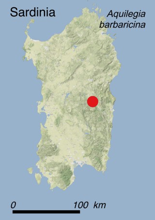
How to recognise it ?

P. gussonei is a perennial herb that smells like the common edible celery. The basal leaves are peltate and have five equal lobes and small teeth at the margins; the upper leaves growing on the stem are tripartite. The typical umbrella-shaped umbel is formed by umbellules, each bearing four white flowers: a central stalkless flower, which can be either female or bisexual, surrounded by three stalked male flowers. The latter are more or less united with the ovary of the central flower. Flowering usually occurs between April and May, but can last until June at the higher sites.

Interesting facts

This species mostly reproduces asexually through horizontal stolons sprouting from the base of the plant. Vegetative propagation may be enhanced by mechanical damages due to trampling from the livestock crossing the water courses. This mechanism allows the plant to colonize the wet edges of the streams. Reproduction from seed occurs only occasionally. Petagnaea is a rather isolated genus within the tribe Saniculoideae. The nearest genus is Astrantia, which has a South and East European-Caucasian distribution range. Together with Siculosciadium, another member of the celery family, it represents the only endemic genus of the whole Sicilian vascular flora.

Why is it threatened ?

Considering the low number of known subpopulations (just 21), each of them counting less than 100 mature individuals and covering an AOO of 56 km2, and the fact that many of them are subject to several threats, this species has been categorized as EN (Endangered) according to IUCN Red List Criteria C2a(i). Recent field investigations suggest a gradual decline in the AOO, habitat quality, number of individuals and subpopulations, due to the modification of the local surface and groundwater regime (threats 7.2.1 and 7.2.3: Abstraction of surface water, for domestic and agricultural uses, respectively). In addition, tree plantations with alien conifers were carried out along the mountain streams inducing a strong alteration of the both local hygrophilous vegetation and soil patterns (threat 7.3: Other ecosystem modifications). Livestock trampling in the sites where the plant occurs, especially during summer, represents another relevant threat (2.3.2: Small-holder grazing, ranching or farming).

What has been done to protect it ?

Legally: this species is listed in Appendix I of the Bern Convention and in Annexes II and IV of the EC Habitats Directive. In both these documents the species is listed under its synonym Petagnia saniculifolia Guss.

In situ: 6 subpopulations out of the 22 known ones are found in unprotected areas, while the others occur within the Nebrodi Regional Park, in the “Vallone Calagna sopra Tortorici” Nature Reserve, as well as in several Natura 2000 sites (ITA030043 “Monti Nebrodi”, ITA030001 “Stretta di Longi”, ITA030002 “Torrente Fiumetto - Pizzo D’Ucina”, ITA030013 “Rocche di Alcara li Fusi”, ITA030038 “Serra del Re - Monte Soro - Biviere di Cesarò”, ITA070007 “Bosco del Flascio”), whose management plans, aiming towards the conservation of wild species and habitats, have been recently approved. No monitoring activity has been funded at present but a LIFE Project focused on the conservation of the species is going to be submitted to EU Life Commission in the near future.

Ex situ: The plant is cultivated by the Universities of Palermo, Catania, Messina and Naples as well as in the English Gardens (“Giardini inglesi”) of the Bourbons’ Royal Palace (“Reggia di Caserta”) north of Naples.

What conservation actions are needed ?

A careful water management is the key to the preservation of the wet habitats of freshwater streams and springs where the species grows, particularly in unprotected locations. The gradual eradication of allochthonous conifer plantations, as well a thorough assessment concerning the sustainable grazing and trampling pressure due to livestock, should be planned and carried out.

Additionally, financial support is needed for reintroducing the species in sites where it has disappeared.

Scientific coordination

Prof. Lorenzo Gianguzzi, Dipartimento di Scienze Agrarie e Forestali (SAF), University of Palermo, Italy.

Dr. Antonino La Mantia, PromoVerde Sicilia, Palermo, Italy.

Photos

Prof. Lorenzo Gianguzzi, Dipartimento di Scienze Agrarie e Forestali (SAF), University of Palermo, Italy.

Additional references

Brullo S., Grillo M., Guglielmo A. 1976. Osservazioni ecologiche preliminari su Petagnia saniculifolia Guss., raro endemismo siculo. Giornale Botanico Italiano, 110 (4-5): 293-296.

Calviño C.I., Martínez S.G., Downie S.R., 2008. Morphology and biogeography of Apiaceae subfamily Saniculoideae as inferred by phylogenetic analysis of molecular data. American Journal of Botany, 95 (2): 196-214.

De Castro O., Cennamo P., Arena C., 2009a. Photochemical activity and leaf functional traits of Petagnaea gussonei and Sanicula europaea (Apiaceae) as affected by variable environmental conditions. 45th International Congress of SISV & FIP (Biodiversity Hotspots in the Mediterranean Area) (Cagliari, 22-24 June): pp. 317.

De Castro O., Cennamo P., De Luca P., 2007a. Phylogenetic relationships of two archaic monotypic genera of Apiaceae endemic of Italy: insights from molecular and literature data. Plant Systematics and Evolution, 278: 239-249.

De Castro O., Cennamo P., De Luca P., 2009b. Analysis of the genus Petagnaea Caruel (Apiaceae), using new molecular and literature data. Plant Systematics and Evolution, 278: 239-249.

Pleurotus nebrodensis

Summary

Latin name Pleurotus nebrodensis (Inzenga) Quél.
Common name Ribbed Cachrys oyster mushroom (English), Funcia di Basiliscu (Sicilian dialect)
Family Pleurotaceae (Fungi)
Status ENDANGERED (EN)
Island
  • Sicily (Italy)
Sicily
Sicily | Pleurotus nebrodensis
Greece
Greece | Pleurotus nebrodensis
Pleurotus nebrodensis
Pleurotus nebrodensis – fungi

Where is it found ?

This species was originally thought to occur only in Sicily. However, its presence was recently also confirmed from mainland Greece. The distribution range of the species in Sicily is restricted to the Madonie Mts. The historical Sicilian collection sites of “Canna” and “Dragonara” were retraced thanks to recently rediscovered documents and through interviews with local people. Both sites, located in Vallone Faguare, a canyon of the Madonie Mts. in northern Sicily, were visited in 2009, and ongoing decline of fruiting individuals was recorded. The species is linked to Prangos ferulacea. This perennial herb, belonging to the family Apiaceae, dominates the mountain pastures subject to overgrazing (habitats 3.8.3: Spiny Mediterranean heaths - phrygana, hedgehog-heats and related coastal cliff vegetation, and 4.4.2: Mesic grassland). The presence of P. nebrodensis in similar habitats in two different Greek mountain ranges, i.e. Kyllini, Erymanthos and Chelmos Mts. in northern Peloponnese, and Parnassos Mt. in Central Greece, was recently confirmed by molecular data.
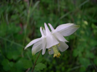
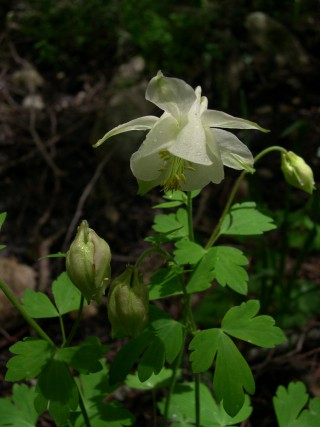
How to recognise it ?

The basidiomata appear between April and June; they are sturdy and fleshy, light ivory colored, sometimes cream to ivory to beige with light brown squamules. The surface of the pileus is shiny or translucent, dry, cracking-glabrous, smooth or glabrous. The flesh of the pileus is cream color, its consistency is hard-tough to turgid, without color changes. The taste is mild and slightly farinaceous. Lamellae are light ivory to light beige. The stipe is eccentrically or laterally attached to the pileus, which in turn is connected with the root or stem residues of Prangos ferulacea. The consistency of the stipe is fibrous, its flesh is solid to stuffed, its surface is smooth and light ivory colored. The growth habit is solitary or gregarious.

Interesting facts

In vitro experiments have shown the ability of Pleurotus nebrodensis to specifically inhibit the proliferation of colon cancer cells by inducing apoptosis. In varying degrees Pleurotus nebrodensis tissues have been proved to perform growth inhibitory activity against a group of reference strains of bacterial micro-organisms of medical relevance such as Staphylococcus aureus ATCC 25923, S. epidermidis RP62A, Pseudomonas aeruginosa ATCC 15442 and Escherichia coli ATCC10536.

Why is it threatened ?

Due to its recent discovery in three different localities of the Greek mainland, the risk level of Pleurotus nebrodensis has been underscored. Hence, it is now categorized as EN (Endangered) according to IUCN Red List Criteria B2ab(iv, v)c(iii, iv). The AOO for both areas (Sicily and Greece) is less than 500 km2.

No quantitive analysis has so far been performed for the Greek subpopulations. As concerns Sicily, the EOO is less than 100 km2, the populations are severely fragmented, and a continuous decline in the number of locations (currently less than 10), subpopulations and in the number of mature individuals (currently less than 150) has been recorded. This is mostly due to the increasing number of gatherers, both professionals and amateurs (threat 5.2.1: Gathering terrestrial plants - Intentional use), who are motivated by the high commercial price of this mushroom and its remarkable organoleptic properties. An additional negative draw-back of increasing gathering pressure is the harvest of unripe mushrooms (i.e., before they reach maturity and release spores), which may severely compromise the offspring of the existing populations.

As concerns Greece, the species is known to occur in only four locations. The disturbance factors are the same, and for the same reasons as was mentioned above, a continuing decline in the number of locations, subpopulations and in the number of mature individuals is expected also in Greece.

What has been done to protect it ?

Legally: Sicilian populations of P. nebrodensis grow in the Madonie Regional Park and are explicitly protected by the regulation of the Park as well as by the Regional Law nr. 3 (February 1st 2006).

In situ: The harvesting of any individual of P. nebrodensis is forbidden in the A zone of the Regional Park of Madonie Mts. which is under a total protection regime, while the collection of unripe individuals (i.e. those under 3 cm in diameter) is forbidden in the whole Park. Moreover, the Sicilian subpopulation of P. nebrodensis falls within the Natura 2000 sites ITA020004 “M. San Salvatore, M. Catarineci, Vallone Mandarini, ambienti umidi”, ITA020016 “Monte Quacella, Monte dei Cervi, Pizzo. Carbonara, Monte Ferro, Pizzo Otiero” and ITA020020 “Querceti sempreverdi di Geraci Siculo e Castelbuono”, while the Greek ones are included in the Natura 2000 sites GR2410002 “Oros Parnassos”, GR2530001 “Koryfes Orous Kyllini (Ziria) kai Charadra Flampouritsa”, GR2320008 “Oros Erymanthos”, GrR2320002 “Oros Chelmos kai Ydata Stygos”

Ex situ: in Sicily, a project dedicated on the cultivation of P. nebrodensis was concluded in 2002. Up to now the fungus has been cultivated in pilot-scale units before starting with a large-scale commercial mushroom production. Nonetheless, the preliminary results are rather promising. As a matter of fact, P. nebrodensis can be grown at various altitudes within strongly shaded tunnels, and cultivated mushrooms retain the same organoleptic characteristics than the wild type, which is not always the case with other mushroom species. Ex situ cultivation may therefore provide additional income for local farmers, who could offer a cheaper product when compared with the ones harvested in the wild, and this could significantly reduce the pressure on wild populations.

Due to its recent discovery in Greece, there are neither legal nor in situ measures aiming at the protection of both the mushroom and its habitat. As concerns ex situ conservation in Greece, several pure cultures of the species are maintained in the Fungal Culture Collection of the Agricultural University of Athens (Laboratory of General and Agricultural Microbiology), which are used in ongoing laboratory experiments aiming at the optimization of P. nebrodensis cultivation under various substrates and production conditions. No dedicated funded project has been implemented so far in Greece, except for one supported by the Mohamed bin Zayed Species Conservation Fund ($6000; 2012).

What conservation actions are needed ?

Pleurotus nebrodensis and its habitat are not protected by any international conservation agreement (e.g. Bern Convention or 92/43 EU ‘Habitats’ Directive). Hence, a strong improvement of awareness of both politicians and the scientific community is urgently needed in order to implement appropriate conservation actions. Furthermore, extensive field surveys should be performed in Greece in order to improve the available information on the ecology and distribution of this endangered mushroom. The regulation on mushroom collection which is issued by the Madonie Park Authority, in order to limit the negative impact on P. nebrodensis populations, is constantly ignored by pickers. In addition, controls on mushroom quantities collected by pickers are quite rare; hence, it is necessary to strengthen such controls. Moreover, it is important to move from the trial-cultivation stage of P. nebrodensis to a commercial cultivation scale in order to reduce pressure due to oveharvesting in natural habitats.

Scientific coordination

Prof. Giuseppe Venturella, Department of Agricultural and Forest Sciences (SAF), University of Palermo. giuseppe.venturella@unipa.it

Dr. Georgios Zervakis, Laboratory of General and Agricultural Microbiology (LGAM), Agricultural University of Athens, Greece. zervakis@aua.gr

Photos

Dimitrios Dimou, Agricultural University of Athens, Greece. dimou@aua.gr

Additional references

Alfonso Spagna F. 1902. Dei funghi velenosi. Nuovi Annali di Agricoltura Siciliana 13: 129–142.

Fontana S., Flugy A., Schillaci O., Cannizzaro A., Gargano M.L., Saitta A., De Leo G., Venturella G., Alessandro R., 2014. In vitro antitumor effects of the cold-water extracts of the Mediterranean species of genus Pleurotus (Higher Basidiomycetes) on human colon cancer cells. International Journal of Medicinal Mushrooms, 16 (1): 49-63.

Gargano M.L., Saitta A., Zervakis G.I., Venturella G., 2011. Building the jigsaw puzzle of the critically endangered Pleurotus nebrodensis: Historical collection sites and an emended description. Mycotaxon, 115 (1):107-114.

Gargano M.L., Zervakis G.I., Venturella G. (eds.), 2014. Pleurotus nebrodensis: A very special mushroom. Bentham e-Book eISBN: 978-1-60805-800-6, 145 pp.

Schillaci D., Arizza V. Gargano M.L., Venturella G., 2013. Antibacterial Activity of Mediterranean Oyster Mushrooms, Species of Genus Pleurotus (Higher Basidiomycetes). International Journal of Medicinal Mushrooms, 15 (6): 591-594.

Venturella G., 2006. Pleurotus nebrodensis. In: IUCN 2010. IUCN Red List of Threatened Species. Version 2010.4.

Venturella, G., Zervakis, G.I., Polemis, E. & Gargano M.L., 2016. Taxonomic identity, geographic distribution, and commercial exploitation of the culinary-medicinal mushroom Pleurotus nebrodensis (Basidiomycetes). International Journal of Medicinal Mushrooms, 18: 59-65.

Zervakis G.I., Ntougias S., Gargano M.L., Besi M.I., Polemis E., Typas M.A., Venturella G., 2014. A reappraisal of the Pleurotus eryngii complex: New species and taxonomic combinations based on the application of a polyphasic approach. And an identification key to Pleurotus taxa associated with Apiaceae plants. Fungal Biology 118, (9-10): 814-834. doi: 10.1016/j.funbio.2014.07.001. Epub 2014 Jul 15.   

Polygala helenae

Summary

Latin name Polygala helenae Greuter
Common name Milkwort of Kithira (English)
Family Polygalaceae
Status CRITICALLY ENDANGERED (CR)
Island
  • Greek Islands (Greece)
Greek Islands
Greek Islands | Kithira
Kithira
Kithira | Polygala helenae
Polygala helenae
Polygala helenae – flowers

Where is it found ?

This species is endemic to the island of Kithira, which lies in the Ionian Sea between Cape Malea, the easternmost tip of the Peloponnese, and Crete. The taxon is known from only three subpopulations located near Kalamos, SE of Kalamos and between the monasteries of Agios Kosmas and Mirtidia, but it probably also occurs elsewhere on the island. Polygala helenae grows on sandy, stony and thin soils and is typical to patchy, low and open vegetation (habitat 3.8.3: Spiny Mediterranean heaths - phrygana, hedgehog-heats and related coastal cliff vegetation). The species is difficult to find not only because it is rare, but also because it is rather inconspicuous. It usually grows between or under co-occurring spiny cushion-like subshrubs such as Genista acanthoclada and Sarcopoterium spinosum and is easily overlooked. Only its slender branches can be seen protruding from these dwarf woody species that locally dominate the phrygana.

How to recognize it ?

Polygala helenae is a 5-12 cm tall, perennial herb that is branched, and sparsely pubescent with short curved hairs further up. The lower part of the stem is lignified and procumbent, while the branches of the upper part are curved upwards. The lower leaves are elliptic-lanceolate with nearly parallel sides. The inflorescence consists of dense terminal racemes with 5-30 flowers on short stalks. The flower stalks have approximately the same length as the modified leaves originating at their base. The flowers have two different types of sepals; the outer two are whitish, 9 mm long and 4 mm wide, and the inner ones (wings) are whitish or lilac, 6-8 long × ca 4 mm wide. The petals are pale blue, united proximally into a tube, free in the distal part, slightly longer than the inner sepals (wings). The lower petal, called keel, is distinctly shorter than the two upper ones. The fruits are capsules containing dark brown seeds about 4-5 mm long.

Interesting facts

P. helenae is a narrow endemic species. A purple tulip, the Greek endemicTulipa goulimyi, co-occurs in the same areas. Interestingly, the nearest relatives of Polygala helenae are two Balkan endemics, i.e. Polygala venulosa and Polygala supina. According to the recently published Atlas of the Aegean Flora, Polygala helenae falls within the range of variation of P. venulosa Greuter; hence its taxonomic status is doubtful.

Why is it threatened ?

This species has been categorized as CR (Critically Endangered) according to IUCN Red List Criteria B1ab(iii)+2ab(iii) because all its known subpopulations are located over a very small area and only occur within "phrygana" communities which have colonized abandoned fields. Although wide surfaces of the island are no longer cultivated, many of them may be re-used for agricultural purposes in the near future (threat 2.1.2: Annual & perennial non-timber crops - Small-holder farming). Should this happen, the species could be affected from land-use changes. The species is also threatened with increasing tourism pressure because its habitat could be transformed due to the construction of touristic facilities (threat 1.3: Tourism and recreation areas). The area of occupancy AOO and the extent of occurence EOO are less than 10 km2 and the subpopulations are severely fragmented.

What has been done to protect it ?

Legally: The species is not included in any international convention nor protected by any national law and the subpopulations do not fall within any Natura 2000 site.

In situ: There are no current measures in place.

Ex situ: Cultivation from seeds and attempts to transplant this species from the wild into the Botanical Garden of the University of Patras (Greece) have both failed.

What conservation actions are needed ?

Given that to date ex situ conservation efforts have been unsuccessful, the best option to conserve this species appears to be the enhancement of extensive and sustainable agricultural practices. Since the species seems to avoid either undisturbed or too disturbed habitats, maintaining a patchwork of old fields and moderately grazed surfaces could provide suitable habitats for the survival and spread of the remnant subpopulations.

Scientific coordination

Prof. Gregoris Iatroú, Department of Biology, Division of Plant Biology, Institute of Botany, University of Patras, Greece.

Photos

http://floracytherea.blogspot.ch/

Additional references

Dimopoulos P., Raus Th., Bergmeier E., Constantinidis Th., Iatroú G., Kokkini S., Strid A. & Tzanoudakis D., 2013. Vascular plants of Greece: an annotated checklist. Berlin: Botanischer Garten und Botanisches Museum Berlin-Dahlem, Freie Universität Berlin; Athens: Hellenic Botanical Society. Englera, 31.

Iatroú G., 2006. Polygala helenae. The IUCN Red List of Threatened Species 2006: e.T61668A12535365. http://dx.doi.org/10.2305/IUCN.UK.2006.RLTS.T61668A12535365.en.

Strid A., 2016. Atlas of the Aegean flora, Part 1: Text & plates. Berlin: Botanic Garden and Botanical Museum Berlin, Freie Universitat Berlin. Englera, 33(1).

Yannitsaros A., 2004. Additions to the flora of Kithira (Greece) II. Willdenowia, 34: 117-128.

Polygala sinisica

Summary

Latin name Polygala sinisica Arrigoni
Common names Poligala del Sinis (Italian); Sinis milkwort (English)
Family Polygalaceae
Status CRITICALLY ENDANGERED (CR)
Island
  • Sardinia (Italy)
Sardinia
Sardinia | Polygala sinisica
Polygala sinisica
Polygala sinisica – flower

Where is it found ?

Polygala sinisica is only found in a single population covering a surface of ca. 1.6 ha in a restricted site along the coast of the Sinis Peninsula (Central-Western Sardinia). The population contains only ca. 70 individuals, 45 of them being mature plants.

The species grows under hot and dry climatic conditions on a limestone hillside within xerophilous Mediterranean plant communities dominated by spiny or aromatic evergreen dwarf shrubs which could be referred to the vegetation class Rosmarinetea officinalis Rivas-Martínez, T.E. Díaz, F. Prieto, Loidi et Peñas 2002 and the order Rosmarinetalia officinalis Br.-Bl. ex Molinier 1934 (Habitat 3.8.2: Garrigue).

How to recognize it ?

Polygala sinisica is a perennial herb with erect or nearly erect 15-20(30) cm long stems. The tough, flexible stems are either hairless or slightly hairy, and bear lanceolate to linear, non-fleshy alternate leaves. Inflorescences have 15-20 flowers on short stalks, grouped in bunches at the ends of the stems.

The corolla is zygomorphic (asymmetric): three of the sepals are small and hairy, while the other two resemble elliptical wings. The pink or bluish petals are 11-12 mm long. The fruits bear hairy seeds with a very short strophiole. The plants flower in February and March and produce fruit immediately afterwards.

Interesting facts

Polygala sinisica grows in the same community with other Sardinian endemics such as Arum pictum, Genista corsica, Ornithogalum biflorum, Bellium bellidioides and Romulea requienii, and co-occurs with several other species of great phytogeographic interest which are also very rare throughout Italy, such as Helianthemum caput-felis, Viola arborescens, and Coris monspeliensis.

Why is it threatened ?

The main threats for the single population of P. sinisica are agricultural activities, in particular pine plantations (Threat 2.2.1: Wood & pulp plantations - Small-holder Plantations), followed by touristic and sport activities, such as off-road racing and unregulated human trampling (Threat 6.1 Recreational activities), leading to considerable damage to the population. Other factors of risk are the increase of coastal roads (Threat 4.1: Roads & railroads) and, secondarily, the construction and expansion of touristic infrastructures (Threat 1.3: Tourism & recreation areas).

P. sinisica must be considered Critically Endangered (CR) according to IUCN Criterion B based on its EOO (16000 m2), AOO (1 km2) , the single location and an observed decline due to habitat loss and reduction in the currently occupied surface-area (ca. 10000 m2), as well as in mature plants. In addition, monitoring activities carried out in recent years showed that the population consists only of ca 45 mature individuals; hence, this plant must also be considered Critically Endangered (CR) according to IUCN Criterion D.

To summarise, P. sinisica must be considered Critically Endangered (CR) according to the formula: CR B1ab(iii,v)+2ab(iii,v); D.

What has been done to protect it ?

Legally: Currently there is no legal protection for this species; despite a (not yet approved) proposal by the Regional Council of Sardinia in 2005 for a law concerning the protection of islands’ plant species.

In situ: The only population of P. sinisica falls within the Natura 2000 site ITB030038 ‟Stagno di Putzu Idu (Salina Manna e Pauli Marigosa)”.

The Autonomous Region of Sardinia funded in 2008 a conservation project aimed at the safeguard of the ten most threatened endemic plants species of the island comprising in situ and ex situ studies. As part of this project, the Biodiversity Conservation Center of the Cagliari University started a periodic in situ monitoring of the population and all mature plants are monitored every year.

Ex situ: At the same time, a long-term ex situ conservation was initiated at the Sardinian Germplasm Bank and specific studies related to the conservation status assessment, the phenological patterns and seed eco-physiological traits of the species were carried out.

What conservation actions are needed ?

Low seed viability and germination were detected in Polygala sinisica. Therefore, there is an urgent need for in situ and ex situ conservation measures for its single population.

As a precautionary measure, the population should be protected through fencing in order to avoid (or at least reduce) human trampling, and any sport activities related to off-road racing should be eliminated from the population site.

The monitoring activities of the population must be continued and a long-term ex situ seed conservation project should be implemented in order to obtain plant material for future reinforcement activities.

Further studies are needed in order to better understand the reproductive biology and ecology of the species, and translocation programs should be considered and planned.

Scientific coordination

Giuseppe Fenu, Centro Conservazione Biodiversità, Dipartimento di Scienze della Vita e dell’Ambiente, Università degli Studi di Cagliari, Viale Sant’Ignazio da Laconi 13, 09123 Cagliari, Italy.

Donatella Cogoni, Centro Conservazione Biodiversità, Dipartimento di Scienze della Vita e dell’Ambiente, Università degli Studi di Cagliari, Viale Sant’Ignazio da Laconi 13, 09123 Cagliari, Italy.

Gianluigi Bacchetta, Centro Conservazione Biodiversità, Dipartimento di Scienze della Vita e dell’Ambiente, and Hortus Botanicus Karalitanus (HBK), Università degli Studi di Cagliari, Viale Sant’Ignazio da Laconi 9 -11, 09123 Cagliari, Italy.

Photos

Efisio Mattana, Centro Conservazione Biodiversità, Dipartimento di Scienze della Vita e dell’Ambiente, Università degli Studi di Cagliari, Viale Sant’Ignazio da Laconi 13, 09123 Cagliari, Italy.

Additional references

Arrigoni, P.V., 1983. Le piante endemiche della Sardegna: 118-128. Bollettino della Società Sarda di Scienze Naturali, 22: 259-316.

Bacchetta G., Fenu G., Mattana E., 2008. Polygala sinisica Arrigoni. In: Rossi G., Gentili R., Abeli T., Gargano D., Foggi B., Raimondo F.M. & Blasi C. (eds.), 2008. Flora da Conservare. Iniziativa per l'implementazione in Italia delle categorie e dei criteri IUCN (2001) per la redazione di nuove Liste Rosse. Informatore Botanico Italiano, 40 (Suppl. 1): 98-100.

Fenu G., Cogoni D., Pinna M.S., Bacchetta G., 2015. Threatened Sardinian vascular flora: a synthesis of ten years of monitoring activities. Plant Biosystems, 149(3): 473-482.

Mattana E., Daws M.I., Fenu G., Bacchetta G., 2010. Ecological and morphological seed traits of Polygala sardoa and P. sinisica: a comparative study on two endemic species of Sardinia. Flora, 205 (12): 825-831.

Ribes sardoum

Summary

Latin name Ribes sardoum Martelli
Common names Ribes sardo (Italian); Sardinian currant (English)
Family Grossulariaceae
Status CRITICALLY ENDANGERED (CR)
Island
  • Sardinia (Italy)
Sardinia
Sardinia | Ribes sardoum
Ribes sardoum
Ribes sardoum – shrub

Where is it found ?

Ribes sardoum is a narrow endemic plant growing in a single population located in Prados (Monte Corrasi, Oliena). The population consists of ca. 80 mature plants spreading over an area of ca. 700 m2.

R. sardoum is a mesophilous plant growing on dolomitic limestone at 1160 m a.s.l.

Unfortunately no data are available to place this plant in a specific plant community. Based on preliminary studies, R. sardoum can be framed to the Pruno-Rubion ulmifolii O. Bòlos 1954 alliance (habitat 3.4.1:Temperate and Mediterranean-montane scrub).

How to recognize it ?

Ribes sardoum is a small deciduous shrub 0.8-2 m tall, with leaves 1-2 cm wide, ovate or nearly circular, with three to five small lobes and a hairy, glandular leaf stalk. The small and inconspicuous greenish-yellow flowers are solitary with short stalks. The fruit are red, ovate berries.

The flowering season lasts from April to the beginning of June, and fruiting season from late July to October. Mechanisms of reproductive biology (i.e. seed dispersal, seed germination, clonal reproduction) are largely unknown. the species has been reported to have a low fertility due to the early dropping of ovaries and, consequently, a low rate of fruit production as well as a low seed viability.

Interesting facts

Ribes sardoum shows numerous morphological and biological characters that are very distinct from all other congeneric taxa. For this reason, the monotypic subgenus Oligocarpa has been created ad hoc. More in detail, it differs in having a peculiar vegetative and flowering apparatus, for the co-existence of ovules and fertile anthers on the same flower, and for the imperfect functionality of the male parts in some flowers, which causes a lack of pollen production and reduced fruit output.

Results of genetic analyses revealed that R. sardoum has a medium to low genetic diversity at the population level. In addition, the population showed a high level of inbreeding, in accordance with its very small size. This indicates that R. sardoum originated from ecologically-based divergent, habitat-driven selection. Such a pattern may be the consequence of genetic bottlenecks during the post-glacial re-colonization of the Mediterranean realm. The phylogenetic differentiation of R. sardoum from the other European Ribes likely indicates a more ancient and independent origin and hence it must be considered as a paleoendemic species, once probably spread throughout the boreal zone, moving to warmer areas as the climate changed. It is now considered a relict species as it is no longer found anywhere else. Its closest relatives occur in China, Japan, and North America.

Why is it threatened ?

The main threat affecting the single population of R. sardoum is unregulated grazing mainly due to wild animals such as mouflons and wild goats (threat 8.2.2: Problematic native species/diseases - named species), followed by touristic and recreational activities, such as unregulated hiking, trekking and the related human trampling (threat 6.1: Recreational activities), leading to considerable damage to the single population. Stochastic environmental events such as fires (threat 7.1.1: Fire and fire suppression - Increase in fire frequency/intensity) and landslides (threats 10.3: Avalanches/landslides) may also represent significant potential threats.

In addition, the genetic patterns observed in R. sardoum are known to enhance the extinction probability in species suffering of range contraction and habitat degradation (threat 11.1: Habitat shifting & alteration); hence, at present, the future survival of this species in its natural environment cannot be predicted.

Based on the Extent Of Occurrence of 700 m2, Area Of Occupancy of 1 km2, the surface-area occupied by the population ca. 700 m2, the small population size, ca. 80 mature plants, the single location and the inferred decline due to habitat loss, the reduction in occupied surface-area and in reproductive plants, R. sardoum must be considered Critically Endangered (CR) according to the IUCN Criteria B and C.

To summarise, R. sardoum must be considered Critically Endangered (CR) according to the formula : CR B1ab(iii,v)+2ab(iii,v); C2a(ii).

What has been done to protect it ?

Legally: Ribes sardoum is listed in Appendix I of the Bern Convention and, as a priority species, in Annexes II and IV of the EEC Habitats Directive. Currently there is no legal protection for this species, despite a (not yet approved) proposal by the Regional Council of Sardinia (2005) of a law concerning the protection of the island’s plant species.

In situ: The only remnant population of R. sardoum falls within the Natura 2000 site ITB022212 ‟Supramonte di Oliena, Orgosolo e Urzulei - Su Sercone” .

The species was included in an agreement concerning the protection of the endemic flora of the town of Oliena (Nuoro). However, this instrument has not yet had any real impact on the threats affecting the population.

The Autonomous Region of Sardinia funded in 2008 a conservation project aimed at the safeguard of the ten most threatened endemic plants species of the island comprising in situ and ex situ studies. As part of this project, the Biodiversity Conservation Center of the Cagliari University started a periodic in situ monitoring of all know populations and the reproductive plants are monitored every year.

Ex situ: At the same time, a long-term ex situ conservation project was initiated at the Sardinian Germplasm Bank. Specific studies on the population characterization and conservation status assessment of the species were carried out through the above mentioned project.

In addition, the Autonomous Region of Sardinia partially supported the genetic analyses for R. sardoum (Project Sardegna 03, ‘‘Tutela di specie vegetali endemiche esclusive della Sardegna ad areale puntiforme ed a grave pericolo di estinzione’’) that allowed to carry out the genetic characterization of the population of this relict plant.

Some plants of R. sardoum, obtained from seeds, are cultivated at the Hortus Botanicus Karalitanus of the Cagliari University.

What conservation actions are needed ?

The last remnant population of R. sardoum, consisting of ca. 80 individuals all living in a single locality, needs a strict protection programme. In particular, serious management plans to protect the species from overgrazing and human disturbance should be developed. Therefore, fencing could be an immediate and effective solution to avoid further damages to the unique extant population.

The monitoring activities of the single population must be continued and the long-term ex situ seed conservation project, already started at the Sardinian Germplasm Bank, should be continued in order to conserve the highest possible genetic variability and obtain plant material for future reinforcement activities.

A translocation project, using plants produced from seeds, has been carried out in 2016 by Hortus Botanicus Karalitanus (Cagliari University) within the Care-Mediflora project. Monitoring activities are currently ongoing to verify the effectiveness of this in situ conservation action.

In depth biological, ecological and further genetic analyses should be carried out to shed light on the effective reproductive biology, demography and phylogenetic relationships of this endemic plant.

Scientific coordination

Giuseppe Fenu, Centro Conservazione Biodiversità, Dipartimento di Scienze della Vita e dell’Ambiente, Università degli Studi di Cagliari, Viale Sant’Ignazio da Laconi 13, 09123 Cagliari, Italy.

Donatella Cogoni, Centro Conservazione Biodiversità, Dipartimento di Scienze della Vita e dell’Ambiente, Università degli Studi di Cagliari, Viale Sant’Ignazio da Laconi 13, 09123 Cagliari, Italy.

Gianluigi Bacchetta, Centro Conservazione Biodiversità, Dipartimento di Scienze della Vita e dell’Ambiente, and Hortus Botanicus Karalitanus (HBK), Università degli Studi di Cagliari, Viale Sant’Ignazio da Laconi 9 -11, 09123 Cagliari, Italy.

Photos

Gianluigi Bacchetta, Centro Conservazione Biodiversità, Dipartimento di Scienze della Vita e dell’Ambiente, and Hortus Botanicus Karalitanus (HBK), Università degli Studi di Cagliari, Viale Sant’Ignazio da Laconi 9 -11, 09123 Cagliari, Italy.

Additional references

Bacchetta G., Congiu A., Fenu G., Mattana E., 2008. Ribes sardoum Martelli. In: Rossi G., Gentili R., Abeli T., Gargano D., Foggi B., Raimondo F.M. & Blasi C. (eds.), 2008. Flora da Conservare. Iniziativa per l'implementazione in Italia delle categorie e dei criteri IUCN (2001) per la redazione di nuove Liste Rosse. Informatore Botanico Italiano, 40 (Suppl. 1): 106-108.

Fenu G., Cogoni D., Pinna M.S., Bacchetta G., 2015. Threatened Sardinian vascular flora: a synthesis of ten years of monitoring activities. Plant Biosystems, 149(3): 473-482.

Fenu G., Mattana E., Bacchetta G., 2012. Conservation of endemic insular plants: the genus Ribes L. (Grossulariaceae) in Sardinia. Oryx, 46(2): 219-222.

Gentili R., Fenu G., Mattana E., De Mattia F., Citterio S., Bacchetta G., 2015. Conservation genetics of two island endemics Ribes (Grossulariaceae) of Sardinia: survival or extinction? Plant Biology, 17(5): 1085-1094.

Porceddu M., Fenu G. & Bacchetta G., 2017. New findings on seed ecology of Ribes sardoum: can it provide a new opportunity to prevent the extinction of a threatened plant species?, Systematics and Biodiversity, 15:5, 480-488, DOI:10.1080/14772000.2016.1271058

Rossi G., Orsenigo S., Montagnani C., Fenu G., Gargano D., Peruzzi L., Wagensommer R.P., Foggi B., Bacchetta G., Domina G., Conti F., Bartolucci F., Gennai M., Ravera S., Cogoni A., Magrini S., Gentili R., Castello M., Blasi C., Abeli T., 2016. Is legal protection sufficient to ensure plant conservation? The Italian Red List of policy species as a case study. Oryx, 50(3): 431-436.

Valsecchi F., 1977. Biologia, posizione sistematica ed ecologia di Ribes sardoum Martelli e Ribes multiflorum Kit. ssp. sandalioticum Arrigoni. Webbia, 31(2): 279-294.

Valsecchi F., 1981. Le piante endemiche della Sardegna: 96-97. Bollettino della Società Sarda di Scienze Naturali, 20: 301-309.

Salvia veneris

Summary

Latin name Salvia veneris Hedge
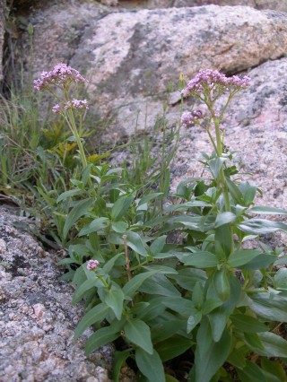
Common name Kythrean sage (English)
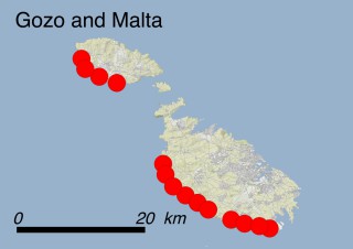
Family Lamiaceae
Status VULNERABLE (VU)
Island
  • Cyprus (Cyprus)
Cyprus
Cyprus | Salvia veneris
Salvia veneris
Salvia veneris – flower
Salvia veneris
Salvia veneris – flower
Salvia veneris
Salvia veneris – plant

Where is it found ?

Endemic to Cyprus, Salvia veneris is localized in the northern and western surroundings of the village of Kythrea. It is restricted in an area of less than 20 km2, in five locations characterized by sparse woody vegetation (habitats 3.8.1: Maquis, arborescent matorral and thermo-Mediterranean brushes and 3.8.2: Garrigue), mostly on a particular substrate called ‘Kythrea Flysch’ including beds of greywacke, marl, sandstone and conglomerate. A small part of the population also grows on outcropping lava intrusions. It is estimated that there are approximately 4000 individuals.

How to recognise it ?

This perennial plant, 20-40 cm high, has a strong woody taproot and felty leaves arranged in a basal rosette. The short flower-bearing stems are produced in late March or April. The flowers are bicoloured, the upper lip pale blue, the lower white with pale yellow markings. Fruiting season is between April and May. The stems produce a faint, pleasant scent when crushed.

Interesting facts

The arrangement of leaves in a basal rosette is thought to be an adaptation to the strong grazing pressure by goats. This is a common trait of many sages of the Mediterranean mountains, yet unusual for plants belonging to the mint family, which normally have paired and opposite leaves.

Why is it threatened ?

As the result of more accurate field surveys, this species is no longer listed as CR (Critically Endangered). Salvia veneris is now considered and has been included in the Red Data Book of the Flora of Cyprus as VU (Vulnerable) according to IUCN Red List Criterion D2 which indicates that the area in which the species is found is very small with an Area of Occupancy <20 Km2. Moreover, it is found in only five locations and there is a high likelihood of decline in the area, extent and quality of habitat. This species is potentially threatened with any future expansion of the nearby village of Kythrea (threat code: 1.1 Housing & urban areas), which could wipe out a large part of the population. It is also potentially threatened with reforestation activities carried out mainly with Acacia saligna (threat 8.1.2: Invasive non-native/alien species - Named species) and with Pinus brutia (threat 8.2.2: Problematic native species/diseases - Named species), road construction (threat 4.1: Roads and railroads), military installations and exercises (threat 6.2: War, civil unrest & military exercises), grazing mostly by goats (threat 2.3.2: Small-holder grazing, ranching or farming) and dust from nearby limestone quarries (threat 9.5: Air-borne pollutants).

What is being done to protect it ?

Legally: The species is protected by the Habitats Directive where it is included in Annexes II and IV, and by the Bern Convention, where it is listed in Appendix I (under the synonym Salvia crassifolia Sibth. & Sm.). Moreover, the species is included in the Red Data Book of the Flora of Cyprus as a Vulnerable species. None of the locations falls within a Natura 2000 site.

In situ: No protection measures have been taken so far.

Ex situ: A small number of seeds of S. veneris are stored in the seedbanks of two public institutions of Nicosia: the Nature Conservation Unit of the Frederick University and the National Seed Bank of the Agricultural Research Institute.

What conservation actions are needed ?

In situ: The distribution area of the species should be included in a protected area such as a Natura 2000 site as it is an Annex II species of the Habitats Directive. However, the site falls within the Turkish occupied area where the Community acquis is currently suspended.

Ex situ: Cultivation in botanical gardens is recommended.

Scientific coordination

Dr Marios Andreou, Nature Conservation Unit - Frederick University, Nicosia, Cyprus.

Dr Charalambos S. Christodoulou, Department of Forests, Ministry of Agriculture, Rural Development and Environment, Nicosia, Cyprus.

Photos

Dr. Charalambos S. Christodoulou, Department of Forests, Ministry of Agriculture, Rural Development and Environment, Nicosia, Cyprus.

Saponaria jagelii

Summary

Latin name Saponaria jagelii Phitos & Greuter
Common name Soapwort of Elafonisos Island (English)
Family Caryophyllaceae
Status CRITICALLY ENDANGERED (CR)
Island
  • Greek Islands (Greece)
Greek Island
Greek Island | Elafonisos
Elafonisos
Elafonisos | Saponaria jagelii
Saponaria jagelii
Saponaria jagelii – plant and flower
Saponaria jagelii
Saponaria jagelii – habitat
Saponaria jagelii
Saponaria jagelii – plant
Saponaria jagelii
Saponaria jagelii – plant
Saponaria jagelii
Saponaria jagelii – plant
Saponaria jagelii
Saponaria jagelii – plant
Saponaria jagelii
Saponaria jagelii – habitat
Saponaria jagelii
Saponaria jagelii – plant

Where is it found ?

Saponaria jagelii grows only in the western part of the small 25 km2 island of Elafonisos which is located 600 m off the southern coast of the Peloponnese. The species only grows in two scattered, very restricted localities on sandy sea shores (Habitat 13.3: Coastal sand dunes).

How to recognize it ?

S. jagelii is an annual plant with an erect, robust 3-10 cm long branching stem. The stem is reddish, covered with scattered glandular hairs in the upper part whereas the lower part is almost glabrous. The leaves are fleshy and reddish-green, 1-4.5 cm long and lanceolate and the leaf margins are occasionally fringed with fine hair. The upper leaf surface and leaf stalks can be hairy as well. The calyx is cylindrical, reddish, bearing short teeth and is covered with glandular hair. The petals are red, but white and tapered towards the base. The flowering period lasts from March to early June. Dispersal occurs shortly after, when the fruit, a nearly cylindrical capsule, opens and releases the seeds.

Interesting facts

The species is characteristic to sand dunes, where it grows together with Ammophila arenaria subsp. australis, Euphorbia paralias, Medicago marina and Silene sedoides. This narrow endemic plant is strictly related to Saponaria calabrica, which occurs on different habitats (rocky slopes and waste places) up to 2000 m a.s.l. According to the the recently published Atlas of the Aegaean Flora, it could actually represent a local ecotype of S. calabrica adapted to coastal sand shores.

Why is it threatened ?

The species has been categorized as CR (Critically Endangered) according to IUCN Red List Criteria B1ab(i,ii,iii,v)+B2ab(i,ii,iii,v) because the plant is only known to occur at two sites covering a very small area, in two restricted sandy sea shores. Furthermore, the quality of habitat and the number of individuals are expected to decline. Tourism is rapidly developing on the island and several human activities on the beaches, such as the transit of motor vehicles and trampling by visitors, represent major threats, especially during the flowering period (threats 1.3: Tourism and recreation areas and 6.1: Recreational activities).

A potential increase of tourism and tourism-related activities in the springtime could result in a rapid decline of the population or even cause the extinction of the species within a short time. However, the species may tolerate a moderate number of tourists during the peak summer tourist season since the fruit capsules are already ripe at the end of May.

What has been done to protect it ?

Legally: This species is not included in any international convention or national legislation. The plant enjoys indirect protection as it falls within the Natura 2000 site GR2540002 ‘Periochi Neapolis kai Nisos Elafonisos’.

In situ: There are no current measures in place.

Ex situ: This species is being cultivated in the Botanical Garden of Bochum University (Germany).

What conservation actions are needed ?

Since it is pointless to prevent tourists from accessing the beach, cars at least should be forbidden and obligate paths indicated through information panels. Ideally, sand dunes should not be accessible during the seed dispersal period of S. jagelii, i.e. from early May to early June. Ex situ conservation initiatives such as cultivating the species in botanical gardens and storing its seeds in seed banks, should be promoted.

Scientific coordination

Prof. Gregoris Iatroú, Department of Biology, Division of Plant Biology, Institute of Botany, University of Patras, Greece.

Ass. Prof. Maria Panitsa, Department of Environmental and Natural Resources Management, University of Patras, Greece.

Photos

Dr. Armin Jagel, Botanischer Garten Bochum, Germany.

Additional references

Dimopoulos P., Raus Th., Bergmeier E., Constantinidis Th., Iatroú G., Kokkini S., Strid A. & Tzanoudakis D., 2013. Vascular plants of Greece: an annotated checklist. Berlin: Botanischer Garten und Botanisches Museum Berlin-Dahlem, Freie Universität Berlin; Athens: Hellenic Botanical Society. Englera, 31.

Iatroú G., 2013. Saponaria jagelii. The IUCN Red List of Threatened Species 2013: e.T61639A50017799. http://dx.doi.org/10.2305/IUCN.UK.2013-2.RLTS.T61639A50017799.en.

Phitos D., Greuter W., 1993. Saponaria jagelii: a new species from the island of Elafonisos (Peloponnisos, Greece). Flora Mediterranea, 3: 277-278.

Strid A., 2016. Atlas of the Aegean flora, Part 1: Text & plates. Berlin: Botanic Garden and Botanical Museum Berlin, Freie Universitat Berlin. Englera, 33(1).

Scilla morrisii

Summary

Latin name Scilla morrisii Meikle
Common name Morris squill (English)
Family Asparagaceae
Status VULNERABLE (VU)
Island
  • Cyprus (Cyprus)
Cyprus
Cyprus | Scilla morisii
Scilla morrisii
Scilla morrisii – flower
Scilla morrisii
Scilla morrisii – flower

Where is it found ?

This plant is found only in the northern and western part of Cyprus in 12 locations that may be grouped into 5 subpopulations. The plants grow between 25 and 1000 m a.s.l., mainly on north-facing slopes, in moist, shaded crevices and sometimes along stream banks (habitat 5.2: Seasonal-Intermittent-Irregular Rivers, Streams, Creeks), in the undergrowth of forest communities (habitats 1.4.2 Broadleaved evergreen woodland, and 1.4.3: Coniferous woodland) or within maquis communities (habitat 3.8.1: Maquis, arborescent matorral and thermo-Mediterranean brushes).

How to recognise it ?

Scilla morrisii is a bulbous perennial herb, up to 35 cm high. It has three to six thick, linear leaves which emerge from a subterranean bulb and curve around the flowering stalk. The leaves are up to 70 cm long and 0.5-1.5 cm wide. Some variability exists with regard to flower colour and possibly timing of leaf expansion. Each of its flowering stems bear one to five flowers, gathered in loose bunches. Flowers are small, star-shaped and lilac or blue, tinged with milky-white. The flowering season lasts from March to April.

Interesting facts

C-band karyotyping and DNA content analyses point out that Scilla morrisii and Scilla cilicica are sibling co-occurring species and that all Cypriot provenances should be considered as a single endemic species, by priority Scilla morrisii. Furthermore, all species belonging to the genus Scilla are known for their toxic properties, which may cause serious digestive disorders.

Why is it threatened ?

As a result of the merging with S. cilicica and the consequent larger population size and wider distribution range, Scilla morrisii has now been underscored and re-categorized as VU (Vulnerable) due to small population size (approximately 3000 individuals) following IUCN Red List criteria C2a(i). This means that the number of mature individuals in each of the 5 subpopulations is less than 1000 and that decline of population size was observed as a result of habitat destruction and land use change due to the expansion and intensification of agricultural practices (threat 2.1.3: Annual & perennial non-timber crops - Agro-industry farming).

What is being done to protect it ?

Legally: This species is protected by the Bern Convention where it is listed in Appendix I, and by the 92/43 EC Habitats Directive where it is included as a priority species in Annexes II and IV. Moreover, it is included in the Red Data Book of the Flora of Cyprus as an Endangered species. However, the evaluation was based on the distribution and population of Scilla morrisii as it was treated in the Flora of Cyprus, without considering the merging of the species with Scilla cilicica.

In situ: Five locations are found within three Natura 2000 sites, i.e. CY4000010 ‟Chersonisos Akama” CY4000008 ‟Koili-Mavrokolympos” and CY4000004 ‟Vouni Panagias”. Monitoring activities of the subpopulations located at Vouni Panagias took place from 2006 to 2009 within the framework of a PhD Thesis and from 2010 to 2013 as part of a LIFE+ project (LIFE08 NAT/CY/000453 - Establishment of a Plant Micro-Reserve Network in Cyprus for the Conservation of Priority Species and Habitats).

Ex situ: Seeds from selected subpopulations are stored in the seedbanks of two public institutions located in Nicosia: the Nature Conservation Unit of the Frederick University and the National Seed Bank of the Agricultural Research Institute of Cyprus.

What conservation actions are needed ?

In situ: Fencing activities at Vouni Panagias will prevent further severe damages to the local subpopulation due to ongoing agricultural intensification and road construction. Furthermore, a reinforcement of the subpopulation of Vouni Panagias should be carried out in order to supplement the losses of the previous years due to habitat destruction.

Ex situ: Seeds from all subpopulations need to be collected and stored in seedbanks. This species should also be cultivated in botanical gardens and used as an ornamental plant in public gardens.

Scientific coordination

Dr. Marios Andreou, Nature Conservation Unit – Frederick University, Nicosia, Cyprus.

Dr. Charalambos S. Christodoulou, Department of Forests, Ministry of Agriculture, Rural Development and Environment, Nicosia, Cyprus.

Photos

Dr. Charalambos S. Christodoulou, Department of Forests, Ministry of Agriculture, Rural Development and Environment, Nicosia, Cyprus.

Additional references

Andreou Μ. 2010. Conservation biology of rare plants of Cyprus. PhD Thesis. National and Kapodistrian University of Athens, Athens.

Andreou M., Kadis C., Delipetrou P., Georghiou K., 2015. Conservation biology of Chionodoxa lochiae and Scilla morrisii (Asparagaceae): Two priority bulbous plant species of the European Union in Cyprus. Global Ecology and Conservation, 3: 511-525.

Greilhuber J., Speta F. 1989. A Giemsa C-banding and DNA content study in Scilla cilicica and S. morrisii, two little known sibling species of the S. siberica alliance (Hyacinthaceae). Plant Systematics and Evolution, 165: 71-83.

Meikle R.D., 1985. Flora of Cyprus. Vol. 2. London: Bentham-Moxon Trust, Royal Botanic Gardens, Kew, pp. 1637-1639

Kadis C., Christodoulou C.S., 2006. Scilla morrisii. The IUCN Red List of Threatened Species 2006: e.T61607A12520512. http://dx.doi.org/10.2305/IUCN.UK.2006.RLTS.T61607A12520512.en.

Tsintides T., Christodoulou C.S., Delipetrou P., Georghiou K., 2007. The Red Data Book of the Flora of Cyprus. Cyprus Forestry Association, Chr. Nicolaou & Sons Ltd., Lefkosia ISBN 978-9963-9288-0-4.

Silene hicesiae

Summary

Latin name Silene hicesiae Brullo & Signor.
Common names Silene vellutata delle Eolie (Italian); Smooth catchfly of the Aeolian islands (English)
Family Caryophyllaceae
Status VULNERABLE (VU)
Island
  • Aeolian Islands (Italy)
Aeolian Islands
Aeolian Islands | Silene hicesiae
Silene hicesiae
Silene hicesiae – habitat
Silene hicesiae
Silene hicesiae – flower
Silene hicesiae
Silene hicesiae – flower
Silene hicesiae
Silene hicesiae – flower
Silene hicesiae
Silene hicesiae – plant
Silene hicesiae
Silene hicesiae – plant

Where is it found ?

Silene hicesiae is endemic to the Aeolian Islands. The population of Panarea covers an area of ca. 0.13 Km2 with 1000-2500 individuals. here It does not show a clear fidelity to cliff habitats and it mostly occurs on steep and stony slopes as part of a grassland community dominated by Brachypodium retusum (habitat 4.4.1: Temperate grassland - Dry grassland), while the small and even more scattered population of Alicudi (some 50 individuals covering less than 400 m2) is only found on volcanic cliffs and ash debris (habitat 6.5: recent volcanic features). The two known populations are situated ca. 60 km apart.

How to recognise it ?

Silene hicesiae is a low-growing shrub that may be up to 30-50 cm tall. It produces both sterile and fertile rosettes with densely hairy, elliptical leaves, 1-2 cm broad, 3-10 cm long. The fertile rosettes produce a hairy, usually non-branched flowering shoot with a 30 to 70 cm long stem with bunches bearing pink or pale pink 5-petal flowers which open in May. The fruits ripen between July and August. The main dispersal mechanism is barochory.

Interesting facts

Silene hicesiae belongs to the “Silene mollissima group”, which includes at least seven species endemic to the coastal cliffs of the western Mediterranean basin. These different species may have evolved when the Mediterranean was almost completely dry during the late Miocene, i.e. ca. 5 millions years ago, and the isolation of the remnant populations of a common ancestor gave rise to several new species. Therefore, this species could be one of numerous examples demonstrating how geographic isolation of populations belonging to the same species may lead to the evolution of new species through genetic divergence mechanisms. However, also alternative hypotheses on the origin of the species of this group have been recently proposed, suggesting a more recent differentiation of the Silene mollissima group.

Why is it threatened ?

This species is categorized as VU (Vulnerable) according to IUCN Red List Criterion D2. The two subpopulations cover an area of 3-4 ha, while the EOO of the species is less than 100 km². The whole population is severely fragmented, with more than 95% of individuals concentrated at Panarea, but the number of subpopulations and mature individuals appears to be stable. However, considering that half of the perimeter of the islet of Alicudi is formed by steep cliffs which are very hard to be explored, it is highly probable that the size of the local population is currently underestimated due to incomplete field surveys.

Silene hicesiae is mostly threatened with wildfires (threat 7.1.1: Fire and fire suppression - Increase in fire frequency/intensity) and browsing by introduced herbivores at Alicudi (mostly sheep, but also rabbits). As for the main subpopulation of Panarea, it is threatened by the overwhelming competition of Agrostis sp., whose native status is doubtful, and has become increasingly frequent in the site during the last 20 years (threat 8.2.1: Problematic native species/disease - unspecified species) and Ailanthus altissima, an invasive alien plant (threat 8.1.2: Invasive non-native/alien species - Named species), by the mechanical damages and trampling of the individuals which grow along the trekking paths of Panarea by hikers (threat 6.1. Recreational activities), by the gathering of flowering stems (threat 5.2.1: Gathering terrestrial plants - Intentional use), and by unintentional cutting during path maintenance/cleaning (threat 6.3: Work and other activities).

What has been done to protect it ?

Legally: This species is listed as a priority species in Annexes II and IV of the EC ‘Habitats’ Directive. The islets of Alicudi and Panarea are nature reserves where the collection of Silene hicesiae is strictly forbidden and its protection figures among the actions of the Management Plan of Aeolian Natura 2000 Sites. However, these rules may be totally neglected due to the lack of rangers watching the behaviour of hikers and tourists within the protected areas.

In situ: A number of conservation measures have been implemented as part of the EU LIFE project “Conservation of priority species of the Eolian Islands’ flora - EOLIFE99” (http://web.tiscali.it/ecogestioni/eolife) such as the improvement of the knowledge on the biology and ecology of Silene hicesiae, the reinforcement of wild populations with plants propagated ex situ, the cultivation in botanical gardens and seed-banks, as well as informing decision-makers, stakeholders and improving public awareness.

Ex situ: in the framework of the projects GENMEDOC (http://www.genmedoc.org) and SEMCLIMED (http://www.semclimed.org) seeds have been collected ca. ten years ago and stored in the seed banks of the University of Catania.

What conservation actions are needed ?

At Panarea Ailanthus altissima should be eradicated, starting from the stands which are spreading near Silene hicesiae. Further field investigations on the ecology, demography and distribution of the species are needed to improve in situ conservation policies. However, instead of been continued and implemented, the conservation programme initiated by EOLIFE99 is currently stalled due to a dramatic shortage of funding for environmental research at national and regional level.

Scientific coordination

Dr. Salvatore Pasta, Department of Biology, University of Fribourg, Switzerland.

Dr. Angelo Troìa, Dipartimento STeBICEF, sezione di Botanica ed Ecologia Vegetale, Università degli Studi di Palermo, Palermo, Italy.

Photos

Pietro Lo Cascio, Associazione ‘Nesos’, Lipari (http://www.nesos.org/), Italy.

Additional references

Almecija G., Audouard M., Paulino le Deune S., Quer E., 2016. Etude de la niche écologique et de la structure démographique de Silene hicesiae, une plante endémique très rare des iles Eoliennes (Sicile). Compte-Rendu de l’Ecole de terrain MEDNET (Sicile, Iles Eoliennes, 4-11 novembre 2016), Aix-Mareseille Université/Master Recherche 2ème année, specialité BEE (Biodiversité, Ecologie, Evolution), 24 pp.

Brullo S., Signorello P., 1984. Silene hicesiae, a new species from Aeolian islands. Willdenowia 14: 141-144.

Domina G., Troìa A., 2013. Silene hicesiae. The IUCN Red List of Threatened Species 2013: e.T61643A12531725 http://dx.doi.org/10.2305/IUCN.UK.2011-1.RTLS.T61643A12531725.en

Jeanmonod, D. 1984. Révision de la section Siphonomorphae Otth. du genre Silene L. (Caryophyllaceae) en Méditerranée occidentale. 2. Le groupe de Silene mollissima. Candollea 39(1): 195-259.

La Manna, M., Lo Cascio, P., Pasta, S. and Troia, A. 2001. A multidisciplinary project for the endangered species Silene hicesiae Brullo & Signorello (Caryophyllaceae): preliminary results. In: Proceedings of "Planta Europa - Third European Conference on the Conservation of wild plants, pp. 23-28. Pruhonice (Prague), Czech Republic, 23-28 June 2001.

Leuzinger M., Naciri Y., Du Pasquier P.-E., Jeanmonod D., 2015. Molecular diversity, phylogeography and genetic relationships of the Silene paradoxa group of section Siphonomorpha (Caryophyllaceae). Plant Systematics and Evolution, 301(1): 265-278.

Lo Cascio P., Pasta S., Rühl J., 2009. Quadro conoscitivo e proposte gestionali relative agli aspetti della fauna, della flora, della vegetazione e degli habitat terrestri. Piano di Gestione dei Siti della Rete Natura 2000 “Isole Eolie”, Provincia Regionale di Messina e Studio FCRR di Messina (= Management plan of the Natura 2000 sites of the Aeolian Islands: http://www.artasicilia.eu/old_site/web/natura2000/index.html)

Martinez C., Tallieu C., Gaboud M., 2015. Démographie et conservation de Silene hicesiae, une plante endémique très localisée des Iles Eoliennes, Sicile. Compte-Rendu de l’Ecole de Terrain MEDNET (Iles Eoliennes, 2-9 novembre 2015), Master de Recherche en Biodiversité, Ecologie et Evolution (BEE), 17 pp.

Naciri Y., Prentice H.C., Troìa A., Hugot L., Burgarella C., Jeanmonod D., 2010. Ancestrality or morphological convergence in the mollissima and italica groups of Silene in the Western Mediterranean Basin. Proceedings of the XIII OPTIMA Meeting, (Antalya, Turkey, March 22-26 2010), p. 178.

Pasta S., Lo Cascio P., 2002. Contributi alla conoscenza botanica delle isole minori circumsiciliane. II. Note tassonomiche e geobotaniche sulla flora delle Isole Eolie. Il Naturalista siciliano, s. 4, 26 (3-4): 131-145.

Troìa A., 2012. Insular endemism in the Mediterranean vascular flora: the case of the Aeolian Islands (Sicily, Italy). Biodiversity Journal, 3(4): 369-374.

Troìa A., 2013. Proposals of plant micro-reserves in Sicily (Italy). In: Kadis C., Thanos C.A. & Laguna Lumbreras E. (eds.) Plant micro-reserves: from theory to practice. Utopia Publishing, Athens, pp. 83-85. ISBN: 978-618-80647-2-0.

Troìa A., Burgarella C., 2004. Genetic variability of the endangered island endemic Silene hicesiae Brullo & Signorello (Caryophyllaceae): Preliminary results. IX IOPB Meeting "Plant Evolution in Mediterranean Climate Zones", Valencia, Spain, 16-19 May 2004, p. 133.

Troìa A., Cardinale M., La Manna M., Lo Cascio P., Pasta S., Puglia A.M., Quatrini P. & Voutsinas E., 2006. Preliminary results of EOLIFE99, a project concerning the conservation of four endangered plant species of Aeolian Archipelago (South Tyrrhenian Sea, Italy). Quaderni di Botanica ambientale e applicata, 16 (2005): 173- 174.

Troìa A., Domina G., 2016. Silene hicesiae Brullo & Signor. Pp. 254-255 in: Ercole S., Giacanelli V., Bacchetta G., Fenu G., Genovesi P. (eds.), Manuali per il monitoraggio di specie e habitat di interesse comuintario (Direttiva 92/43/CEE) in Italia. Specie vegetali. ISPRA, Serie Manuali e Linee Guida, 140/2016.

Troìa A., Marino P., 2011. Schede per una Lista Rossa della Flora vascolare e crittogamica Italiana. Silene hicesiae Brullo & Signorello. Informatore Botanico Italiano, 43(2): 429-431.

Viola ucriana

Summary

Latin name Viola ucriana Erben & Raimondo
Common names Viola di Ucria (Italian); Ucria’s violet (English)
Family Violaceae
Status CRITICALLY ENDANGERED (CR)
Island
  • Sicily (Italy)
Sicily
Sicily | Viola ucriana
Viola ucriana
Viola ucriana – flower

Where is it found ?

The whole distribution range of Viola ucriana is very small, with the EOO being 0,25 km2. This endemic species only grows between 950 and 1300 m a.s.l. on the ridges of Coste di Fratantoni, near the summit of Mt. Pizzuta, the highest relief of the Palermo Mts. (NW Sicily), It occurs on calcareous-dolomitic outcropping rocks and gravels, preferring the sunny gaps within a patchwork of garrigue dominated by the heath Erica multiflora (habitat 3.8.2: Garrigue) and perennial meso-xerophilous grassland dominated by Brachypodium rupestre or Ampelodesmos mauritanicus (habitat 4.4.1: Arid grassland).

How to recognise it ?

The flowers of this perennial and caespitose herb are yellow to pale yellow. The petals bear 3-5 purple lines; the spur, straight or slightly curved, is half as long as the lower petal. The stems are 3-15 cm long, prostrate or ascending, without or with sparse hairs. The leaves are green-greyish, the lower ones with a rounded or widely ovate and blunt blade, while the upper ones have an ovate to elliptic-lanceolate blade.

Interesting facts

Leaf morphology suggests some adaptation to mountain habitats. Viola ucriana is a close relative of two other Sicilian endemic violets, i.e. Viola tineorum Raimondo & Erben (with purple to violet-bluish flowers) growing only on the top of Rocca Busambra (Sicani Mts.) between 1500 and 1600 m a.s.l., and Viola nebrodensis C. Presl (with deep violet flowers), which occurs on the Madonie Mts. between and 1600 and 2000 m a.s.l.

Why is it threatened ?

The species has been categorized as CR (Critically Endangered) according to IUCN Red List Criteria B1ab(i,iii,v)+2ab(i,iii,v). Along with the extremely narrow distribution range of the only known population, covering an AOO of 8 km2 and having an unsteady number of mature individuals, the species appears to be severely threatened with arsons (threat 7.1.1: Fire and fire suppression - Increase in fire frequency/intensity), which are very frequent on Palermo Mts. in general and in the area of occurrence in particular. In fact, repeated burning, mostly occurring during the flowering and dispersal season, may have a strong negative impact on the sexual reproduction of the species. Artificial plantations with allochthonous pines in the surroundings (ca. 30 years ago) and more recent (ca. 10-15 years ago) afforestation with broadleaved trees (threat 8.1.2: Invasive non-native/alien species - Named species) within the perennial grasslands where Viola ucriana occurs, may represent a major disturbance factor for the habitat of the species due to induced shading and to the physical and chemical alteration of soil properties (threat 11.1: Habitat shifting & alteration). Pastoral activities (threat 2.3.2: Small-holder grazing, ranching or farming) may cause some damages in case of overgrazing and trampling due to the permanent presence of cattle on the top of the mountains during the summer season.

What has been done to protect it ?

Legally: although it has been included within all the published national and regional Red Lists, up to now V. ucriana is not protected by any special law or convention.

In situ: the whole population falls within the Natura 2000 site ITA020026 Monte Pizzuta, Costa del Carpineto, Moarda” but all the plants are outside of the Nature Reserve ‟Serre della Pizzuta”. Thus, no effective protection measure is present at the moment.

Ex situ: in the framework of the projects GENMEDOC (http://lnx.ondeweb.net/ccb2/index.php?cat=genmedoc_it) and SEMCLIMED (http://www.ccb-sardegna.it/html/semclimed.htm) seeds have been collected ca. ten years ago and are stored in the seed banks of the Universities of Palermo and Catania.

What conservation actions are needed ?

A more effective plan to prevent and fight fires is urgently needed in order to protect the species and its habitat. The perimeter of the Nature Reserve should be modified in order to include the whole population of Viola ucriana. Regular monitoring activities of the demographic trends and ad hoc studies on the reproductive biology (pollination and dispersal mechanisms and vectors) of the species should be promoted.

Scientific coordination

Prof. Lorenzo Gianguzzi, Dipartimento di Scienze Agrarie e Forestali (SAF), University of Palermo, Italy.

Dr. Antonino La Mantia, PromoVerde Sicilia, Palermo, Italy.

Dr. Salvatore Pasta, Department of Biology, University of Fribourg, Switzerland.

Photos

Dr. Salvatore Romano, Dipartimento Scienze della Terra e del Mare (DiSTeM), University of Palermo, Italy.

Additional references

Colombo P., Spadaro V., Raimondo F.M., 2007. Morpho-anatomical analysis of Viola tineorum and V. ucriana (Violaceae) endemic to the mountains around Palermo (NW-Sicily). Bocconea, 21: 233-247.

Erben M., Raimondo F. M., 1995. Viola tineorum e Viola ucriana nuove specie dei Monti del Palermitano (Sicilia). Giornale Botanico Italiano, 129: 79-92.

Gianguzzi L., La Mantia A., 2006. Viola ucriana. The IUCN Red List of Threatened Species 2006: e. T61681A12523710. http://dx.doi.org/10.2305/IUCN.UK.2006.RLTS.T61681A12523710.en.

Zelkova sicula

Summary

Latin name Zelkova sicula Di Pasquale, Garfì & Quézel
Common names Zelkova siciliana (Italian); Sicilian Zelkova (English)
Family Ulmaceae
Status CRITICALLY ENDANGERED (CR)
Island
  • Sicily (Italy)
Location of Zelkova sicula
Zelkova sicula
Zelkova sicula – flowering branchlet
Zelkova sicula
Zelkova sicula – habitat
Zelkova sicula
Zelkova sicula – trunk

Where is it found ?

Up to now only two small subpopulations are known: the first one, discovered in 1991 within the municipality of Buccheri, includes ca. 250 individuals thriving within a mosaic-like open landscape dominated by thorny shrubland (habitat 3.8.3: Spiny Mediterranean heaths - phrygana, hedgehog-heats and related coastal cliff vegetation) and open Quercus suber (cork oak) woodland (habitat 3.8.1: Maquis, arborescent matorral and thermo-Mediterranean brushes). The second is an almost pure population counting ca. 1600 plants and was discovered in 2009 ca. 17 km further east than the first population in the municipality of Melilli. Both stands are located on the northern slopes of the Iblei Mounts (south-eastern Sicily), between 320 and 520 m a.s.l., on bare soils with outcropping volcanic rocks. Both subpopulations are restricted to the bottom of gullies and along narrow streams (habitat 5.2: Seasonal-Intermittent-Irregular Rivers, Streams, Creeks), suggesting that these micro-habitats play a key role in helping the species withstand seasonal water stress.

How to recognise it ?

The plants growing in the natural sites often show a shrub habit, growing up to 7 m tall only in the most suitable conditions. Interestingly, a root sucker of the first population planted twenty years ago in the town of Buccheri (820 m a.s.l.) turned into a small tree and presently is 8 m tall. Its bark is smooth and greyish, turning brownish-grey on the young twigs; it peels off in plates on the trunks of bigger trees. The leaves are ovate, dentate, densely covered by bristly hairs on both sides and are shed in autumn (October-November). The flowering period is April, when male, female and bisexual flowers can be found on the same individual. Flowering is irregularly observed every 2-3 years.

Interesting facts

Z. sicula represents the westernmost species of the relict genus Zelkova, which includes five more species: three of them - Z. serrata, Z. schneideriana and Z. sinica - occur in Eastern Asia, Z. carpinifolia thrives in the Caucasian area, while Z. abelicea is endemic to the island of Crete (Greece). No successful pollination has so far been observed in the few flowering plants of Z. sicula, fluctuating from year to year from about 20 to 70 in total for the two subpopulations. All the examined seeds proved to be sterile, and the species is able to reproduce only through root suckers, whereas re-sprouting allows recovering promptly from damages caused by disturbance and drought stress. The total lack of sexual reproduction in Z. sicula results from triploidy. No genetic variability was recorded within each of the two subpopulations, so that each may derive from the spread of one single clone. If this hypothesis is confirmed, Z. sicula is without doubt the rarest woody plant of Europe and these last two clones probably are among the oldest living tree individuals on Earth.

Why is it threatened ?

Although a second population was recently found, Z. sicula should be considered as CR (Critically Endangered) according to IUCN Red List Criteria B1ab(iii)+2ab(iii). In fact, the current range is very small (0.18 and 0.50 hectares for the two subpopulations, respectively), with both EOO and AOO equal to 8 km2; moreover the population is severely fragmented and the habitat is concerned by severe decline since the last 10 years. Being unable to perform sexual reproduction and due to its extreme genetic impoverishment, the probability of extinction of this species is very high.

The plant communities hosting this species are still degraded due to past land uses (e.g. logging), and current cork harvesting (threat 5.3.3: Logging & wood harvesting - Unintentional effects: subsistence/small scale (species being assessed is not the target)), wildfires (threat 7.1.1: Fire and fire suppression - Increase in fire frequency/intensity) and grazing, mostly by cows (threat 2.3.2: Small-holder grazing, ranching or farming). Ongoing investigations on the water physiology of Z. sicula suggest that it requires moist conditions and point out the negative effects of severe heat episodes (threat 11.3: Extreme temperatures) and droughts (threat 11.2: Droughts), which periodically cause severe injuries to the plants. These factors may increase the frequency of wildfires and the impact of pests and diseases such as the aphid Zelkovaphis trinacriae and several endophyte mushrooms and molds (threats 8.2.1 Problematic native species/diseases – Named species and 8.2.2: Problematic native species/diseases – Unspecified species).

What has been done to protect it ?

Legally: since 2013 Z. sicula is officially protected by the Presidential Decree of the Sicilian Region 27/05/2013.

In situ: both subpopulations are fenced to prevent grazing and fall within two sites of the European Natura 2000 Network. Several actions of the ongoing EU LIFE Project (http://zelkovazione.eu/), such as the grazing management plan and the afforestation activities aimed at restoring local habitats and speeding up vegetation dynamics, are improving the conservation status of the species.

Ex situ: in the framework of the above-mentioned project, new plants have been obtained through root cuttings (by the Conservatoire National Botanique of Brest) and in vitro techniques (by the Institute of Biosciences and BioResources of Palermo with the support of the University of Fribourg). Part of this material is being used to re-inforce the Buccheri population and to create new subpopulations in other Sicilian sites selected outside its current range but assumed more suitable for its survival in case of global warming.

What conservation actions are needed ?

Future field exploration throughout the Iblei Mts and the Sicilian territory, supported by modern GIS and remote sensing tools, have been planned in order to find new subpopulations which may contain precious genetic heritage to be conserved. Better information on the reproduction biology, ecological requirements (soil and water) and on ecosystem-level relationships (competition, facilitation, parasites and predators) should improve conservation measures, too.

Scientific coordination

Giuseppe Garfì, Italian National Council of Research, Institute of Biosciences and BioResources (IBBR), Unit of Palermo, Italy.

Salvatore Pasta, Department of Biology, University of Fribourg, Switzerland.

Laurence Fazan, Department of Biology, University of Fribourg, Switzerland.

Gregor Kozlowski, Department of Biology, University of Fribourg, Switzerland.

Photos

Gregor Kozlowski, Department of Biology, University of Fribourg, Switzerland.

Giuseppe Garfì, Italian National Council of Research, Institute of Biosciences and BioResources (IBBR), Unit of Palermo, Italy.

Additional references

Christe C., Kozlowski G., Frey D., Bétrisey S., Maharramova E., Garfì G., Pirintsos S., Naciri Y. 2014. Footprints of past intensive diversification and structuring in the genus Zelkova (Ulmaceae) in south-western Eurasia. Journal of Biogeography, 41: 1081-1093.

Garfì G., 2017. Zelkova sicula. The IUCN Red List of Threatened Species 2017. dx.doi.org/10.2305/IUCN.UK.2006.RLTS.T61678A12522379.en

Garfì G., Buord S. 2012. Relict species and the challenges for conservation: the emblematic case of Zelkova sicula Di Pasquale, Garfì et Quézel and the efforts to save it from extinction. Biodiversity Journal, 3(4): 281-296.

Garfì G., Carimi F., Pasta S., Rühl J., Trigila S., 2011. Additional insights on the ecology of the relic tree Zelkova sicula di Pasquale, Garfì et Quézel (Ulmaceae) after the finding of new population. Flora 206: 407-417.

Gratzfeld J., Kozlowski G., Buord S., Fazan L., Christe C., Bétrisey S., Garfì G., Pasta S., Gotsiou P., Fournaraki C., Dimitriou D., Sklavaki P., Naciri Y., Dadashova A., Selimov R., Davitashvili N., Song Y., in press. Relict trees driving international cooperation, research and conservation: The example of Zelkova spp. (Ulmaceae). Proc. of the VII Eurogard Congress (Paris, 06-10.07.2015), G20/O99

Gratzfeld J., Kozlowski G., Fazan L., Buord S., Garfì G., Pasta S., Gotsiou P., Fournaraki C., Dimitriou D., 2015. Whither rare relict trees in a climate of rapid change? Conservation challenges of Zelkova sicula and Z. abelicea, two Mediterranean narrow endemics. BCJournal, 12 (2): 21-25. ISSN: 1811-8712

Jasińska A.K., Rucińska B., Kozlowski G., Fazan L., Garfì G., Gerber E., Safarov H., Boratyńska K., Boratyński A., accepted. Can species of the relict tree genus Zelkova (Ulmaceae) be distinguished using leaf morphological characteristics? Review of Palaeobotany and Palynology   

Kozlowski G., Gratzfeld J., 2013. Zelkova - an ancient tree. Global status and conservation action. Natural History Museum Fribourg, Switzerland, 60 pages.

Downloads

Links

Contact

IUCN/SSC/Mediterranean Plant Specialist Group
Bertrand de Montmollin (Chair)
bertrand@montmollin.me
+41 79 220 58 93